
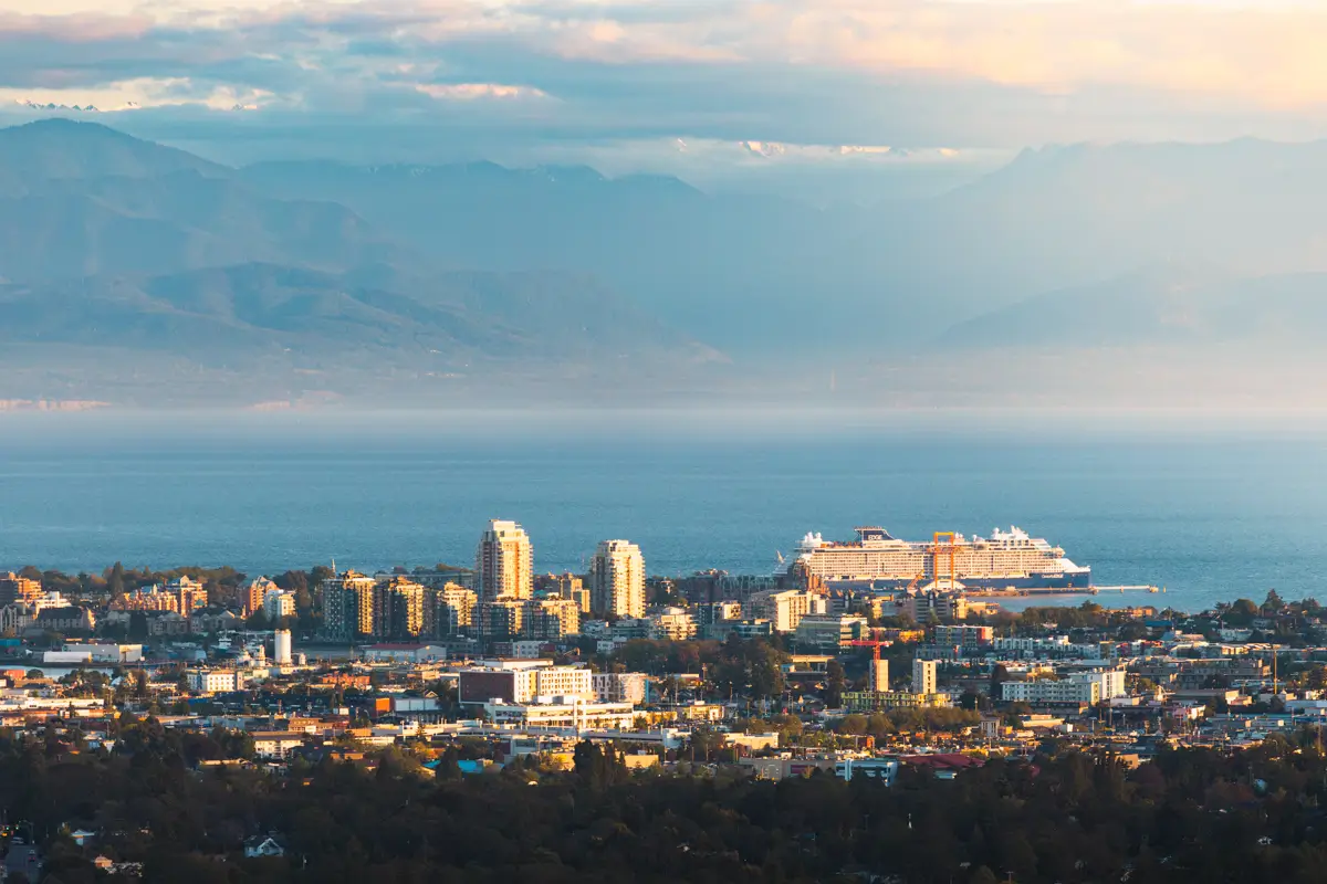
For those looking for either the best sunset views in Victoria, or one of the best hikes within the city, Mount Doug / PKOLS is the obvious choice. Panoramic views from the summit include over the city itself, as well as out over the surrounding ocean, islands, and mountains.
Like many of the “mountains” near Victoria, it’s really just a hill with a big ego. The benefit of its humble stature however, is that it’s a short and accessible peak that nearly anyone can get up to. Worst case scenario, you can even drive all the way up to just below the summit – though the views are so much better if you’ve worked for them a little first.
There are a number of different routes for hiking up and and down the mountain, with the easiest probably being walking along the side of the road. A lot more fun is this route which starts near Mount Douglas Beach and climbs up via Irvine Trail, a little steeply at some points, before finally reaching the scenic South Ridge and then onto the summit. It’s also possible to mix and match, taking a different route down than the way up.
Because of the accessibility to cars, the summit tends to attract not just hikers, but all kinds of locals and visitors come to see the views. Sadly some of these people suck, and its not super uncommon to see people trampling vegetation and leaving garbage lying around. This behaviour is unacceptable.
Continue reading this blog post for everything you need to know to experience the Mount Douglas / PKOLS hike on Vancouver Island for yourself, including distance, elevation gain, how to get there, the best time to visit, and lots of photos of my experience.
When hiking it’s important to avoid harmful practices such as disturbing plants or rock-stacking, or removing any natural object from flowers to rocks, as it’s important to leave the environment as natural as possible for the animals and for fellow hikers to enjoy in perpetuity. As many flowers as there are, there are few enough that if we all took one, then there wouldn’t be any left. Take only photos, leave only footprints.
If you haven’t heard of Leave No Trace principles, they’re also really essential to read up on before heading anywhere into the outdoors in general. Following these important principles basically means doing your best to leave beautiful places like Mount Douglas / PKOLS as good (if not better) than you found them, both for their preservation and for the enjoyment of other visitors.
Mount Douglas / PKOLS History
PKOLS, translated from SENĆOŦEN as “White Head”, was possibly the last place glaciers receded from the southern Island. The hill was a meeting point for the W̱SÁNEĆ, Songhees, and Esquimalt (SXIMEȽEȽ) peoples for thousands of years, and was used to mark the boundary between their respective lands.
In 1852 W̱SÁNEĆ chiefs called a meeting on top of PKOLS with Vancouver Island Governor James Douglas after a farmer had shot and killed a 14 year old W̱SÁNEĆ messenger boy. Tensions between the First Nations and the white settlers were at a high, and the chiefs were happy to sign what they believed to be a peace treaty.
Between 1850 and 1854, James Douglas signed 14 treaties with Vancouver Island First Nations, in which they agreed to “surrender, entirely and for ever,” nearly all of their land in exchange for blankets and shillings, keeping their “village sites and enclosed fields” and the right to “hunt over the unoccupied lands, and to carry on their fisheries as formerly.”
Mount Douglas / PKOLS Round Trip Details
Distance: 3.5 KM / 2.2 MI
Elevation Gain: 195 M / 640 FT
Hiking Time: 1.5 HRS
Hiking & Safety Tips
- Research current trail conditions and make sure you are well-informed about the route before you leave, and assess if it is within your capability. Be aware of what time it gets dark and check the weather forecast. Make sure to tell someone where you’re going and when you expect to return. Every year as more and more people try hiking for the first time, the number of rescues goes up. Being prepared is the best defense.
- Pack everything you need for a successful hike, including enough water and energy-rich snacks. Remember to pack out everything you pack in though – don’t expect to find a convenient garbage can halfway up the trail. Bring appropriate layers (remember you’ll warm up once you start hiking) and sun protection. Hiking poles may be helpful but are not required. In addition to not leaving any garbage on the trail yourself, I highly recommend bringing a garbage bag and collecting any trash that you do see on the trail. You’re guaranteed to make the hike up Mount Douglas / PKOLS a more enjoyable experience for the next person.
How to Get to Mount Douglas / PKOLS Trailhead
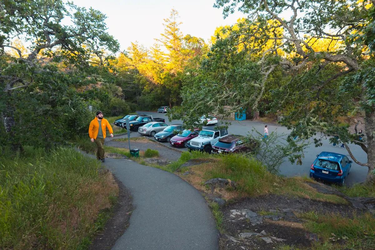
I started my hike from the Mount Douglas Beach Parking Lot, which is about twenty minutes from Downtwon Victoria. While it’s also possible to start the hike from the parking lot on Churchill Drive, the beach parking lot has room for far more cars and also offers the opportunity to head down to the beach before or after your hike, making it an obvious choice for me. From Downtown Victoria, head north on Blanshard Street, which turns into Patricia Bay Highway. After ten to fifteen minutes, exit right onto Royal Oak Drive, continuing along it for seven minutes as it enters PKOLS (Mount Douglas Park), leaving residences behind. You’ll know you’re in the park because all of a sudden you;ll find yourself in the forest. After driving through the park for a minute or two, take your first left, which prettymuch immediately leads into the Beach Parking Lot.
Click here to open the exact trailhead location in Google Maps.
Hiking Mount Douglas / PKOLS
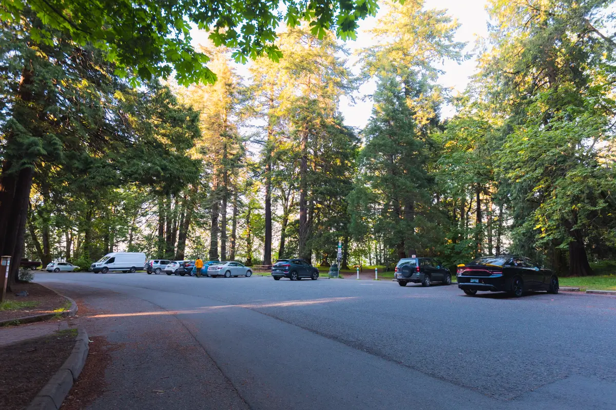
The Mount Douglas Beach Parking Lot. While it’s also possible to start the hike from the parking lot on Churchill Drive, the beach parking lot has room for far more cars.
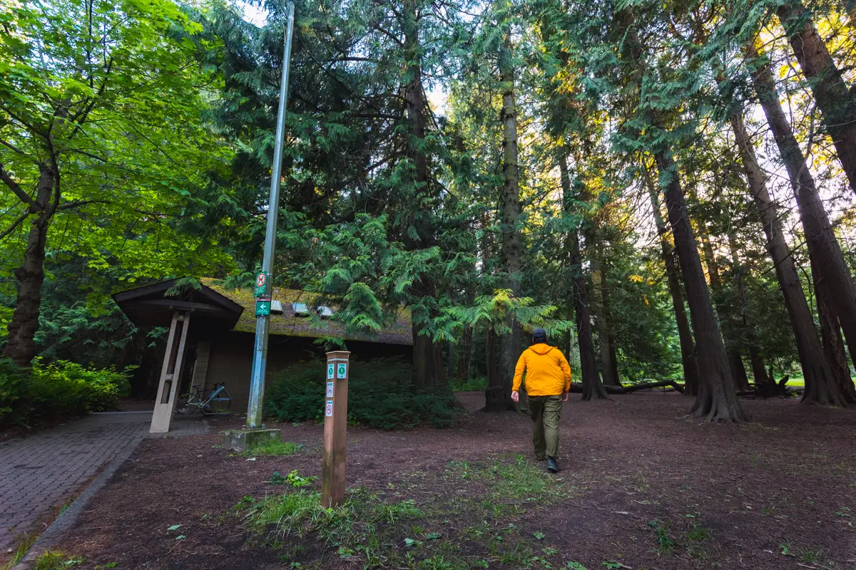
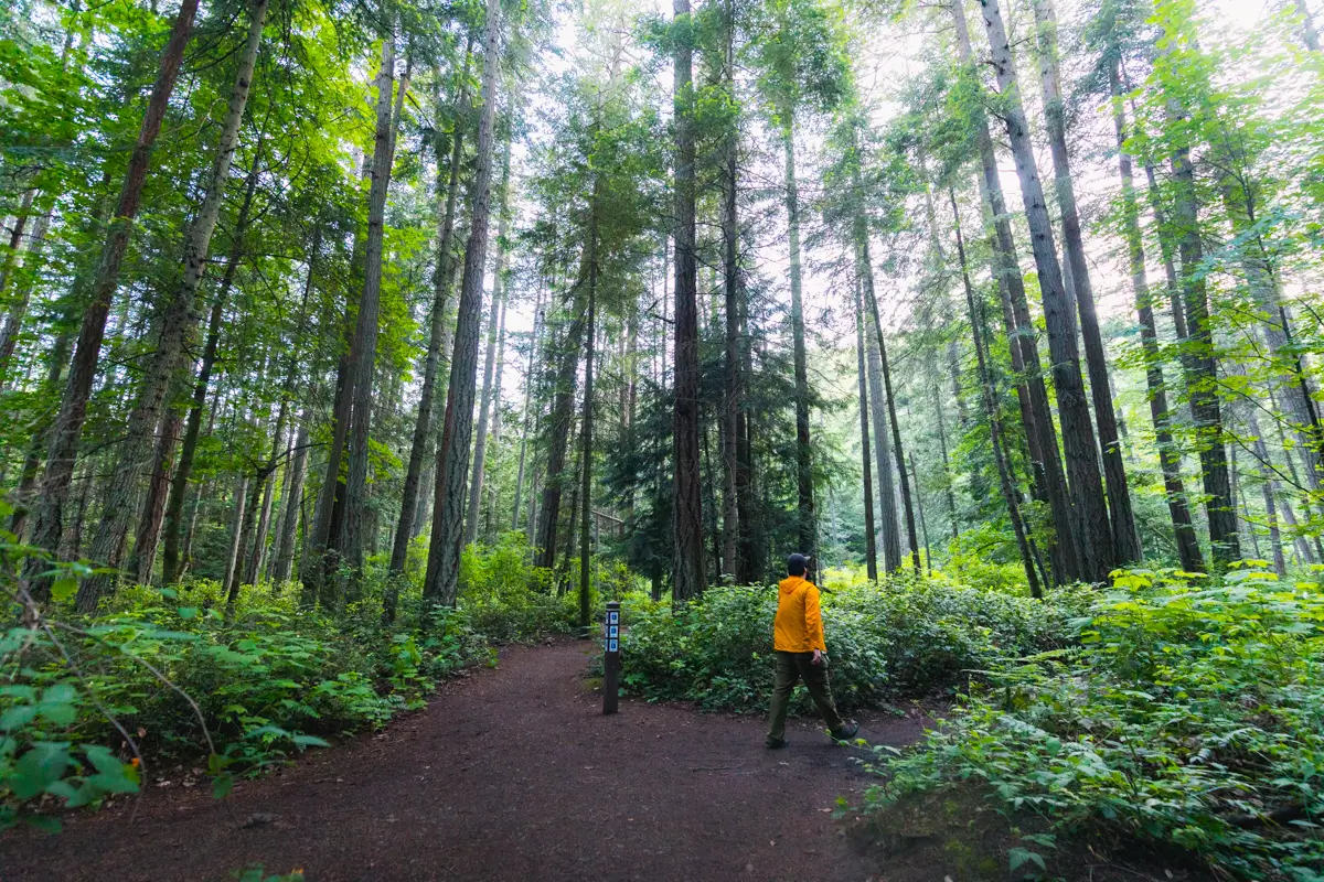
The beginning of the trail is a bit unclear as the entire area has been trampled. Just head behind the bathroom building and keep on going until you see the more obvious trail.
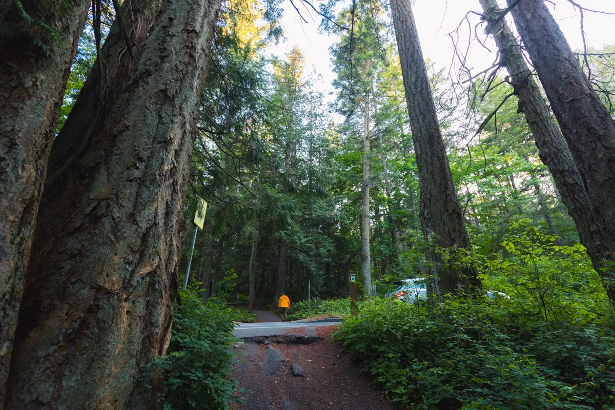
After a couple of minutes, cross the road and immediately head left. The intersection is well-signed though just in case. Remember to stay on Irvine Trail.
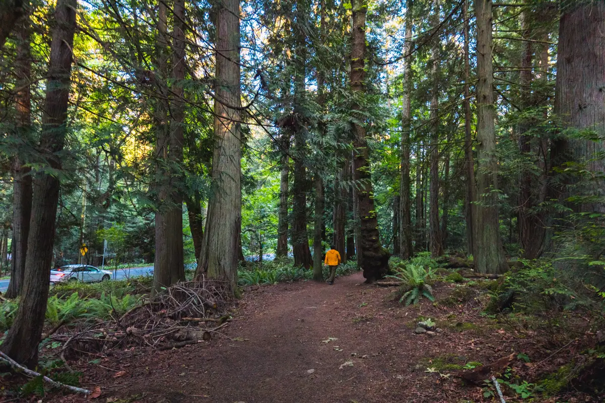
The walk through the forest here is pleasant, though the road on the left is a little distracting. I didn’t take any photos but sadly there was a lot of visibly trampled vegetation from people walking around through the woods, as well as a bunch of false trails. They aren’t so defined as to confuse you which is the real trail, but it’s unfortunate that people can’t stay on the trail.
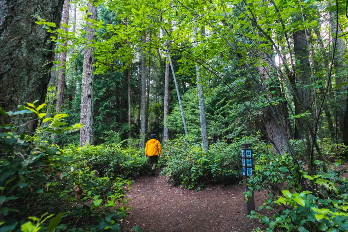
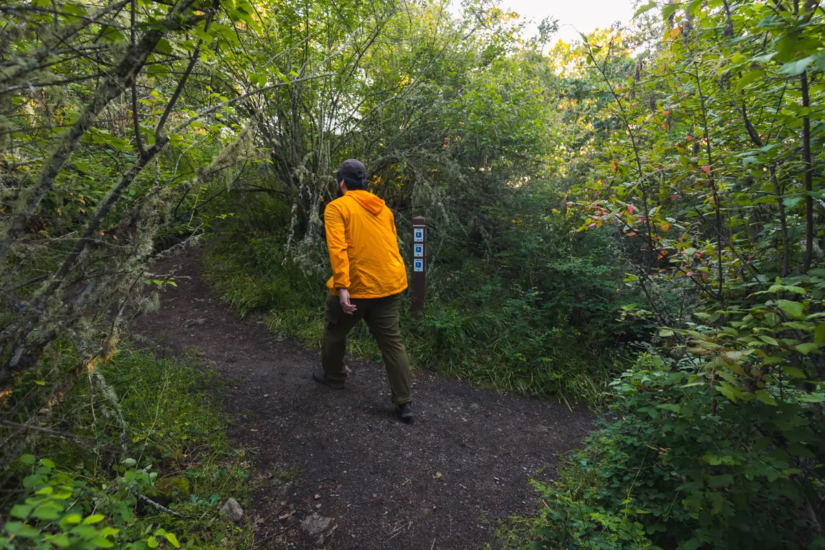
There are a couple of intersections here, and I haven’t photographed them both because that would be redundant, especially considering how well-signed they are. Just remember to stay on Irvine Trail
Turning right to stay on Irvine Trail.
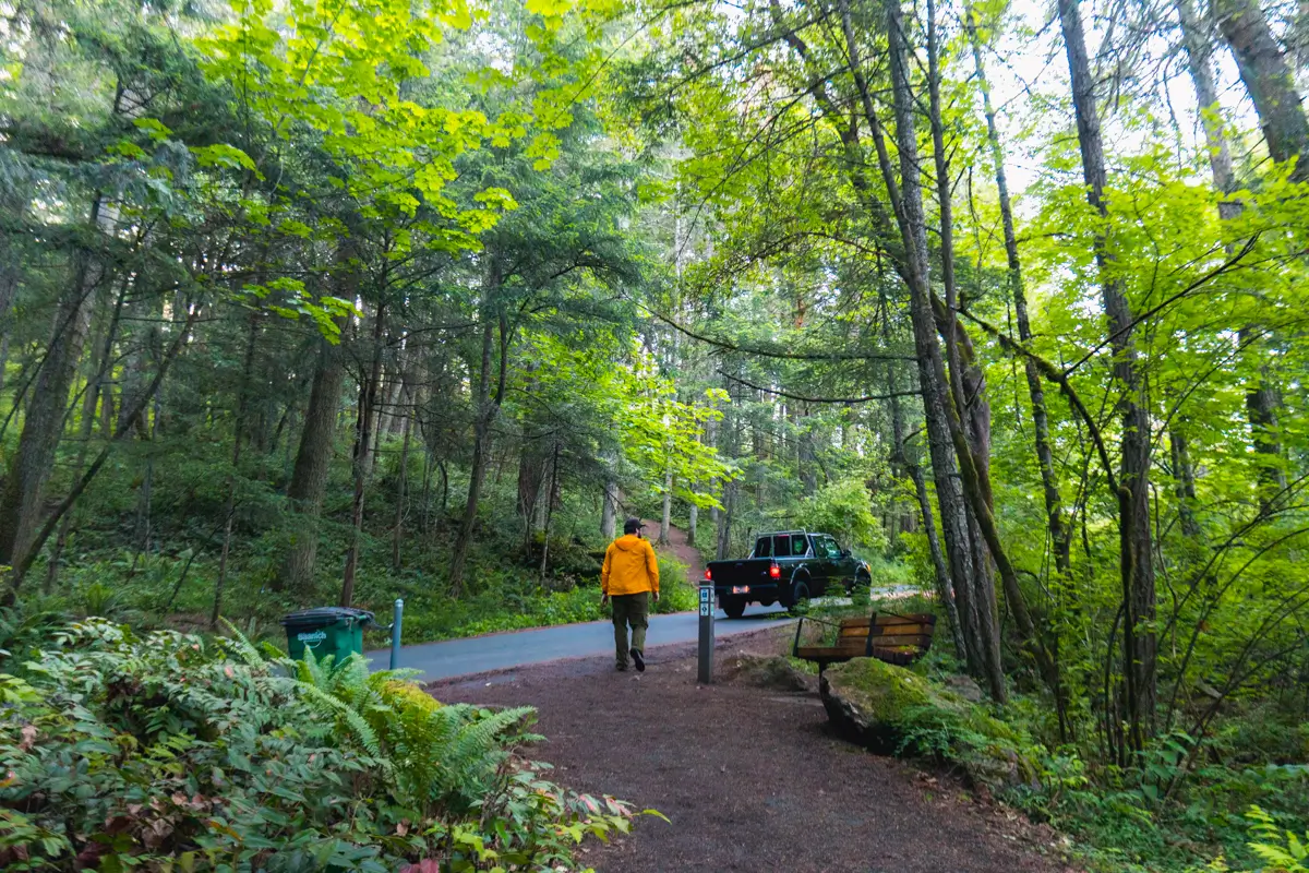
The trail crosses the road again. Churchill Road continues all the way up to a parking lot below the summit, but is closed every day before noon making the Mount Douglas hike especially suited for the morning. Note the trail resuming on the other side of the road, heading distinctly uphill now. Up until this point the trail has been relatively flat, but it’s time to start gaining elevation.
Up up up.
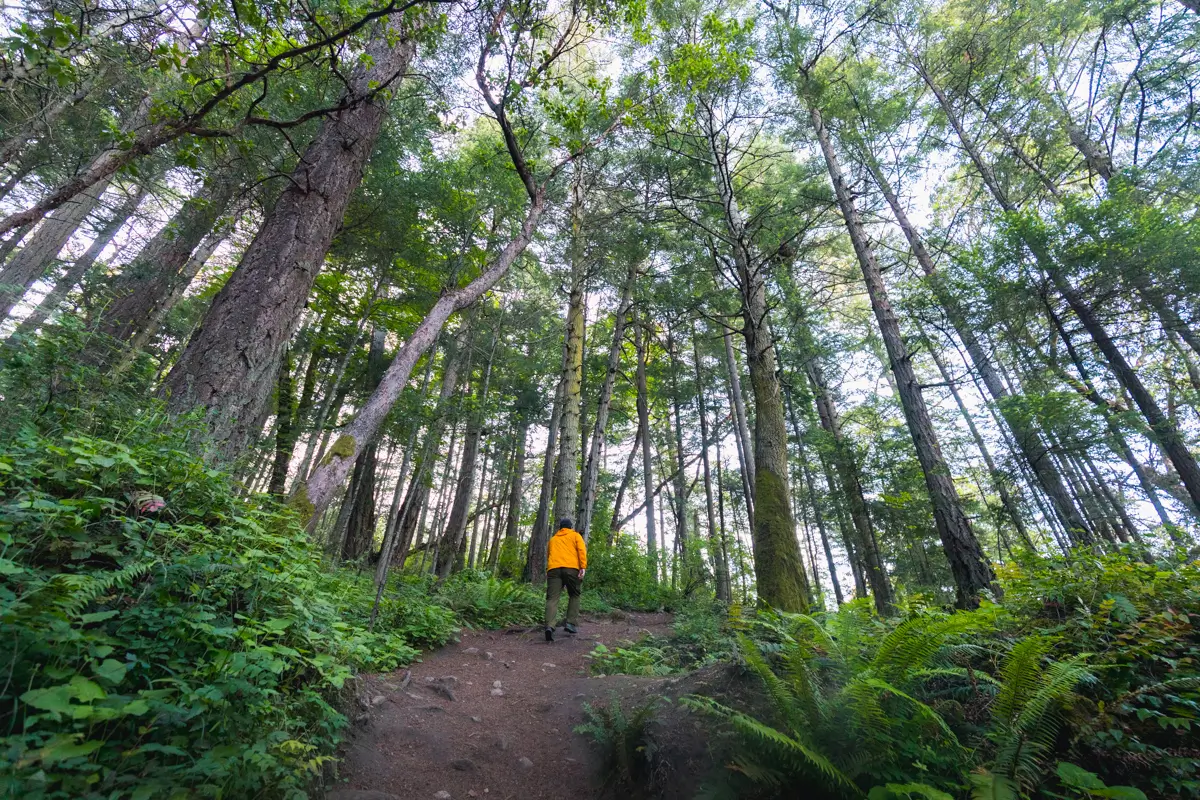
After a little while, the trail starts to become rocky. This section might be challenging for the unfit, but should pose little trouble for most people.
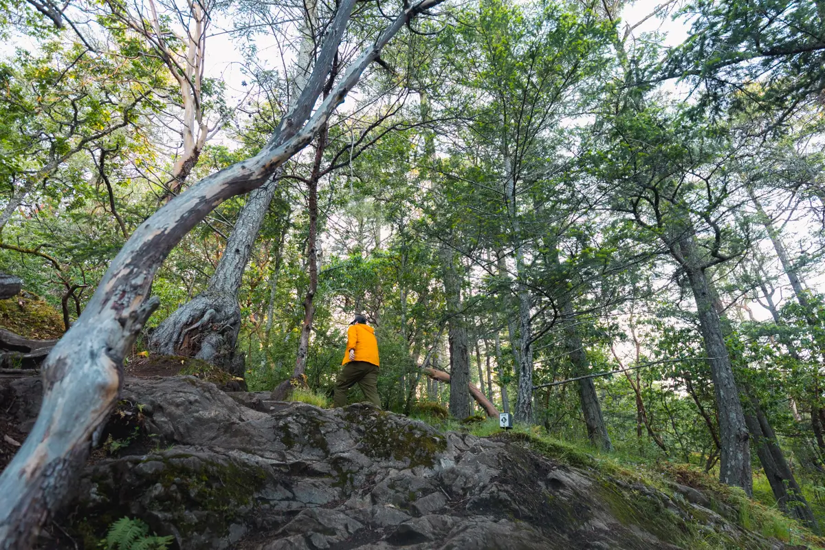
Continuing up the now-rocky path, following the small white signs keeping me on the trail.
This section might be slippery when wet, particularly if one was wearing bad footwear.
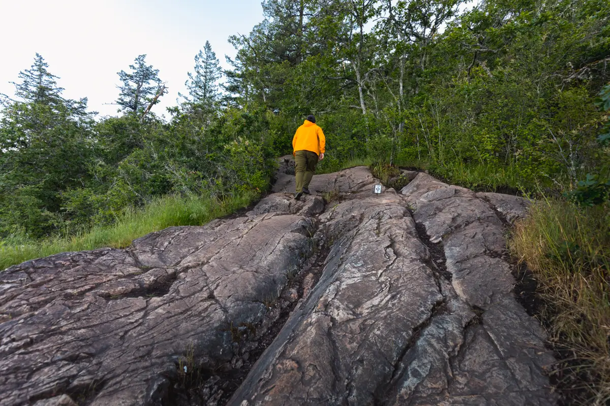
Views finally appearing. Don’t enjoy them too long, this is only about five minutes from the real views. Around here is probably the steepest section of the hike up Mount Douglas.
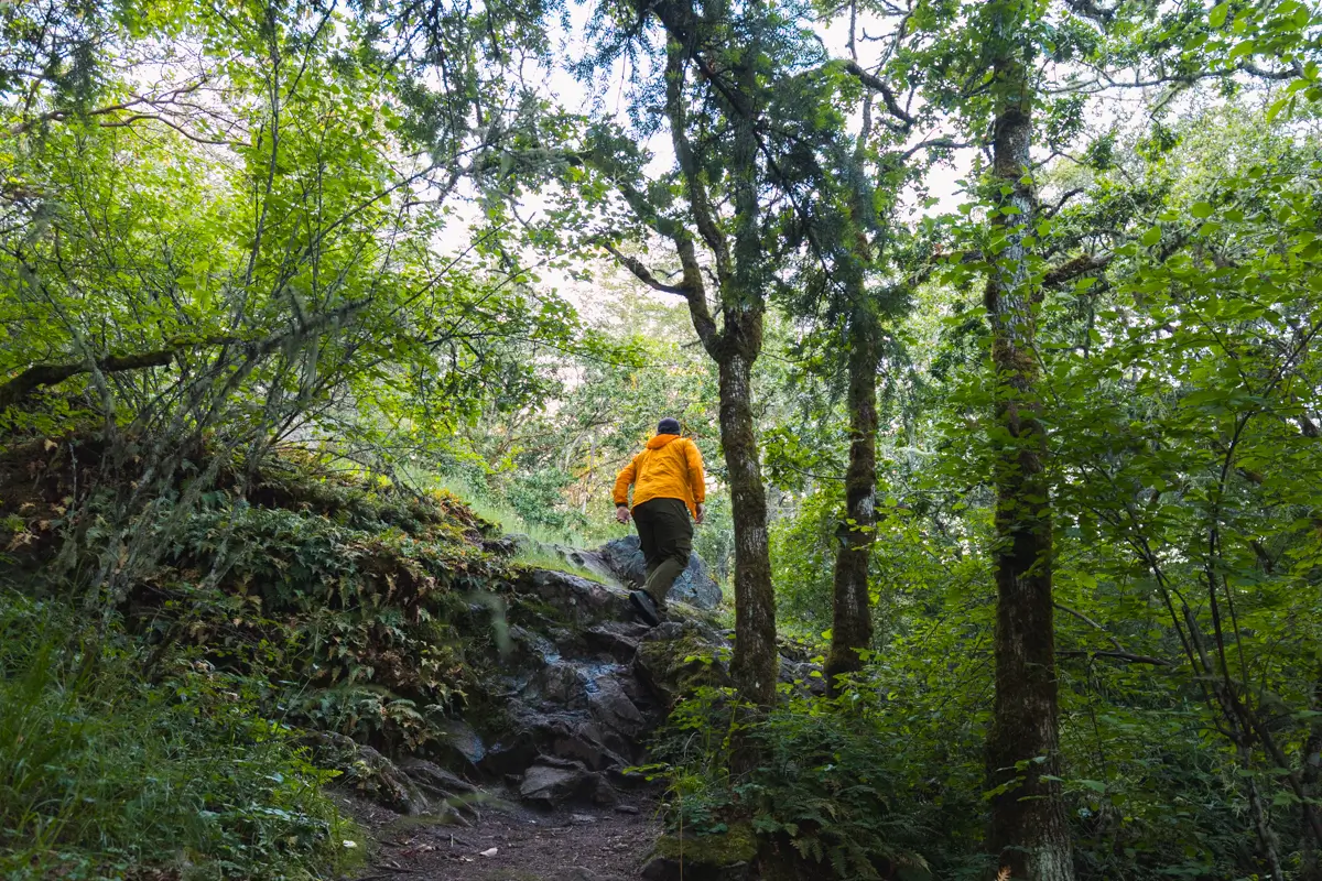
The path to the right leads straight to the parking lot, and then onto the summit, but first I recommend taking a detour to the South Ridge, which offers the best views to the south and the east.
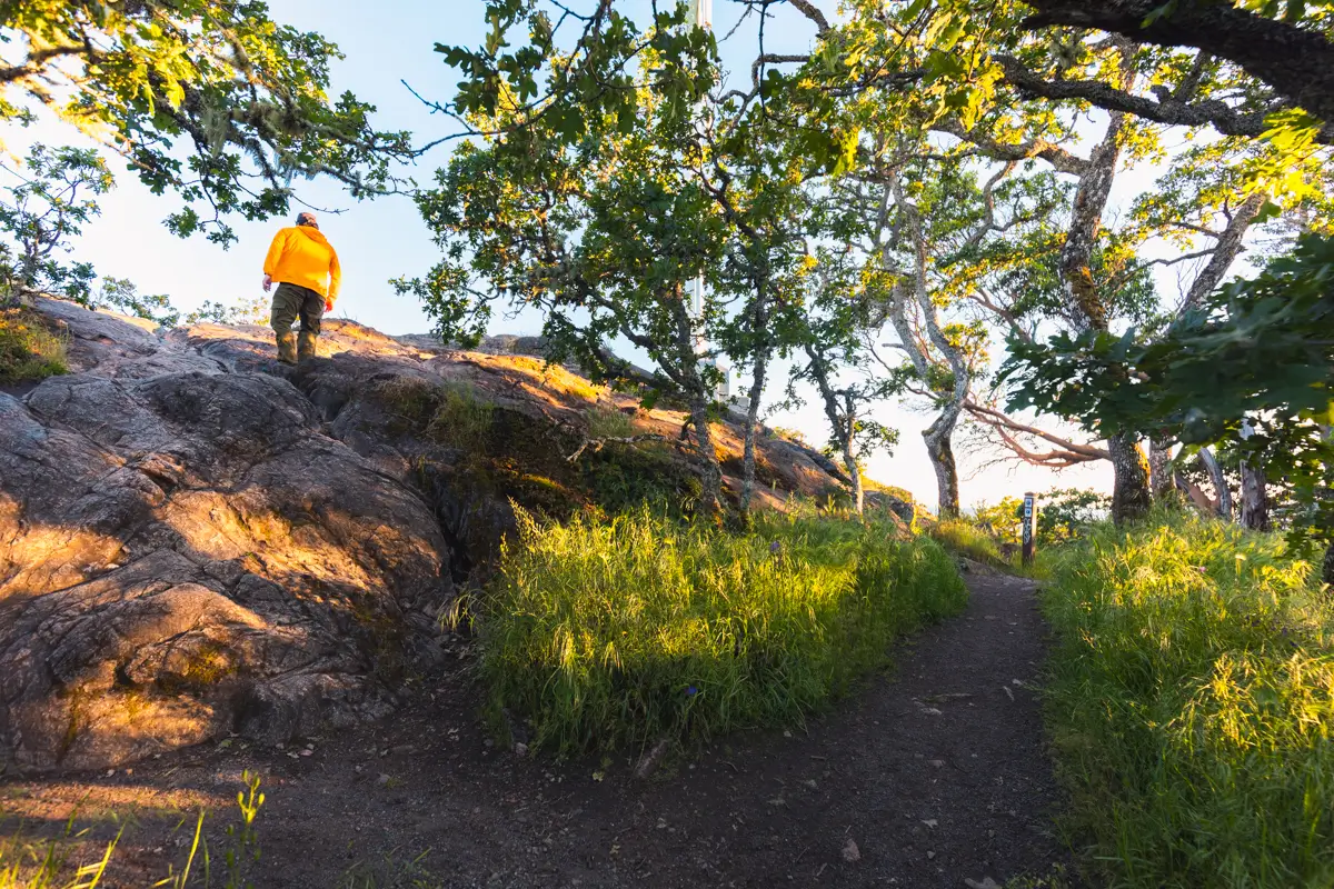
There are a couple ways up, and both are steeper than anything else on the trail so far, but both steep sections are very short.
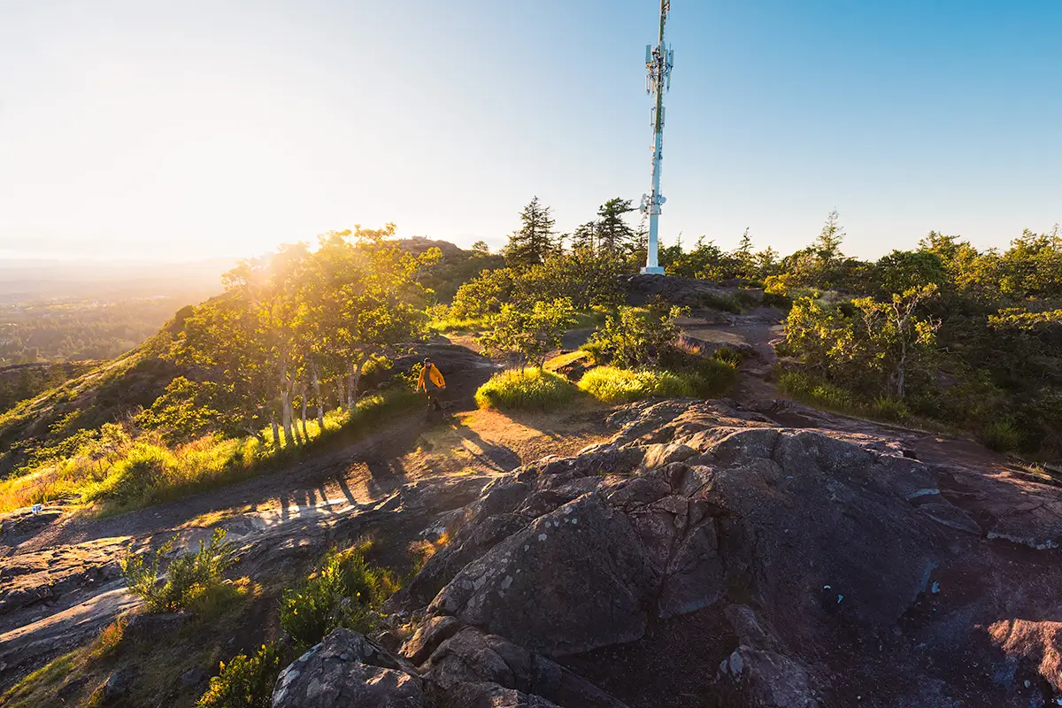
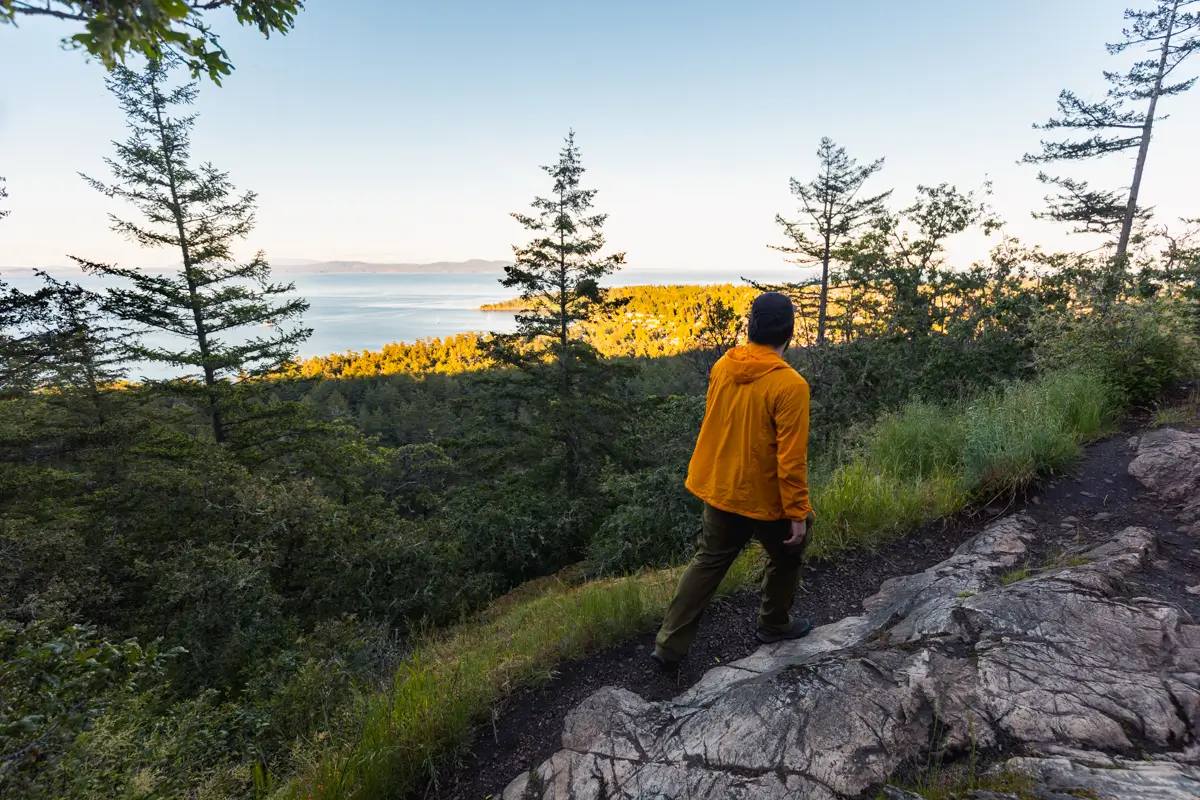
On the South Ridge of Mount Douglas, following the trail to the lookout. Note the radio tower on the ridge as well. Visible right above me is the silhouette of the summit and the lookout on top.
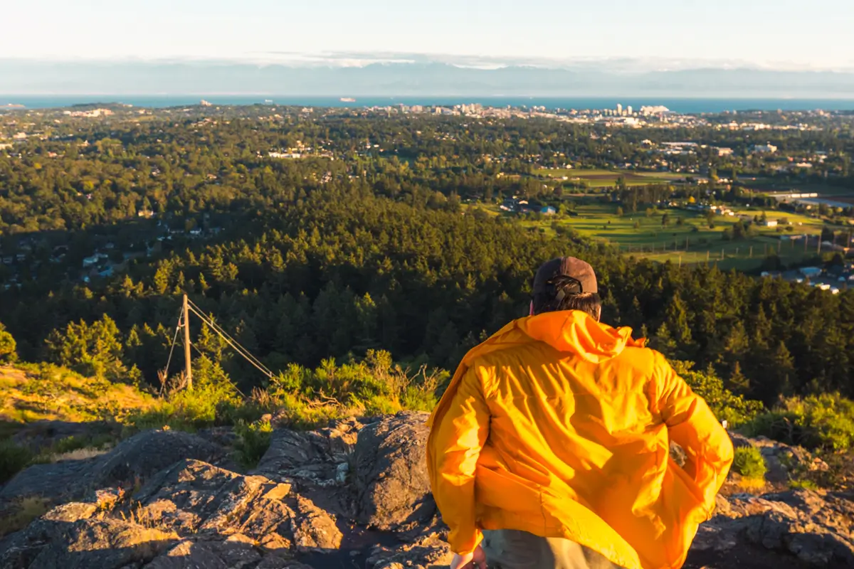
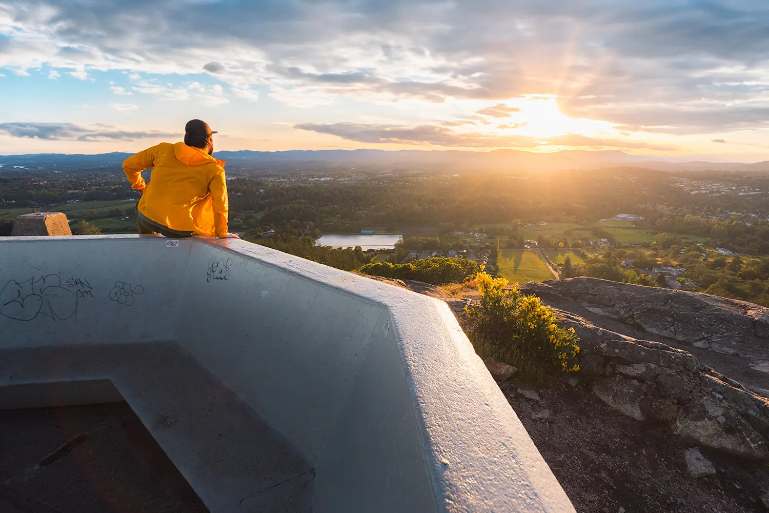
While the summit offers the best views to the north and west, the views from the South ridge south and east, including over Victoria, are fantastic. It’s also usually a little less busy here than the actual summit.
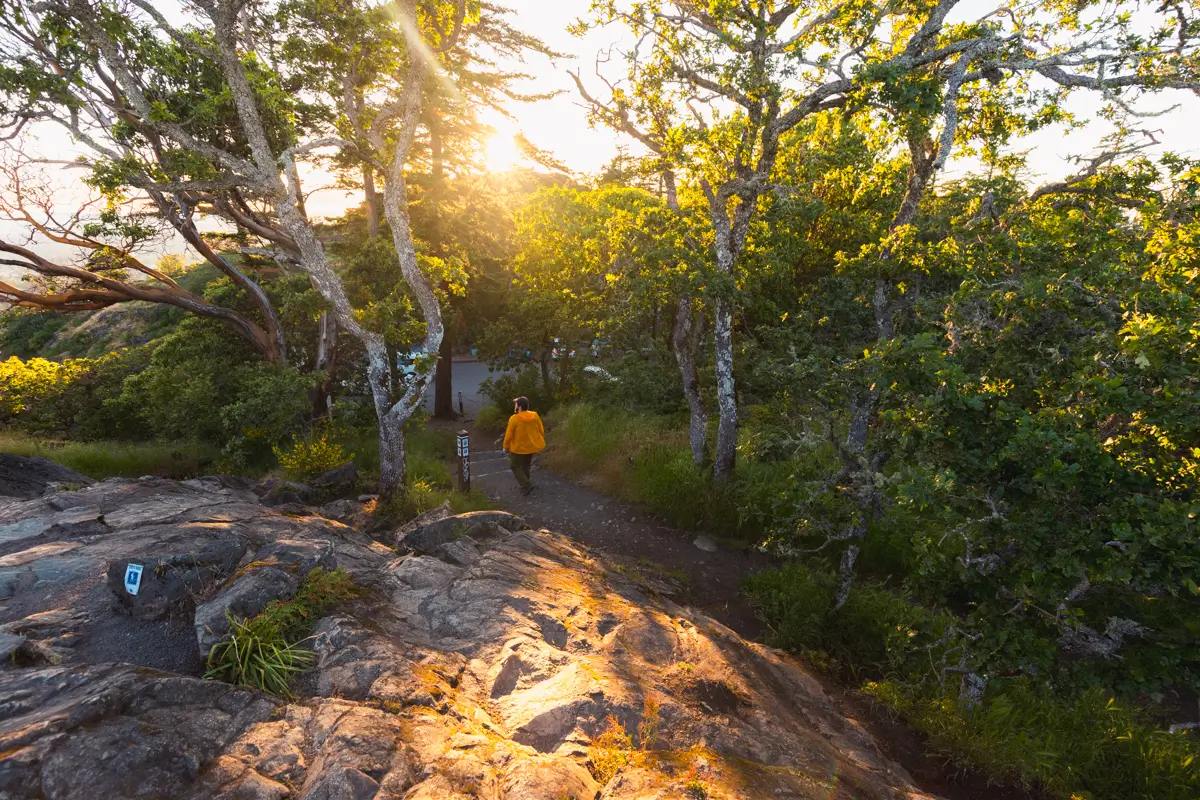
Heading back down. The parking lot is visible here, and there’s another short trail on the other side of the lot leading up to the summit. As great as I think it is that views are accessible to people who might not be able to hike all the way up from the base of Mount Douglas, it also seems to be those same sorts of people who are most likely to trample vegetation and leave beer cans lying around. Working to get up the hill seems to make people respect it more. Remember to bring a garbage bag and collect any rubbish you see left on the trail by idiots.
Heading up the other side of the parking lot. As you can see, this trail is very easy.
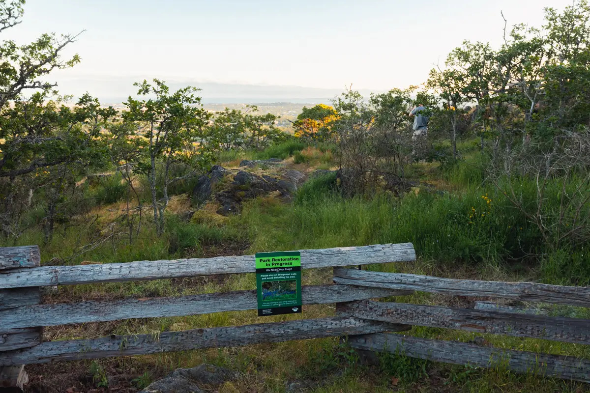
Note the sign asking visitors to stay on the trail to allow trampled plants to regrow. Also note the selfish idiot who has hopped the fence, thinking that he’s more special than everyone else.
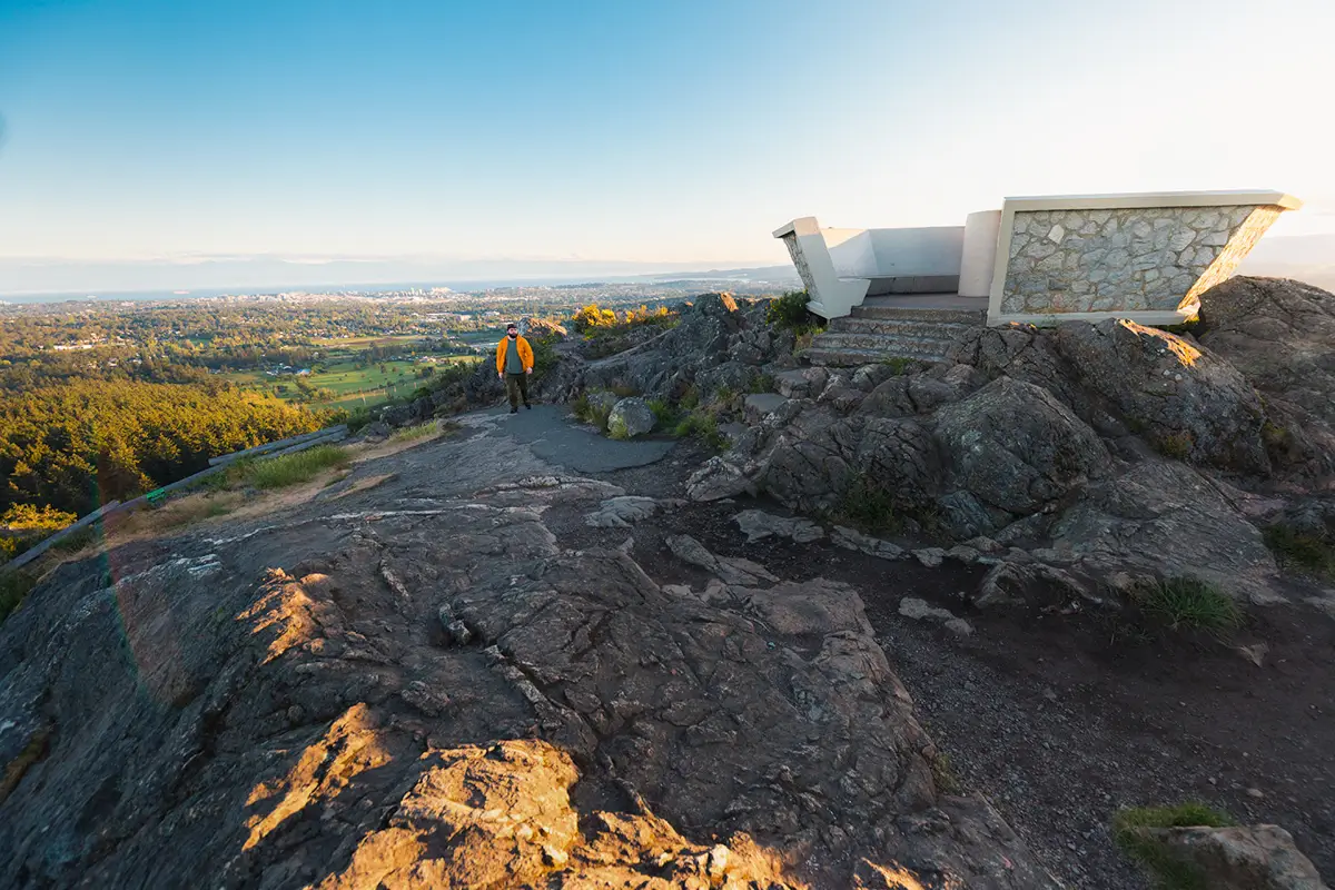
The unusual structure at the top of Mt Douglas. The concrete foundation was previously used for a WWII-era military high frequency direction finding radio system silo.
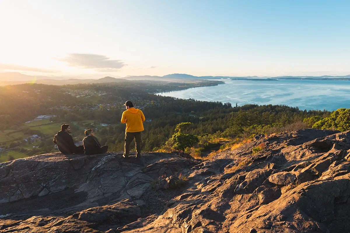
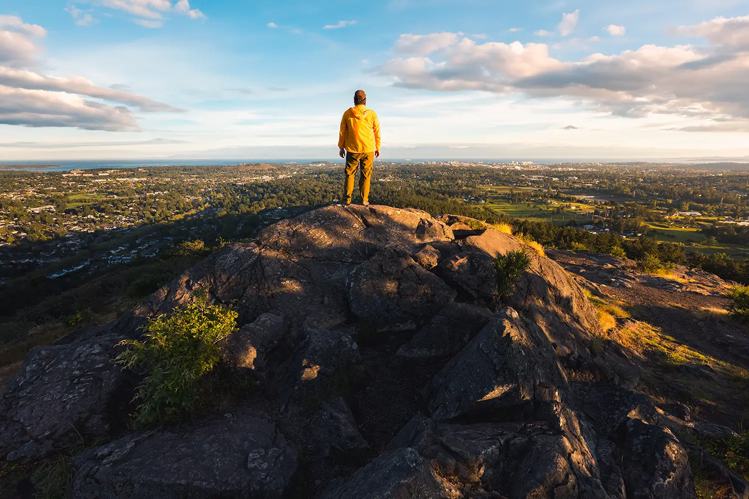
Views from the summit of Mount Douglas over Cordova Bay, the Saanich Peninsula, and Salt Spring Island. Bumps in the distance include Bear Hill, Mount Newton, Maple Mountain, Mount Bruce and Mount Tuam. The sunset views here are spectacular – so don’t expect to have them all to yourself.
Recommended Hiking Gear


Water is a must whenever I’m hiking, especially if the sun is going to be out. My favourite water filter I’ve used is the Katadyn BeFree 0.6L, which unlike other water filters I’ve used packs up really small and lightweight. For hikes where I know there won’t be any readily available water sources along the way, I make sure to bring my own. The Hydrapak Stow 1L bottle is my go-to, for the same reason that it’s made of a soft plastic that folds up and doesn’t take up any more extra space than necessary in my pack. Finally, Aquatabs are another great option for purifying water, with one tablet being suitable for one litre of water. I previously used the Grayl water filter while travelling internationally, and though I found its hard body more convenient for day to day use and easier to drink from, it has a little too much bulk for my fast-and-light style of hiking.


The secret to all my photos of gorgeous sunset and sunrise mountaintop views? A lot of hiking in the dark. And let me speak from personal experience when I say that the last thing that you want to happen when hiking is to be caught in the dark without a headlamp. I used the Black Diamond Spot 400 for years and it worked great – until I lost it on top of a mountain somewhere. The only downside to it was having to worry about the batteries dying, though there’s also a slightly more expensive version that has a rechargeable battery. Nowadays I’m using the Petzl Actik Core, which is a bit pricier than the more budget-friendly Black Diamond, but is also brighter, more comfortable (in my opinion), and has a hybrid power system that is rechargeable but can also take AAA batteries if needed.
You won’t see me using trekking poles on shorter hikes often – but on long hikes and backpacking trips, as well as certain scrambles, they are an absolute lifesaver. I’ve invested in a high quality ultra-lightweight pair of MSR DynaLock Ascent carbon poles which, while pricey, I don’t regret one bit. If you’re not entirely sure how much use you’re going to get out of a pair of trekking poles, the best budget-friendly option would be the Trekology Trek Z 2.0. Amazon does sell a lot of cheaper Made in China-style trekking poles for cheaper, but these usually are much much heavier and not worth buying.
All the best and most long-lasting cables and power banks I’ve ever owned have been Anker. I once had a phone cable from them that lasted me over three years of daily use! That’s why I keep an Anker PowerCore Essential 20K power bank on me. Like many people I use my phone for a lot of stuff when hiking (checking in with family, using online maps, taking photos, flying my drone) so I like to be prepared for that low battery warning by having a backup power source on me just in case.


The only socks I ever buy for myself are from Darn Tough, and I almost always make sure to wear them when hiking. After years of having no problems only wearing these comfortable and rugged socks for hikes, I accidentally wore a pair of no-name socks on a hike last year and ended up with blisters on both feet. Safe to say I’m back to sticking with the Darn Tough. And the best part? They have a lifetime guarantee, meaning that if they ever wear out you can send them back for a brand new pair. For hiking footwear I go between a pair of lightweight approach shoes for quick and dirty mountain ascents or anything involving scrambling and more heavy-duty boots for longer treks. I’ve worn a couple different versions of the lightweight but super durable Arc’teryx Konseal FL 2 approach shoes for a few years now and am very impressed with the durability. I also really like the thick toecap that keeps me protected every time I stumble into a root or large rock. For longer, tougher, or muddier treks I rely on my LOWA Camino EVO GTX, which I find insanely comfortable and made of very high quality.


I wear my Ar’teryx Gamma Lightweight Pants on every single hike I go on, and on many days when I’m not hiking. After several years of abuse they are still holding together extraordinarily well, with only a few small holes from where I’ve fallen down and some slight stains from being repeatedly coated with mud. They’re lightweight, breathable, and super comfortable. For lightweight and breathable hiking tops I’m a big fan of both the Patagonia Capilene Shirt and the MEC Core Shirt. My Arc’teryx Squamish Hoody shows up in a lot of my photos. It’s super lightweight and packable, and does a great job of cutting the wind while also being pretty breathable. I also have an Arc’teryx Atom Hoody and Arc’teryx Beta LT that I pull out for cooler or wetter conditions.
I hope you enjoyed this guide to hiking Mount Douglas / PKOLS in Victoria on Vancouver Island! Feel free to leave any questions in the comment section below or to contact me directly via social media.