
Port Alberni is an underrated Vancouver Island town with some of my favourite geography – it’s not everywhere that you can have mountain views in every direction while also being next to the ocean. Trails in the Alberni Valley include high mountain peaks, stunning walks alongside the scenic Alberni Inlet, and beautiful rushing waterfalls and dense old-growth forest. I highly suggest taking the time to see what Port Alberni’s fantastic trails have to offer.
Continue reading this blog post for everything you need to know to experience these awesome Port Alberni hikes for yourself, including distance, elevation gain, how to get there, the best time to visit, and lots of photos of my experience.
- Tips for Hiking in Port Alberni
- Alberni Valley Lookout
- Wesley Ridge
- Cathedral Grove
- Mount Hankin Bluffs Viewpoint
- China Creek Falls
- Weiner Falls
- Alberni Inlet Trail
- Cold Creek Falls
- Stokes Creek Falls
- Ginger Creek Falls
- Snow Creek Falls
- Hole in the Wall
- Rogers Creek Falls
- Great Central Lake Lookout
- Recommended Hiking Gear
Tips for Hiking in Port Alberni
When in the outdoors it’s important to avoid harmful practices such as disturbing plants or rock-stacking, or removing any natural object from flowers to rocks, as it’s important to leave the environment as natural as possible for the animals and for fellow hikers to enjoy in perpetuity. As many flowers as there are, there are few enough that if we all took one, then there wouldn’t be any left. Take only photos, leave only footprints.
I also highly recommend reading up on Leave No Trace principles before heading anywhere into the outdoors in general. Following these important principles basically means doing your best to leave beautiful places like these Port Alberni hikes as good (if not better) than you found them, both for their preservation and for the enjoyment of other visitors.
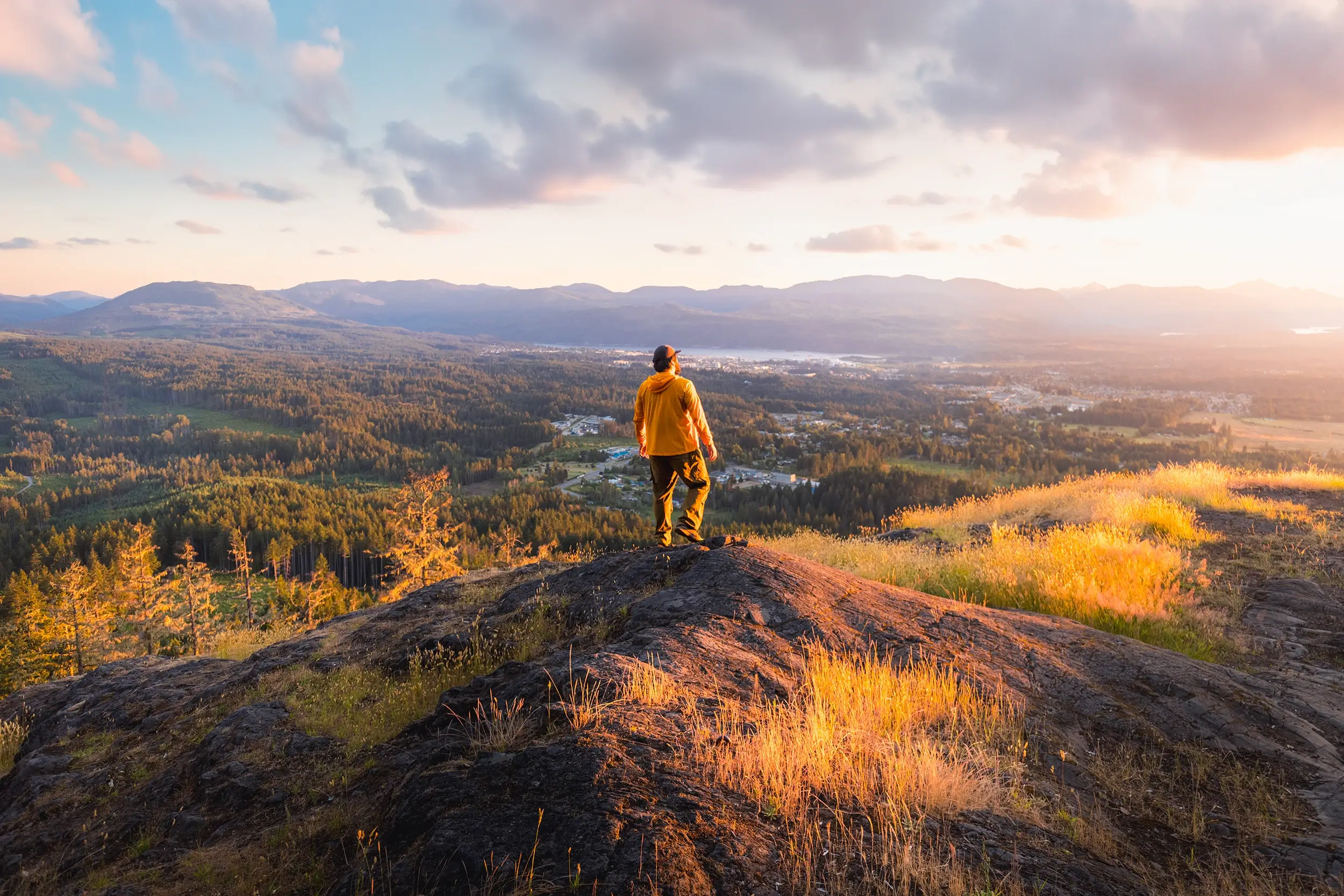
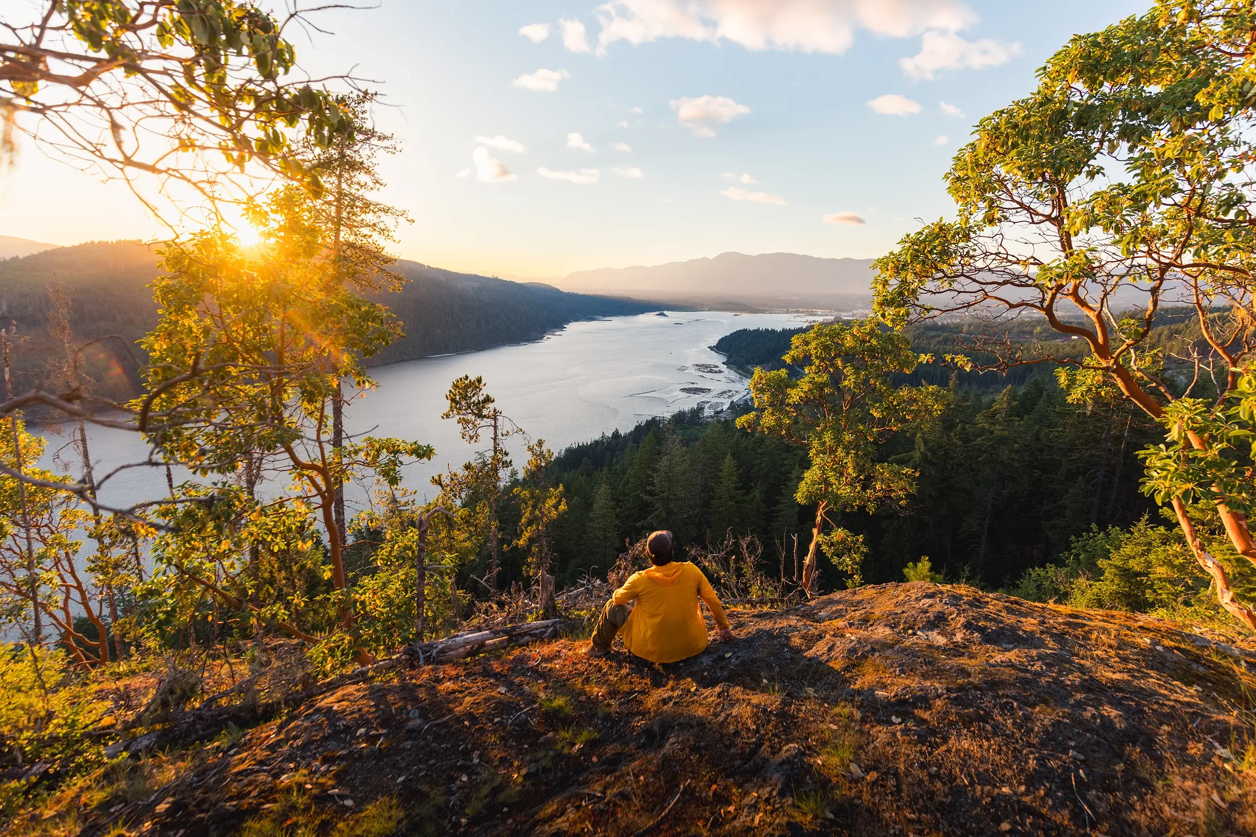
Alberni Valley Lookout
Distance: 4 KM / 2.5 MI
Elevation Gain: 291 M / 955 FT
Hiking Time: 1 Hr
There is no more quintessential Port Alberni hike than the one up to the Alberni Valley Lookout. This viewpoint, located above the highway on the east end of the town, starts from the same rugged parking lot as the Hole in the Wall and Rogers Creek Falls. From there it follows logging road and mountain bike trails up to the small bald spot in the hills above. From here, check out the panoramic views over Port Alberni as well as of the Alberni Inlet, Sproat Lake, and Great Central Lake. It might not be the best viewpoint in the area, but definitely has the best effort to reward ratio. It’s one I would be careful to bring your pets though, as nearly the entire summit area is covered in fine pieces of broken glass left by partiers. As long as you’re not barefoot you’ll be fine, but it does leave a stain on an otherwise beautiful spot.
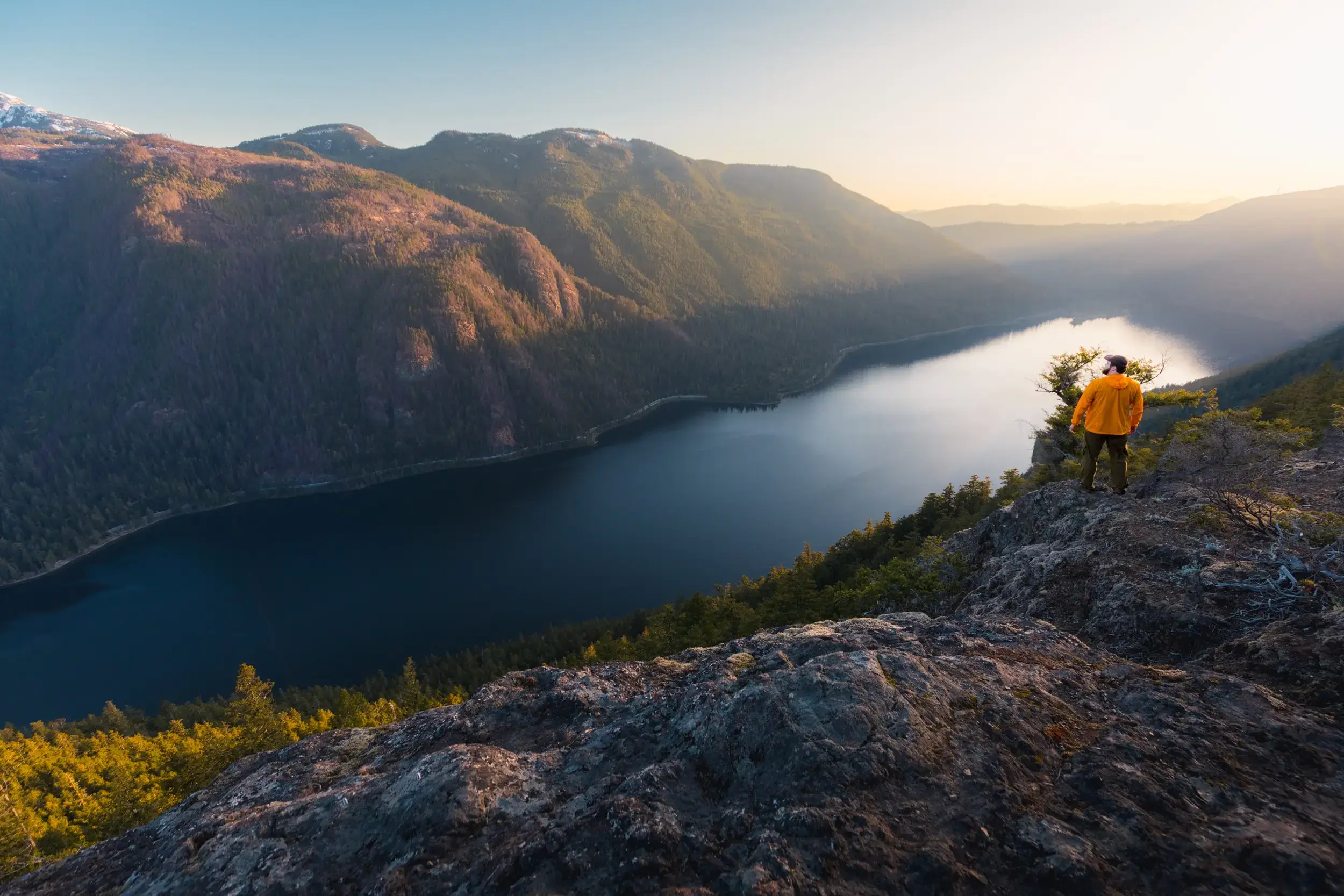
Wesley Ridge
Distance: 7.2 KM / 4.5 MI
Elevation Gain: 555 M / 1821 FT
Hiking Time: 3 Hrs
Wesley Ridge is a steep uphill climb on the opposite side of Cameron Lake from the Highway. In my opinion it’s one of the best viewpoints in the region, and well worth the steep hike to get up there. The small lookout below the summit offers spectacular views of Cameron Lake and Mount Arrowsmith, but the views from the summit itself actually look east, towards the Salish Sea and distant mountains on the mainland.
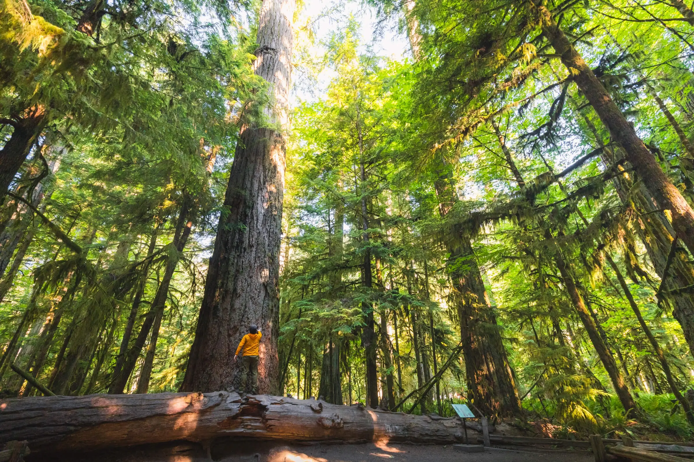
Cathedral Grove
I’d be remiss if I didn’t mention Cathedral Grove, even if neither of the short fifteen-minute loops through this beautiful forest can really be called hikes. Tourists come from all over the world in order to see the last few remaining old-growth trees on Vancouver Island, many of which are still in danger of logging today. The tiny protected area of Cathedral Grove just outside of Port Alberni is one of the best places to see some of these 1000 year-old trees that have been protected. There are two short walks through the grove, and it’s impossible to miss – the highway passes right through it on the way into Port Alberni. I advise visiting early in the day though – the spot becomes something like Disneyland if you’re visiting midday in the summer, and parking can become chaotic.
Mount Hankin Bluffs Viewpoint
Distance: 9.6 KM / 6 MI
Elevation Gain: 330 M / 1083 FT
Hiking Time: 2.5 Hrs
Mount Hankin is a peak south of Port Alberni alongside the Alberni Inlet, and while there aren’t any views from the summit itself, the rocky bluffs about a third of the way up offer fantastic views up and down the inlet and of distant Port Alberni. There are a couple of routes to get up here, both of which utilize to some extent the network of logging roads in the area, but my preference is to use the Alberni Inlet Trail on the way up.
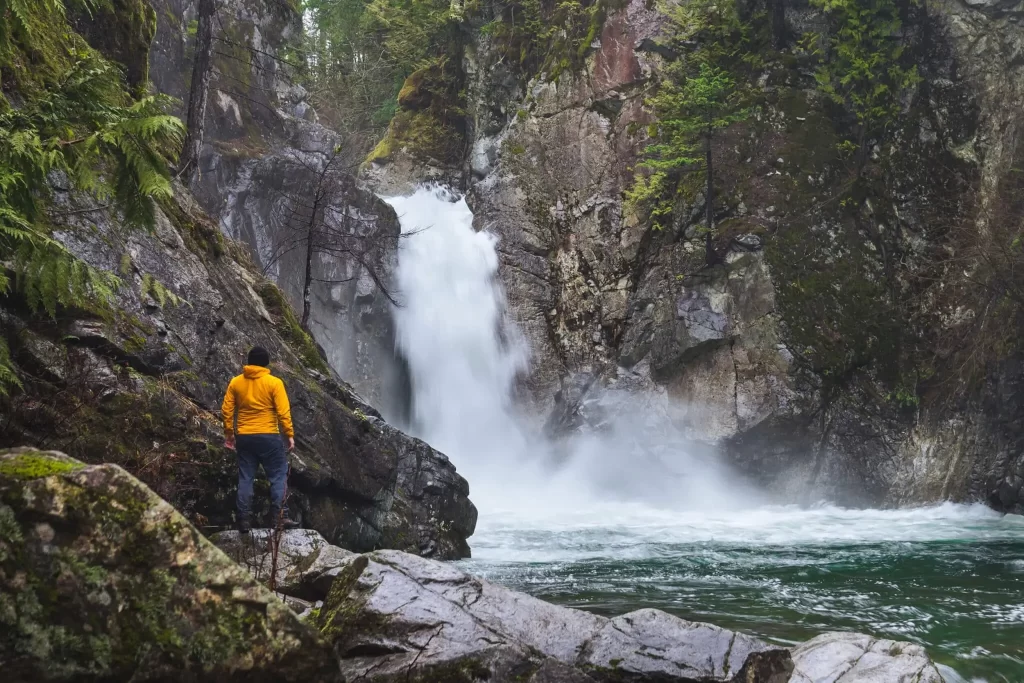
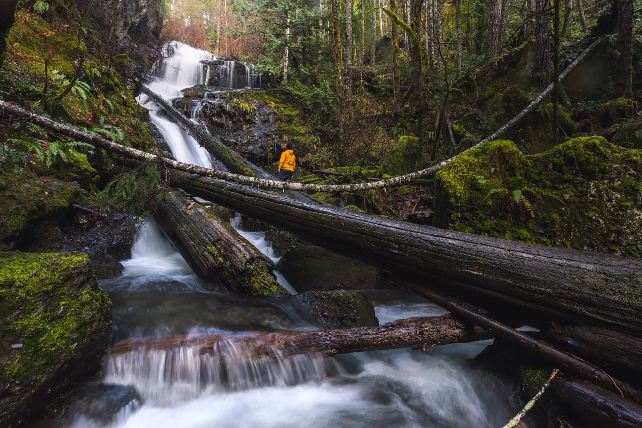
China Creek Falls
Distance: 3.5 KM / 2.2 MI
Elevation Gain: 62 M / 203 FT
Hiking Time: 1.5 HRS
The trail to China Creek Falls follows fairly closely alongside the impossibly turquoise China Creek as it makes its way upstream through beautiful Vancouver Island rainforest. Tall, verdant, moss-draped trees drip water on the heads of unsuspecting hikers as they pass below. As it approaches the waterfall, the China Creek trail gains elevation sharply, heading up a steep hillside overlooking the creek before descending straight to the falls. Caution is definitely required on the steep sections, and I wouldn’t necessarily recommend the trail for small kids. Ropes are conveniently strung up for most of the steep sections which are of a definite help.
There isn’t a lot of area to move around once at the small rocky bank at the base of the falls and it would be challenging to approach the falls any closer, but the view of China Creek Falls is fantastic nonetheless.
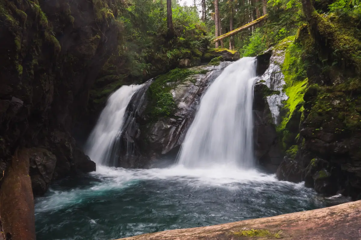
Weiner Falls
Distance: 1.8 KM / 1.1 MI
Elevation Gain: 80 M / 262 FT
Hiking Time: 30-45 MINS
Weiner Falls, named after Swedish-born Nils Weiner, an early settler in the area, is an absolutely spectacular waterfall near Port Alberni, and one of my favourite waterfalls on Vancouver Island. Weiner Falls is located not far from Sproat Lake, and is a great short hike to do between Port Alberni and Tofino. Just a short drive down a logging road, the trail to Weiner Falls is largely easy and straightforward, with the only exception being a challenging rope-assisted scramble down the steep hill near the falls. The climb down requires some careful footwork, as you’re using various tree roots and branches on your way down. That said, it’s a lot of fun. If you’re looking for something a bit less adventurous, it’s very easy to end your hike from the viewpoint above the falls. The views aren’t quite as good, but it’s still a great Port Alberni hike.
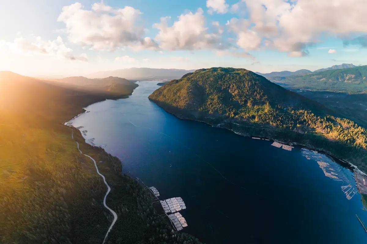
Alberni Inlet Trail
So you’ve heard of the West Coast Trail, the Juan de Fuca Marine Trail, and maybe even the North Coast Trail, but have you heard of the Alberni Inlet Trail? I wouldn’t be surprised if you hadn’t. In its entirety, the Alberni Inlet Trail runs just under 30km from tip to tip, broken up into three stages which can each be hiked in a day (provided you have someone waiting to pick you up at the other end.) Sections of the trail utilize historic Canadian Northern Pacific Railway grade, and the various viewpoints of the inlet are spectacular. This Port Alberni hike is way less well known than other Vancouver Island multi-day routes, so you’re also much more likely to have the trail to yourself.
Cold Creek Falls
Distance: 5.2 KM / 3.2 MI
Elevation Gain: 100 M / 328 FT
Hiking Time: 1 HR
From the high mountains of the Beaufort Range overlooking Port Alberni, Cold Creek cascades down through the lush and verdant forest towards the valley below. It’s down here amidst the beautiful greenery that the Alberni Pacific Lumber Company’s railway once transported freshly fallen giants of the Alberni Valley’s forests along the shadow of the Beaufort Range.
Today logging continues in the region, but with trucks the transport of choice, the former rail bed has been turned into a lovely 25km multi-use trail. One of the highlights of the Port Alberni Log Train Trail is of course Cold Creek Falls, a multi-tiered waterfall that crashes over and around jammed logs and massive boulders that have crashed down from the cliff side above, now carpeted in thick moss.
The walk there is straightforward and relatively easy, with the only challenges being a couple of short steep sections, including one final section leading right up to the falls themselves. The trail much is much-loved by locals and popular amongst families for the wide trail and the wonderful forest atmosphere.
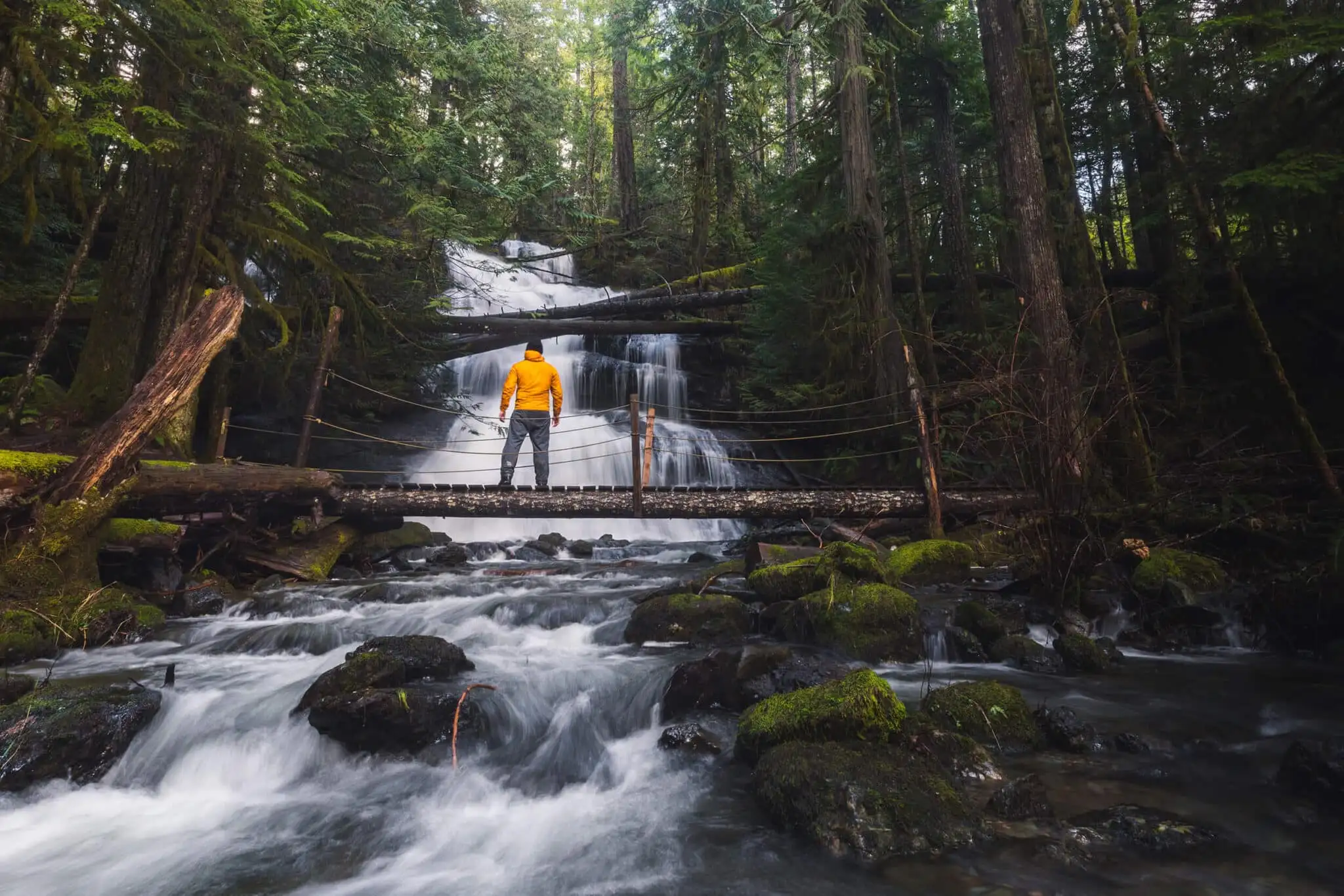
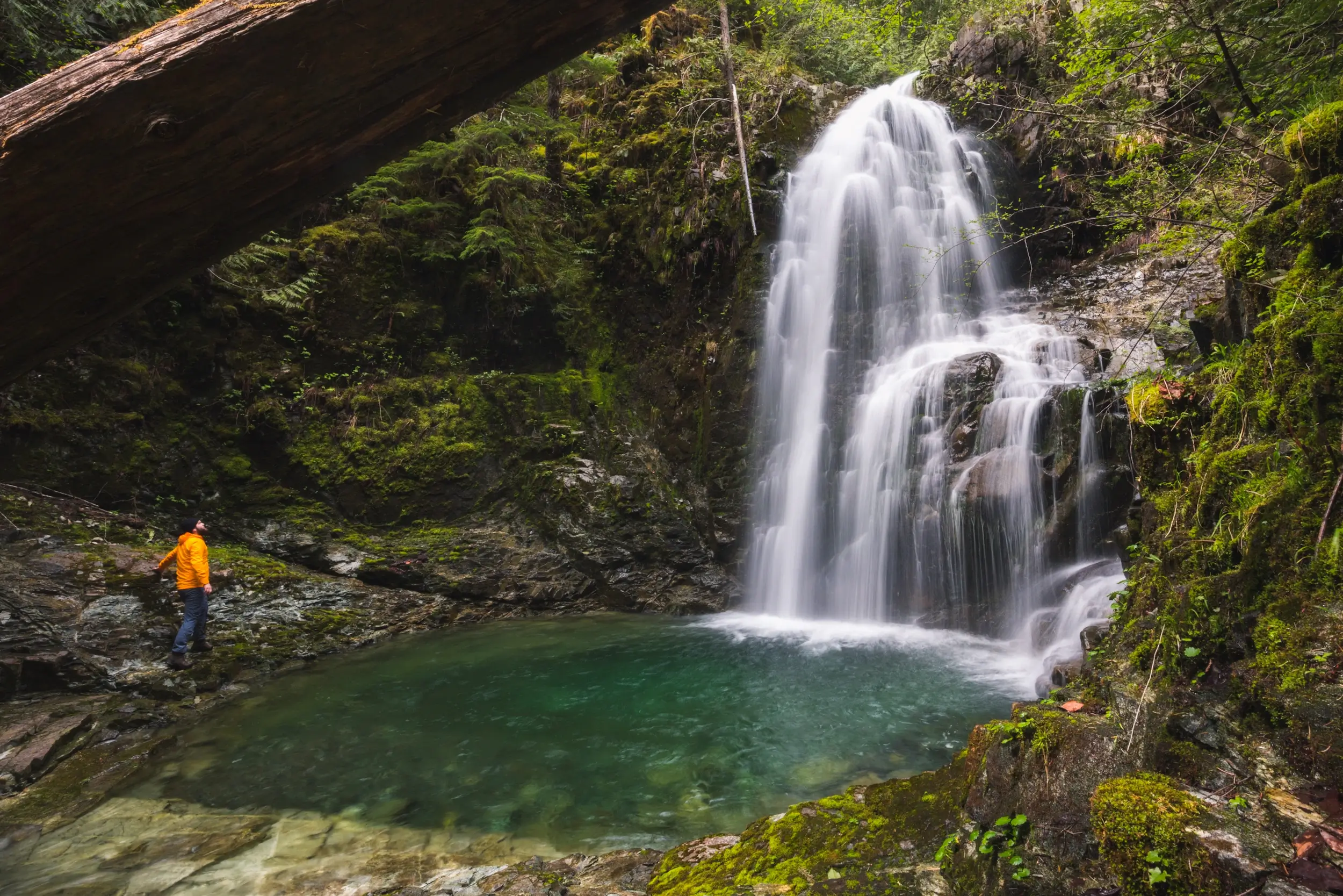
Stokes Creek Falls
Distance: 2.7 KM / 1.7 MI
Elevation Gain: 57 M / 187 FT
Hiking Time: 40 MINS
Stokes Creek Falls is a fantastic Port Alberni waterfall, and the short hike to get to it is a must-do thing if you’re in the area. The Stokes Creek hike follows a very well-cared for trail through mossy verdant forest and over several crystal streams on the way to gushing Stokes Creek Falls. A small wooden bridge is right in front of the falls, making it easy to get right up close without having to get wet.
The trail leads through third growth, second growth, and even a small area of old growth forest as it passes through several different former cut blocks along the way. It’s interesting to see the different forests at different stages, but of course the mossy old growth trees near the waterfall itself are the most beautiful.
The trail does involve some steepness going up and down a hill before the falls, but nothing super difficult. Plus, as well as the obvious care that has been put into clearing the trail and building bridges, ropes are in place to help especially on the steep sections. Ultimately, the Stokes Creek Falls hike is one that nearly anyone should be able to do, and one of my favourite Port Alberni waterfalls.
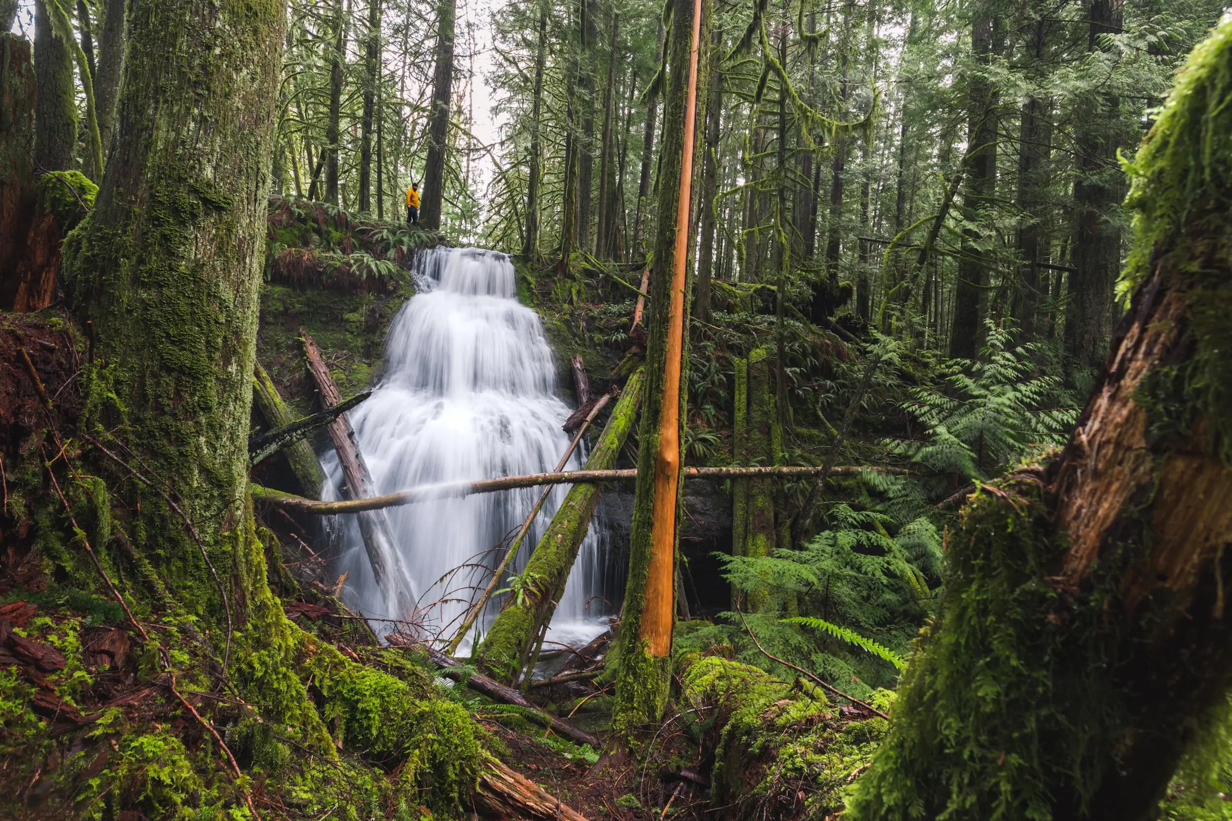
Ginger Creek Falls
Distance: 3 KM / 1.9 MI
Elevation Gain: 92 M / 302 FT
Hiking Time: 40 MINS
Unofficially named for some wild ginger growing along its banks upstream, unassuming Ginger Creek (which doesn’t appear on maps) passes under the highway connecting Port Alberni to the east. I can’t imagine how many people drive over Ginger Creek Falls without having any idea that only a tiny distance from the highway Ginger Creek cascades down, forming a gorgeous three-step waterfall. Like many Port Alberni waterfalls, Ginger Creek Falls receives little attention or fanfare – despite how beautiful the waterfall and surrounding forest is, as well as its proximity within hiking distance to other Port Alberni waterfalls Stokes Creek Falls, Hole in the Wall, and Rogers Creek Falls.
Ginger Creek Falls can be reached via the Stokes Creek trail network, making it a fantastic short hike near Port Alberni. For those who are used to walking the trail to much more well-known Stokes Creek Falls, incorporating a visit to the always-lovely Ginger Creek Falls is a great way to explore some new sections of trail. While it is possible to hike Stokes Creek Falls, Upper Stokes Creek Falls, and Ginger Creek Falls as a loop, this blog post will just focus on directions to the one waterfall. Because the area has at least five lovely waterfalls in such close proximity, visitors looking for the best things to do in Port Alberni in a short timeframe may be interested in cramming all the waterfalls into one hiking day, and this is definitely doable.
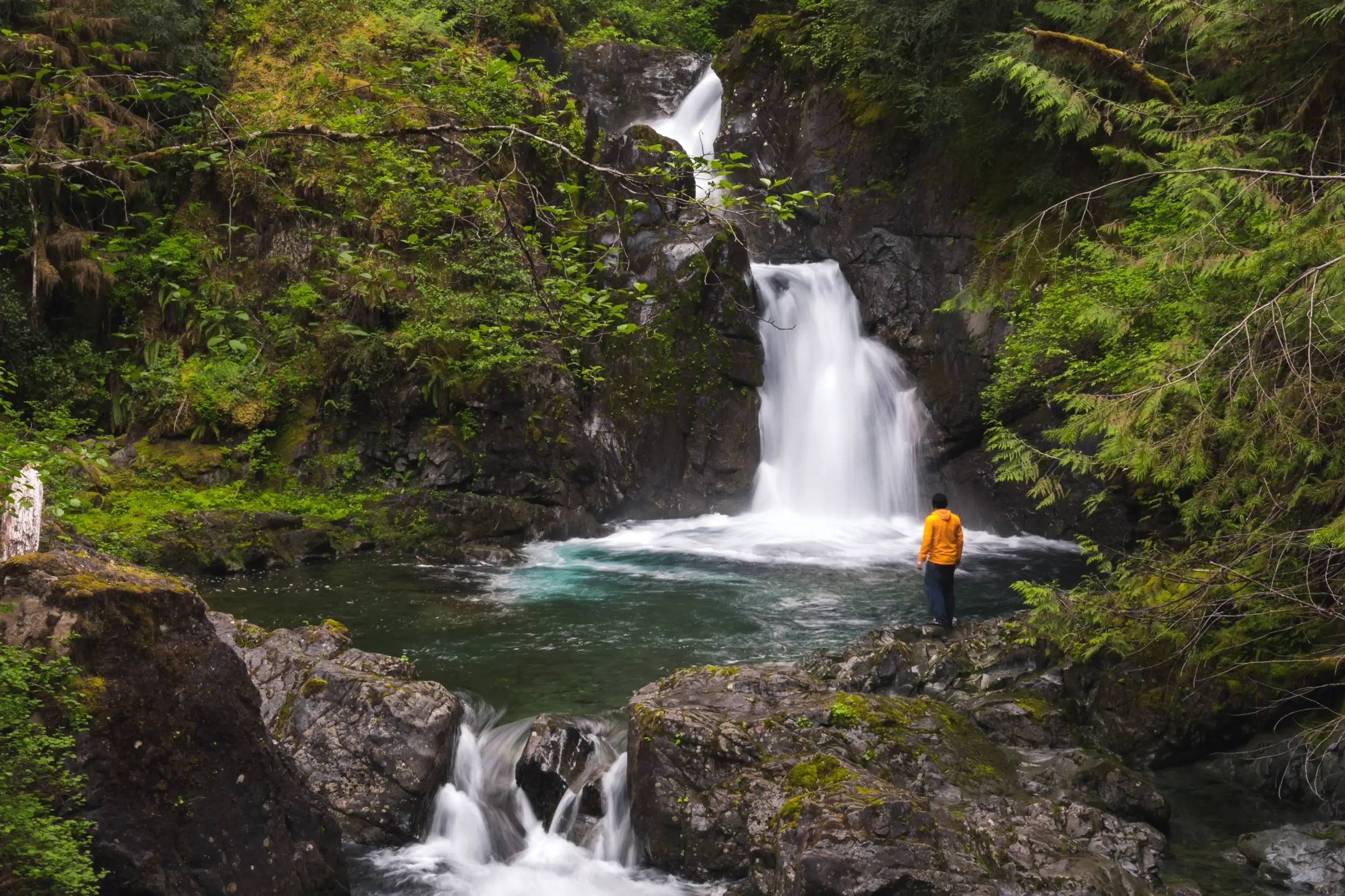
Snow Creek Falls
Distance: 0.5 KM / 0.3 MI
Elevation Gain: 60 M / 197 FT
Hiking Time: 20 MINS
Snow Creek is a lovely creek about an hours drive from Port Alberni on the south side of Sproat Lake that produces some absolutely stunning waterfalls as it surges down the steep forested slopes of Mt Klitsa. While it’s possible to view the lowest waterfalls on Snow Creek from the road without getting out of your car, adventurous hikers who follow a rugged social trail up through the dense forest alongside the creek will be greeted by the sight of several other gorgeous waterfalls. The trail is not often used and is a bit overgrown in sections, with plenty of deadfall to be hopped over or ducked under. Snow Creek Falls is definitely not as popular as other Port Alberni waterfalls such as China Creek Falls or Stokes Creek Falls. Even though it can be a little hard to follow, it’s not easy to get lost as it does just follow alongside the creek after all. I highly recommend following the Snow Creek trail as it leads past two-tiered Snow Creek Falls, unofficially named Gemini Falls and Galleon Falls, and eventually peters out near unofficially named Tangled Falls. The hike is very short but the trail is fun and the main waterfalls along Snow Creek are stunning, as well as several smaller drops along the way. There are plenty more Snow Creek waterfalls upstream, but until the trail is extended, getting any further upstream is very much a bushwack, and not one I recommend to any but the experienced.
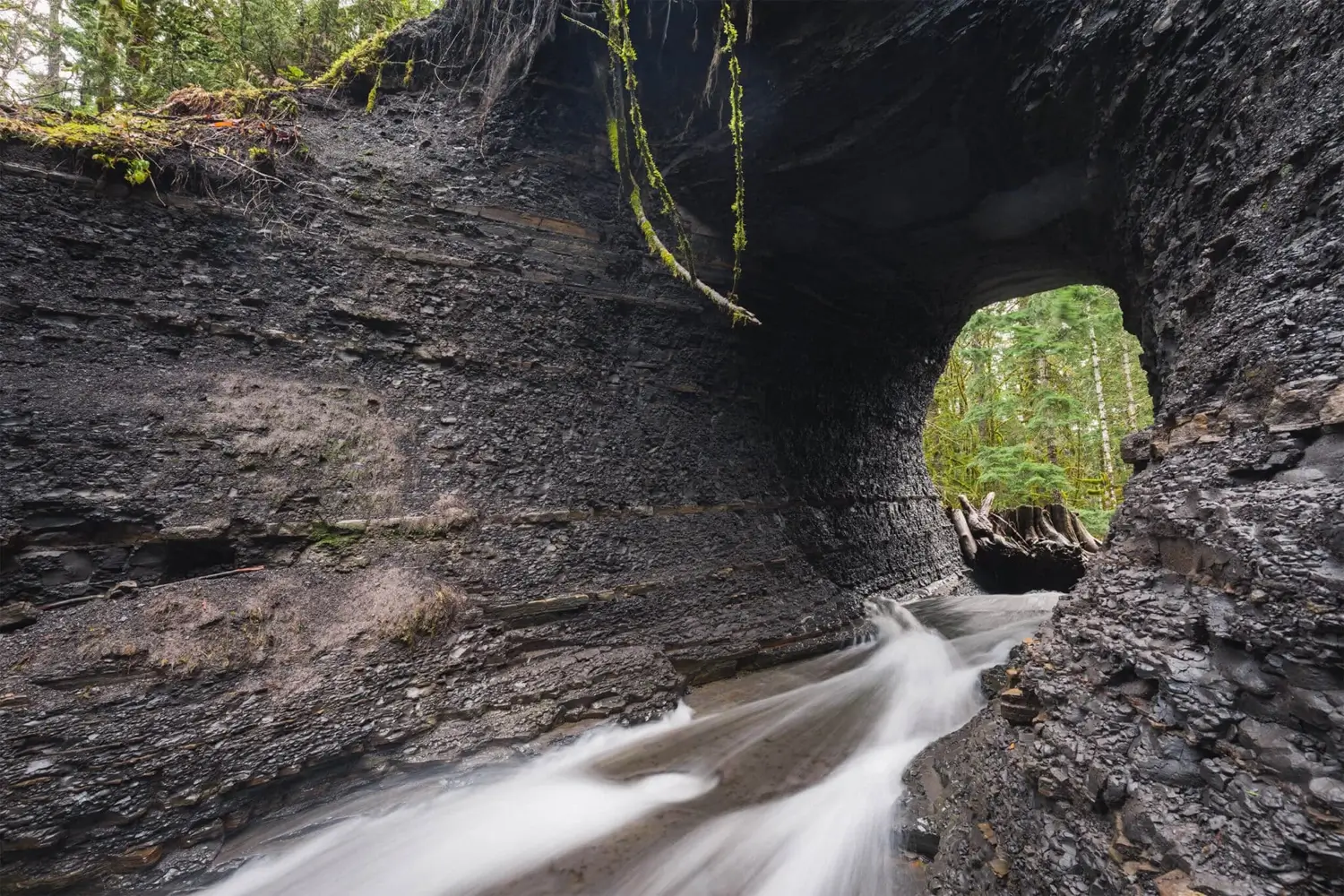
Hole in the Wall
DISTANCE: 1.7 KM / 1 MI
ELEVATION GAIN: 35 M / 115 FT
HIKING TIME: 30 MINS
The Hole in the Wall is located at a bend where Rogers Creek loops around a tall and wide natural shale wall. When locals’ water was provided by old wooden stave pipes that connected the creek to the town, a hole was made through the steep cliff for the pipes to go through. Today, remains of the old pipes can be found in the forest near the creek, but the most obvious reminder is the large hole which now just connects Rogers Creek to itself.
The area is popular due to its view of the unique water feature, as well as the fact that it’s only a short and easy walk to reach the end of the trail. The trail can be connected with Rogers Creek Falls downstream, rewarding hikers with another (in my mind even more spectacular) waterfall for only ten minutes more walking.
In recent years a large tree stump has gotten wedged at the end of the hole, creating the beginnings of a dam which other logs and sticks have gotten stuck on, so the flow of water through the hole is reduced somewhat.
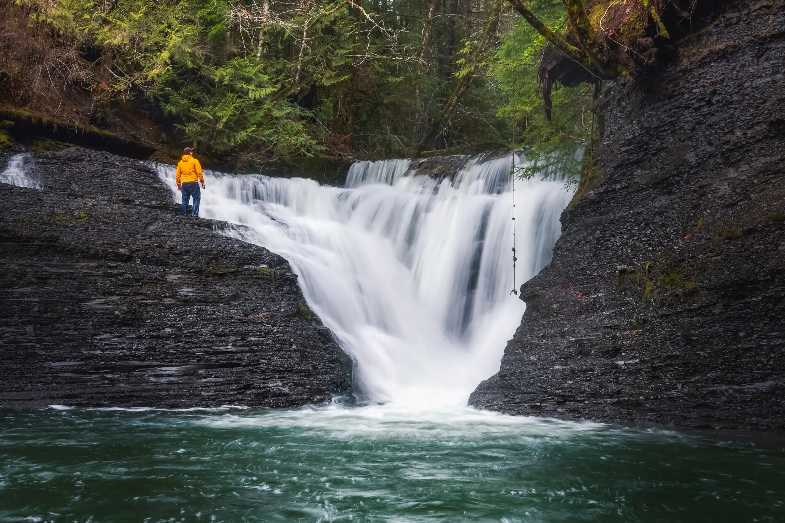
Rogers Creek Falls
Distance: 2.3 KM / 1.4 MI
Elevation Gain: 43 M / 141 FT
Hiking Time: 30 MINS
What most people visiting Hole in the Wall don’t realize is that by extending their hike and following Rogers Creek downstream for only a few more minutes they can visit another beautiful waterfall. Rogers Creek Falls cascades over the exposed slate bedrock characteristic of this section of the creek named for pioneering Alberni Valley logger Jeremiah Rogers. While this waterfall might not be as popular as Hole in the Wall, in my opinion it’s far more beautiful.
The remnants of a dam are visible at the top of Rogers Creek Falls, once serving as an intake for the water system that was built to serve Alberni in the late 1930s. This alongside the remaining bits of the wooden stave pipe that once went through the Hole in the Wall upstream help tell the story of the growing communities in the Alberni Valley up to nearly a century ago.
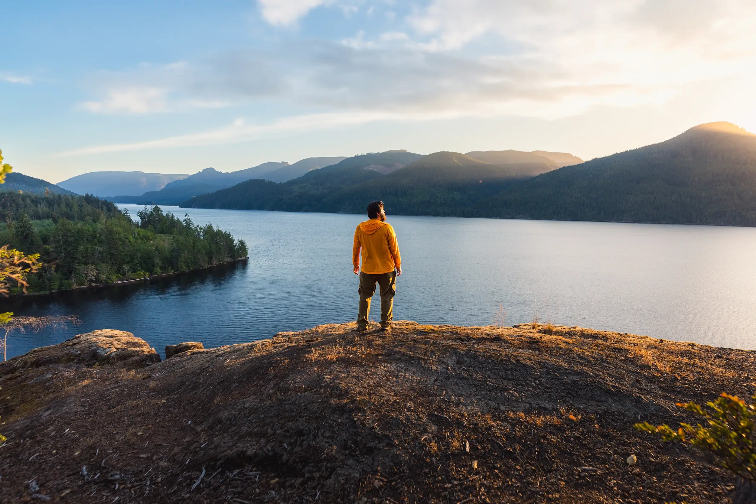
Great Central Lake Lookout
Distance: 4.5 KM / 2.8 MI
Elevation Gain: 170 M / 558 FT
Hiking Time: 1 Hr
Great Central Lake is well known for the boat ride to its other end in Strathcona Provincial Park where the hike to Della Falls begins. Less well known is the short hike on the Port Alberni side of the lake that leads to a spectacular viewpoint over Great Central Lake and the distant peaks of Strathcona beyond. This is one that’s definitely more about the destination than the journey, as the “trail” up to the viewpoint mostly follows logging road up through cutblock.
Recommended Hiking Gear


Water is a must whenever I’m hiking, especially if the sun is going to be out. My favourite water filter I’ve used is the Katadyn BeFree 0.6L, which unlike other water filters I’ve used packs up really small and lightweight. For hikes where I know there won’t be any readily available water sources along the way, I make sure to bring my own. The Hydrapak Stow 1L bottle is my go-to, for the same reason that it’s made of a soft plastic that folds up and doesn’t take up any more extra space than necessary in my pack. Finally, Aquatabs are another great option for purifying water, with one tablet being suitable for one litre of water. I previously used the Grayl water filter while travelling internationally, and though I found its hard body more convenient for day to day use and easier to drink from, it has a little too much bulk for my fast-and-light style of hiking.


The secret to all my photos of gorgeous sunset and sunrise mountaintop views? A lot of hiking in the dark. And let me speak from personal experience when I say that the last thing that you want to happen when hiking is to be caught in the dark without a headlamp. I used the Black Diamond Spot 400 for years and it worked great – until I lost it on top of a mountain somewhere. The only downside to it was having to worry about the batteries dying, though there’s also a slightly more expensive version that has a rechargeable battery. Nowadays I’m using the Petzl Actik Core, which is a bit pricier than the more budget-friendly Black Diamond, but is also brighter, more comfortable (in my opinion), and has a hybrid power system that is rechargeable but can also take AAA batteries if needed.
You won’t see me using trekking poles on shorter hikes often – but on long hikes and backpacking trips, as well as certain scrambles, they are an absolute lifesaver. I’ve invested in a high quality ultra-lightweight pair of MSR DynaLock Ascent carbon poles which, while pricey, I don’t regret one bit. If you’re not entirely sure how much use you’re going to get out of a pair of trekking poles, the best budget-friendly option would be the Trekology Trek Z 2.0. Amazon does sell a lot of cheaper Made in China-style trekking poles for cheaper, but these usually are much much heavier and not worth buying.
All the best and most long-lasting cables and power banks I’ve ever owned have been Anker. I once had a phone cable from them that lasted me over three years of daily use! That’s why I keep an Anker PowerCore Essential 20K power bank on me. Like many people I use my phone for a lot of stuff when hiking (checking in with family, using online maps, taking photos, flying my drone) so I like to be prepared for that low battery warning by having a backup power source on me just in case.


The only socks I ever buy for myself are from Darn Tough, and I almost always make sure to wear them when hiking. After years of having no problems only wearing these comfortable and rugged socks for hikes, I accidentally wore a pair of no-name socks on a hike last year and ended up with blisters on both feet. Safe to say I’m back to sticking with the Darn Tough. And the best part? They have a lifetime guarantee, meaning that if they ever wear out you can send them back for a brand new pair. For hiking footwear I go between a pair of lightweight approach shoes for quick and dirty mountain ascents or anything involving scrambling and more heavy-duty boots for longer treks. I’ve worn a couple different versions of the lightweight but super durable Arc’teryx Konseal FL 2 approach shoes for a few years now and am very impressed with the durability. I also really like the thick toecap that keeps me protected every time I stumble into a root or large rock. For longer, tougher, or muddier treks I rely on my LOWA Camino EVO GTX, which I find insanely comfortable and made of very high quality.


I wear my Ar’teryx Gamma Lightweight Pants on every single hike I go on, and on many days when I’m not hiking. After several years of abuse they are still holding together extraordinarily well, with only a few small holes from where I’ve fallen down and some slight stains from being repeatedly coated with mud. They’re lightweight, breathable, and super comfortable. For lightweight and breathable hiking tops I’m a big fan of both the Patagonia Capilene Shirt and the MEC Core Shirt. My Arc’teryx Squamish Hoody shows up in a lot of my photos. It’s super lightweight and packable, and does a great job of cutting the wind while also being pretty breathable. I also have an Arc’teryx Atom Hoody and Arc’teryx Beta LT that I pull out for cooler or wetter conditions.