
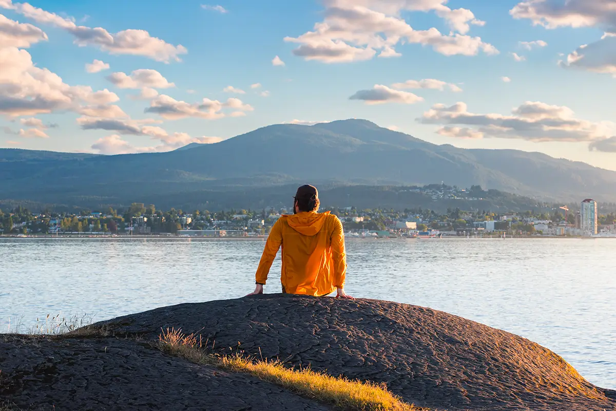
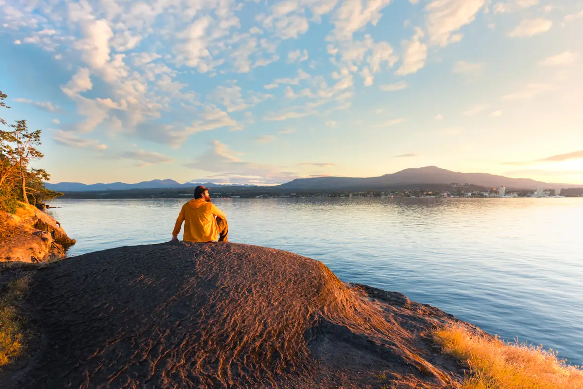
As amazing as the view down over Nanaimo from Mount Benson is, deep down I think the seaside walk along Jack Point just might be the best Nanaimo hike you can do.
The Jack Point hike is definitely not a perfect hike by any means. To be glass-half-full about it, it’s the ideal hike for the deaf hiking community. For the rest of us there’s a lot of industrial noise to put up with nearly the entire way. Even as I sat at the viewpoint at the very tip of Jack Point enjoying the view, a BC ferry came around the corner, horn blaring and car alarm wailing from somewhere onboard.
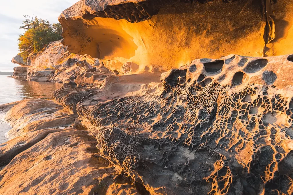
Buuuut, jeez this hike is beautiful. First off, these are the best views of Nanaimo you’re going to get from anywhere. And you get them the entire hike. Then let’s talk about the beautiful honeycomb weathering and spectacular overhangs on the sandstone shore that are only visible at low tide. The only comparable spot nearby is the Malaspina Galleries on Gabriola Island, but Jack Point is the only place to see these beautiful and unique rock formations here on Vancouver Island.
Continue reading this blog post for everything you need to know to experience the Jack Point hike near Nanaimo on Vancouver Island for yourself, including distance, elevation gain, how to get there, the best time to visit, and lots of photos of my experience.
When hiking it’s important to avoid harmful practices such as disturbing plants or rock-stacking, or removing any natural object from flowers to rocks, as it’s important to leave the environment as natural as possible for the animals and for fellow hikers to enjoy in perpetuity. As many flowers as there are, there are few enough that if we all took one, then there wouldn’t be any left. Take only photos, leave only footprints.
If you haven’t heard of Leave No Trace principles, they’re also really essential to read up on before heading anywhere into the outdoors in general. Following these important principles basically means doing your best to leave beautiful places like Jack Point as good (if not better) than you found them, both for their preservation and for the enjoyment of other visitors.
Jack Point Round Trip Details
Distance: 5 KM / 3.1 .MI
Elevation Gain: 64 M / 210 FT
Hiking Time: 1.5 Hrs
Hiking & Safety Tips
- Prepare for the possibility of wildlife encounters. There are almost no grizzly bears on Vancouver Island, but black bears are still common. Bear bells are proven to be an ineffective bear deterrent, and are even actively discouraged by Parks Canada. The best way to let bears know you’re around is simply to use your voice. Make sure to keep a respectful distance from wildlife and never feed the animals. It may seem kind but it doesn’t just kill wildlife and put people in danger, it’s also in many cases illegal.
- Research current trail conditions and make sure you are well-informed about the route before you leave, and assess if it is within your capability. Be aware of what time it gets dark and check the weather forecast. Make sure to tell someone where you’re going and when you expect to return. Every year as more and more people try hiking for the first time, the number of rescues goes up. Being prepared is the best defense.
- Pack everything you need for a successful hike, including enough water and energy-rich snacks. Remember to pack out everything you pack in though – don’t expect to find a convenient garbage can halfway up the trail. Bring appropriate layers (remember you’ll warm up once you start hiking) and sun protection. Hiking poles may be helpful but are not required. In addition to not leaving any garbage on the trail yourself, I highly recommend bringing a garbage bag and collecting any trash that you do see on the trail. You’re guaranteed to make the Jack Point hike a more enjoyable experience for the next person.
How to Get to Jack Point Trailhead
It’s easy to go the wrong way when getting to the Jack Point trailhead, and I say that from experience. If you follow Google Maps directions to Jack Point and Biggs Park, you’ll go the wrong way and not find parking. The issue is that the parking lot, and the Jack Point trailhead, are actually not very close to the rest of the park, and off of a different road. If you’re using Google Maps, make sure to use the Parking – Jack Point and Biggs Park pin for navigation instead.
The trailhead for the Jack Point hike, located in Jack Point and Biggs Park, is about fifteen minutes from Downtown Nanaimo. Drive South on Highway 1, following signs for Highway 19 towards Vancouver & Delta. This is the way towards the Duke Point Ferry Terminal, so signs are easy to follow. After about three minuts heading along Highway 19, take the exit for Duke Point Industrial Park / Cedar. Continue straight along Maughan Road into the Industrial park, before turning right onto Jackson Road. After two kilometers on Jackson, you’ll spot the small parking area on your left.
Click here to open the exact trailhead location in Google Maps.
Hiking Jack Point
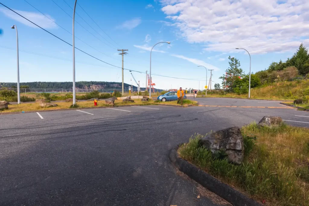
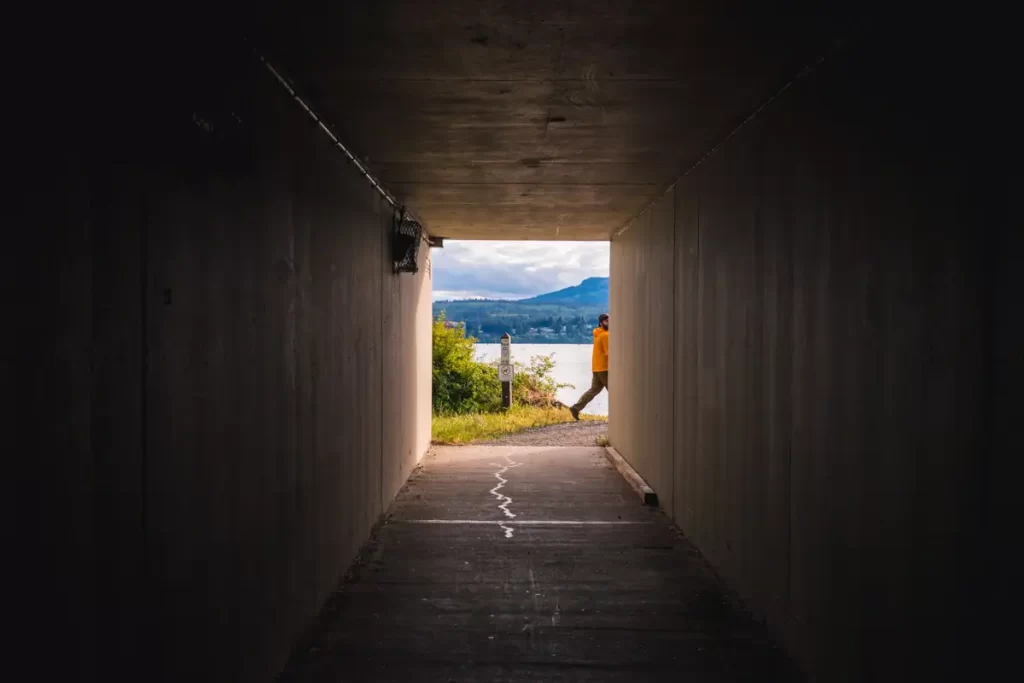
The Jack Point and Biggs Park parking lot, with the industrial park behind it. From here, there’s an obvious underpass below the road, leading to the path along the shore.
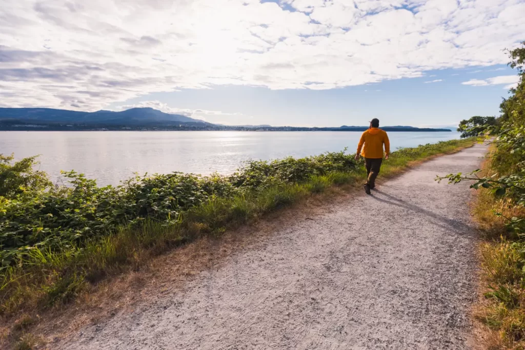
The start of the path along Jack Point.
As unpleasant as this part of the walk next to the highway is (invasive blackberries everywhere, lots of industrial noise), the views towards Nanaimo nearly make up for it.
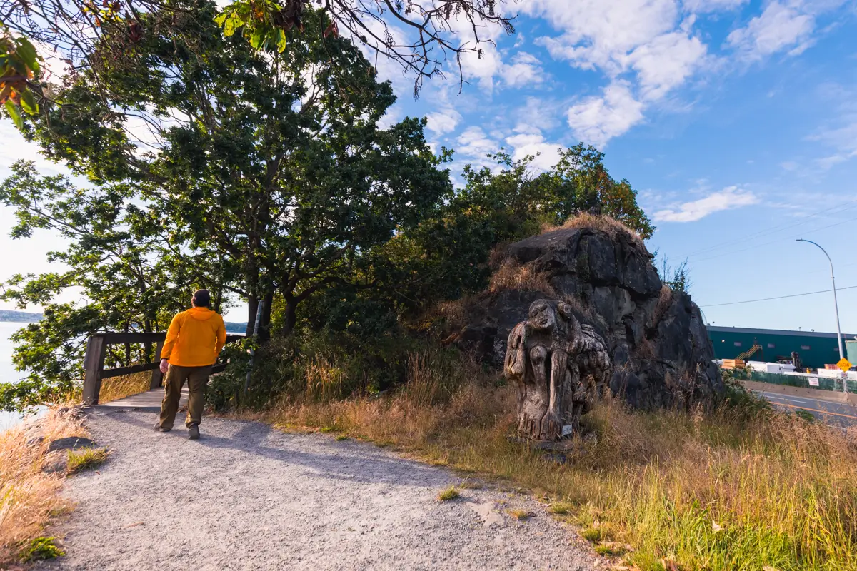
Note the small sculpture at right. Here is where a small social trail veers off of the path to the left, heading down to the largest overhangs in sandstone.
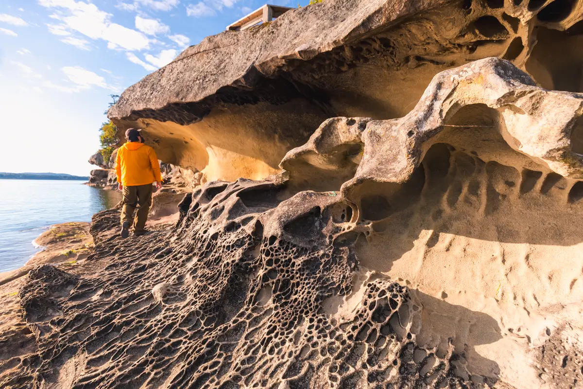
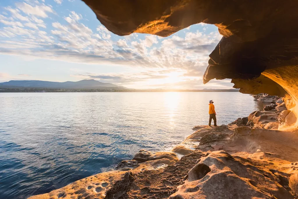
As you can see the path continues overhead, but its worth taking a brief detour down here if the tide is low enough. At high tide the water rises up to not much higher than where I’m standing, making access possible, but not easy. Almost all the other formations further along Jack Point require low tide in order to be accessible.
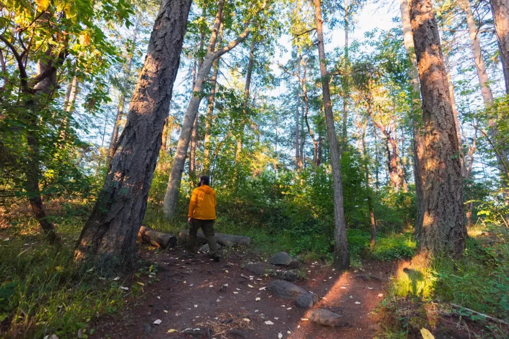
Continuing along the path.

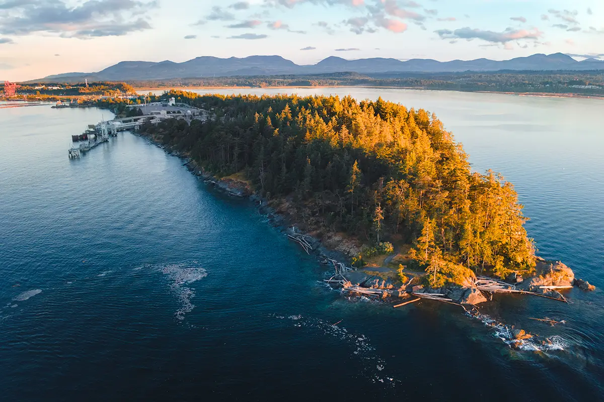
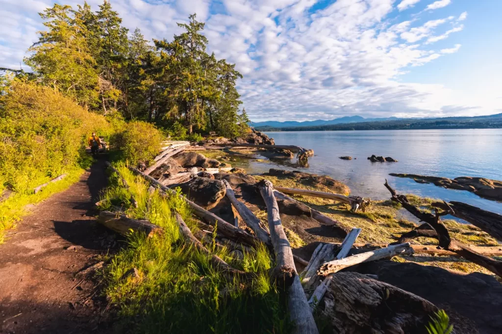
The long narrow Jack Point stretches out into the water. Its north side is almost completely industrialized. Though the trail follows along the south edge, there are for now still views (and sounds) of the industrial area.
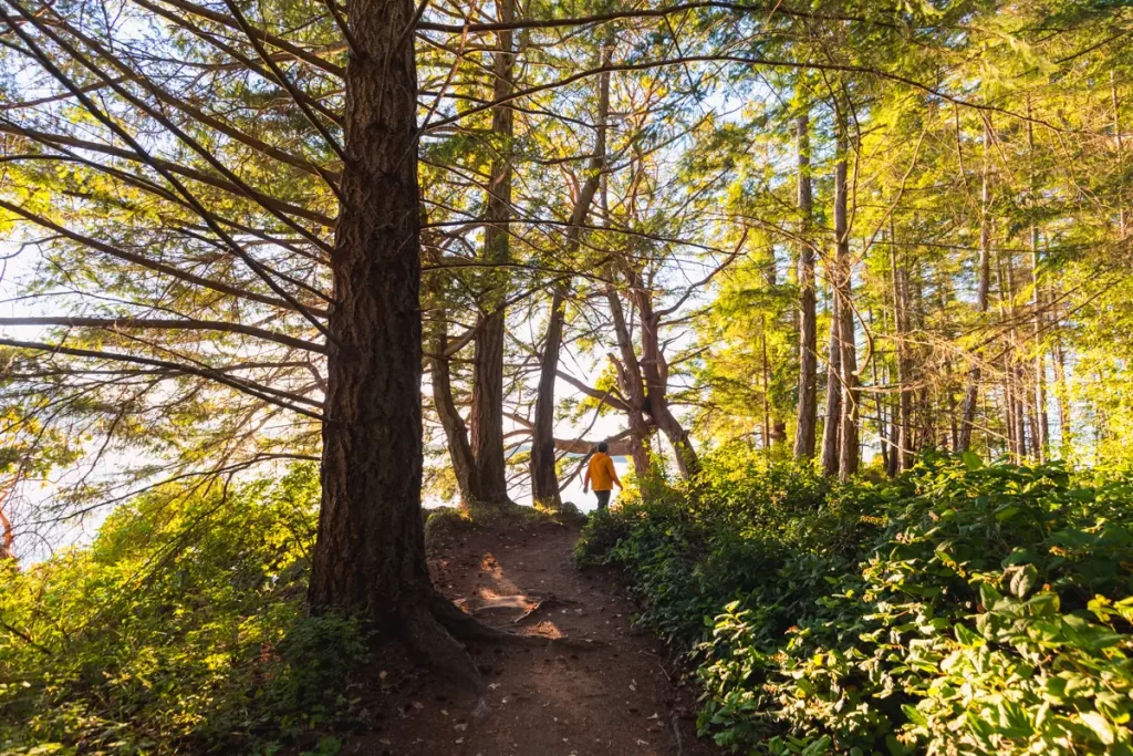
Fortunately the trail soon enters actual forest, and quickly becomes way more enjoyable than the flat gravel path at the start.
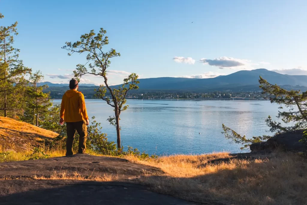
The peaks of the Nanaimo Lakes region are visible looking back.
The tide was going up as I did my hike, so while more of the honeycomb weathering was visible here, much more of it was underwater already.
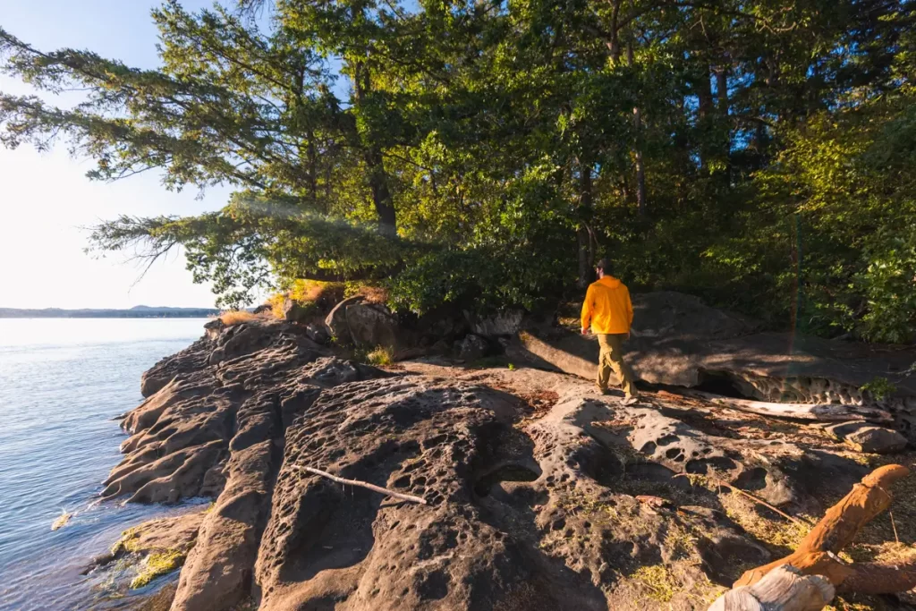
A small stretch of land juts out, offering a great view of the rest of the shoreline (especially at low tide when more of the unique erosion is visible).
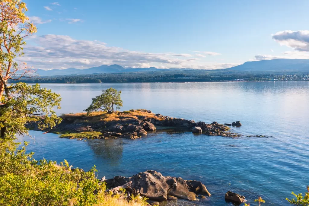
The small piece of land as seen from further on. Visible here are the two trees seen in the previous photo.
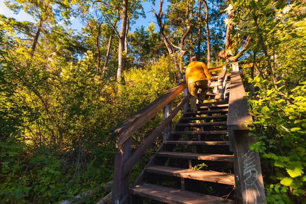
One of a couple sets of stairs along the Jack Point trail.
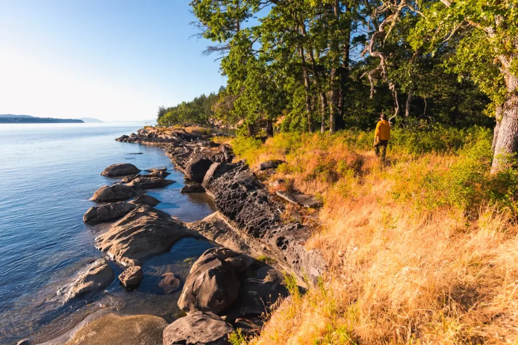
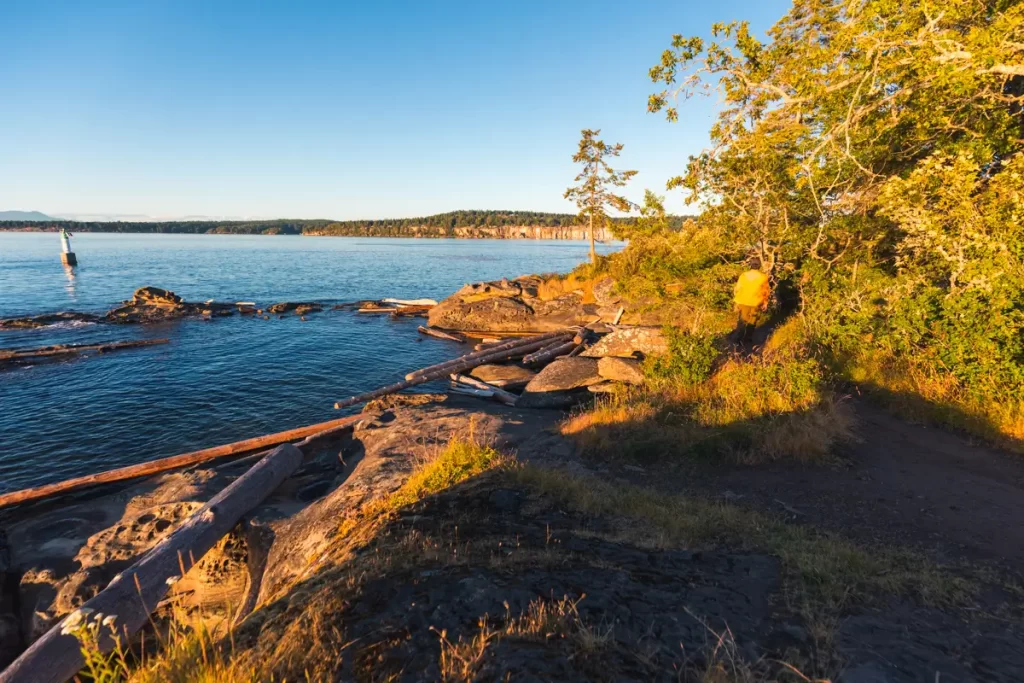
The woods get prettier as the hike gets closer to the end of Jack Point. By this point most of the industrial noise is left behind.
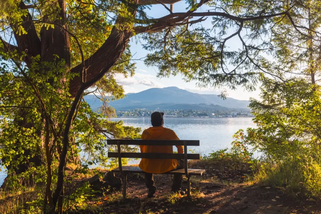
In my opinion the trail could use a few more benches in shady spots along the route, because these views are just splendid.
At the end of Jack Point is a loop, where the trail follows around the tip of the point before circling back to the south side. Go left here.
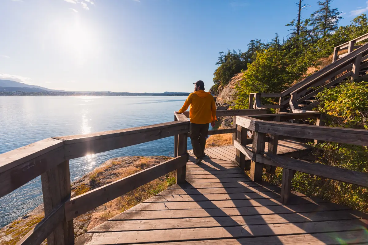
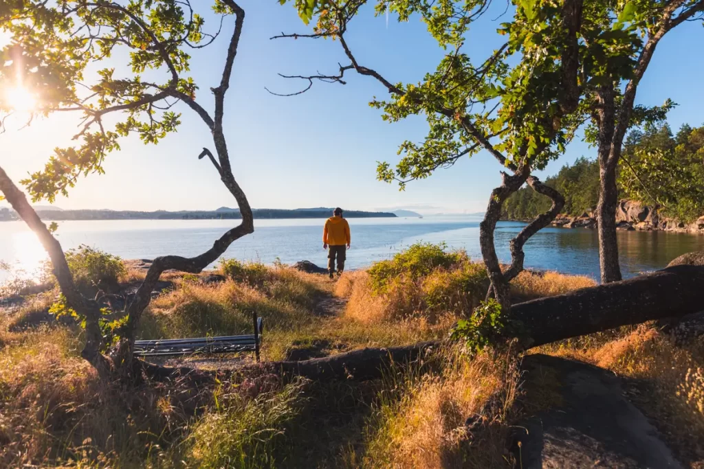
Another fantastic open viewpoint.
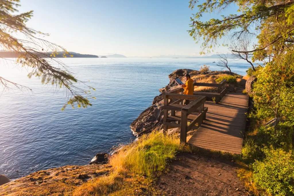
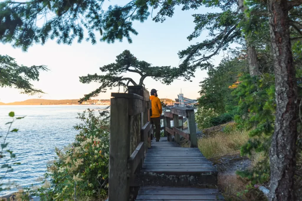
The final viewpoint of the Jack Point hike. It was so beautiful and calm here, and the panoramic views to the north as well as south were the best yet.
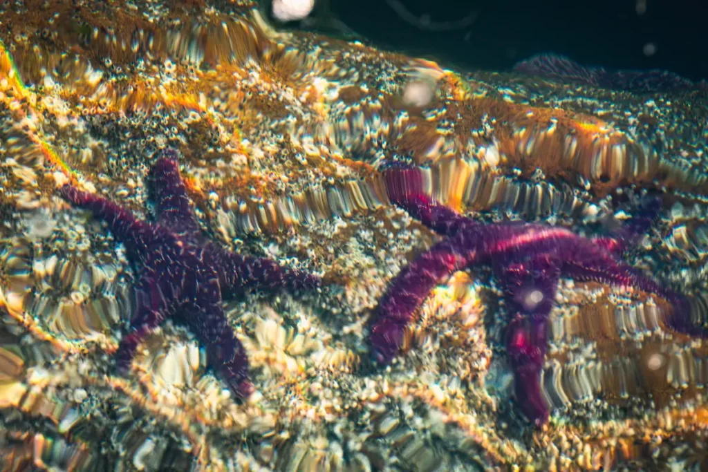
Two of what were probably a dozen purple sea stars that were visible looking down into the water.
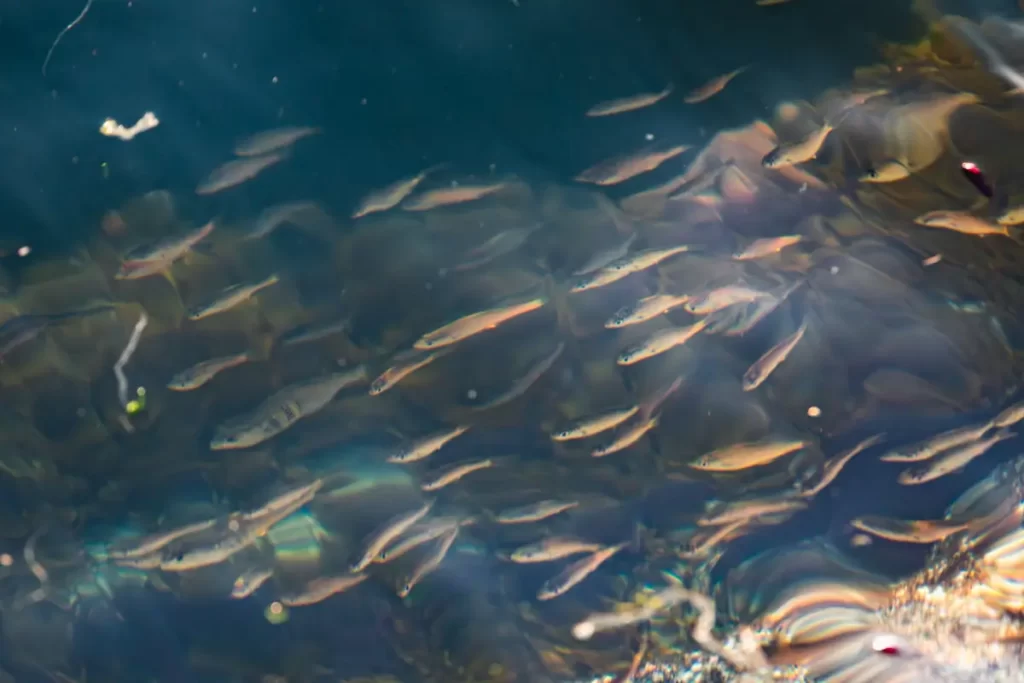
A school of shiner perch were also visible.
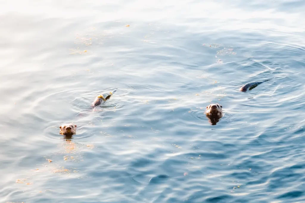
Every couple of minutes these river otters poked their heads up to observe me. Possibly they were hunting the shiner perch.
The trail curving around the tip of Jack Point. Gabriola Island visible to the east. It should be of little surprise, given its proximity, that Gabriola is also well known for its honeycomb sandstone formations. If you were able to zoom in really far you’d be able to see them on the very very left edge of this image.
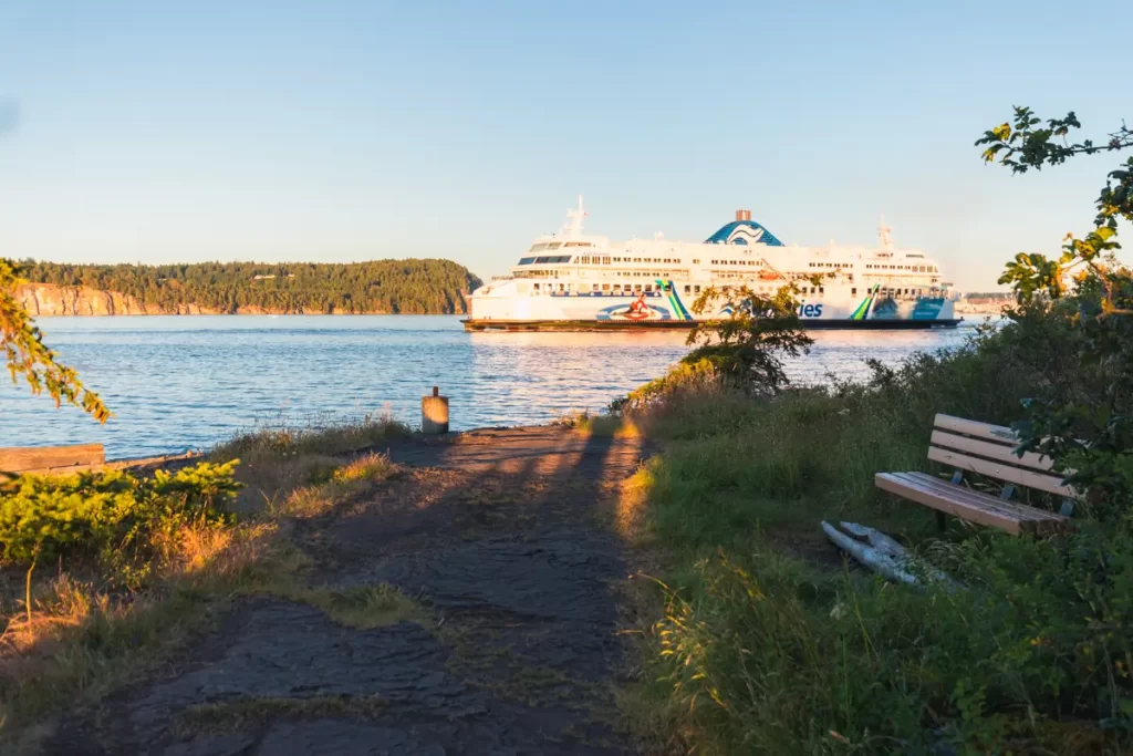
Just as I walked around this corner this BC ferry blared its horn just as it came into view, making me jump. The pace and quiet I had enjoyed, however brief, was appreciated while it lasted.
Walking back along the other side of Jack Point. The trail continues along this shore before connecting back to complete the loop, and returning the way it came.
Recommended Hiking Gear


Water is a must whenever I’m hiking, especially if the sun is going to be out. My favourite water filter I’ve used is the Katadyn BeFree 0.6L, which unlike other water filters I’ve used packs up really small and lightweight. For hikes where I know there won’t be any readily available water sources along the way, I make sure to bring my own. The Hydrapak Stow 1L bottle is my go-to, for the same reason that it’s made of a soft plastic that folds up and doesn’t take up any more extra space than necessary in my pack. Finally, Aquatabs are another great option for purifying water, with one tablet being suitable for one litre of water. I previously used the Grayl water filter while travelling internationally, and though I found its hard body more convenient for day to day use and easier to drink from, it has a little too much bulk for my fast-and-light style of hiking.


The secret to all my photos of gorgeous sunset and sunrise mountaintop views? A lot of hiking in the dark. And let me speak from personal experience when I say that the last thing that you want to happen when hiking is to be caught in the dark without a headlamp. I used the Black Diamond Spot 400 for years and it worked great – until I lost it on top of a mountain somewhere. The only downside to it was having to worry about the batteries dying, though there’s also a slightly more expensive version that has a rechargeable battery. Nowadays I’m using the Petzl Actik Core, which is a bit pricier than the more budget-friendly Black Diamond, but is also brighter, more comfortable (in my opinion), and has a hybrid power system that is rechargeable but can also take AAA batteries if needed.
You won’t see me using trekking poles on shorter hikes often – but on long hikes and backpacking trips, as well as certain scrambles, they are an absolute lifesaver. I’ve invested in a high quality ultra-lightweight pair of MSR DynaLock Ascent carbon poles which, while pricey, I don’t regret one bit. If you’re not entirely sure how much use you’re going to get out of a pair of trekking poles, the best budget-friendly option would be the Trekology Trek Z 2.0. Amazon does sell a lot of cheaper Made in China-style trekking poles for cheaper, but these usually are much much heavier and not worth buying.
All the best and most long-lasting cables and power banks I’ve ever owned have been Anker. I once had a phone cable from them that lasted me over three years of daily use! That’s why I keep an Anker PowerCore Essential 20K power bank on me. Like many people I use my phone for a lot of stuff when hiking (checking in with family, using online maps, taking photos, flying my drone) so I like to be prepared for that low battery warning by having a backup power source on me just in case.


The only socks I ever buy for myself are from Darn Tough, and I almost always make sure to wear them when hiking. After years of having no problems only wearing these comfortable and rugged socks for hikes, I accidentally wore a pair of no-name socks on a hike last year and ended up with blisters on both feet. Safe to say I’m back to sticking with the Darn Tough. And the best part? They have a lifetime guarantee, meaning that if they ever wear out you can send them back for a brand new pair. For hiking footwear I go between a pair of lightweight approach shoes for quick and dirty mountain ascents or anything involving scrambling and more heavy-duty boots for longer treks. I’ve worn a couple different versions of the lightweight but super durable Arc’teryx Konseal FL 2 approach shoes for a few years now and am very impressed with the durability. I also really like the thick toecap that keeps me protected every time I stumble into a root or large rock. For longer, tougher, or muddier treks I rely on my LOWA Camino EVO GTX, which I find insanely comfortable and made of very high quality.


I wear my Ar’teryx Gamma Lightweight Pants on every single hike I go on, and on many days when I’m not hiking. After several years of abuse they are still holding together extraordinarily well, with only a few small holes from where I’ve fallen down and some slight stains from being repeatedly coated with mud. They’re lightweight, breathable, and super comfortable. For lightweight and breathable hiking tops I’m a big fan of both the Patagonia Capilene Shirt and the MEC Core Shirt. My Arc’teryx Squamish Hoody shows up in a lot of my photos. It’s super lightweight and packable, and does a great job of cutting the wind while also being pretty breathable. I also have an Arc’teryx Atom Hoody and Arc’teryx Beta LT that I pull out for cooler or wetter conditions.
I hope you enjoyed this guide to hiking Jack Point near Nanaimo! Feel free to leave any questions in the comment section below or to contact me directly via social media.