
The Crowsnest Pass region of Alberta’s Rockies doesn’t come up enough when it comes to discussions of Alberta’s best hiking and outdoor recreation destinations. If after looking at my photos of my hike up McGillivray Ridge there is still any question of the Crowsnest Pass being able to deliver some absolutely superb views on some outrageously fun hikes, then I really don’t know what to think. My hike up McGillivray Ridge was a highlight of my 2022 hiking season, and I’m excited to shed some light on one of the best Crowsnest Pass hikes – an underappreciated hike in an underappreciated area.
McGillivray Ridge sits at the northern end of the Crowsnest Volcanics, a series of 100 million year old undulating ridges that are evidence of volcanic activity predating the surrounding Rockies entirely. Panoramic views from the top are so extensive that it would be a waste of time to list all the visible peaks, but suffice it to say that on a clear day you can see really really far.
The hike itself feels like a snapshot of every kind of hike – containing a little bit of something for every hiker to love, and maybe something for every hiker to hate. It involves a steep uphill bushwack under power lines, an easy section of obvious and well-maintained forest trail, walking old access road, a little bit of scrambling, and near the end some ridgeline boulder hopping. No section of the McGillivray Ridge trail is alike.
Continue reading this blog post for everything you need to know to experience the McGillivray Ridge hike in the Crowsnest Pass for yourself, including distance, elevation gain, how to get there, the best time to visit, and lots of photos of my experience.
When hiking it’s important to avoid harmful practices such as disturbing plants or rock-stacking, or removing any natural object from flowers to rocks, as it’s important to leave the environment as natural as possible for the animals and for fellow hikers to enjoy in perpetuity. As many flowers as there are, there are few enough that if we all took one, then there wouldn’t be any left. Take only photos, leave only footprints.
If you haven’t heard of Leave No Trace principles, they’re also really essential to read up on before heading anywhere into the outdoors in general. Following these important principles basically means doing your best to leave beautiful places like McGillivray Ridge as good (if not better) than you found them, both for their preservation and for the enjoyment of other visitors.
McGillivray Ridge Round Trip Details
Distance: 12.1 KM / 7.5 MI
Elevation Gain: 654 M / 2146 FT
Hiking Time: 4-5 HRS
Hiking & Safety Tips
- Prepare for the possibility of wildlife encounters. Bear spray is a must whenever travelling in bear country, as well as learning how to use it. Though your chance of an aggressive bear encounter is low, it is always better to be prepared with bear spray. Bear bells are proven to be an ineffective bear deterrent, and are actively discouraged by Parks Canada. The best way to let bears know you’re around is simply to use your voice. Make sure to keep a respectful distance from wildlife and never feed the animals. It may seem kind but it doesn’t just kill wildlife and put people in danger, it’s also in many cases illegal.
- Research current trail conditions and make sure you are well-informed about the route before you leave, and assess if it is within your capability. Be aware of what time it gets dark and check the weather forecast. Make sure to tell someone where you’re going and when you expect to return. Every year as more and more people try hiking for the first time, the number of rescues goes up. Being prepared is the best defense.
- Pack everything you need for a successful hike, including enough water and energy-rich snacks. Remember to pack out everything you pack in though – don’t expect to find a convenient garbage can halfway up the trail. Bring appropriate layers (remember you’ll warm up once you start hiking) and sun protection. Hiking poles may be helpful but are not required. In addition to not leaving any garbage on the trail yourself, I highly recommend bringing a garbage bag and collecting any trash that you do see on the trail. You’re guaranteed to make the hike to McGillivray Ridge a more enjoyable experience for the next person.
How to Get to McGillivray Ridge Trailhead
One of the best things about reaching the McGillivray Ridge trailhead is that the road gains over 400 m of elevation before the hike even starts. From Coleman in the Crowsnest Pass, turn north onto Highway 40 at the large intersection in front of the Subway. Drive straight until you reach the junction with 24 Ave. Turn left onto 24 Ave and follow the road as it curves to the right to another junction. Turn left onto 27 Ave and take the first right onto 28 Ave. Continue straight along gravel Highway 40 for 8.9 km as it winds up the valley. Pull off on the shoulder near where an old atv trail turns into the woods at left and begin hiking from here. Unlike some popular Banff or Kananaskis hikes where trailheads are easy to identify by the lineup of cars on the shoulder, there isn’t likely to be anyone else parked at the McGillivray Ridge trailhead so I highly suggest using the Google Maps pin for precise navigation.
Click here to open the exact trailhead location in Google Maps.
Hiking to McGillivray Ridge
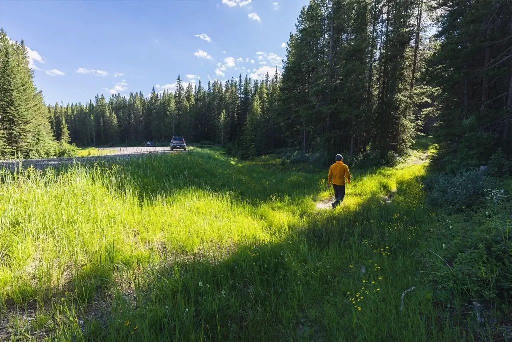
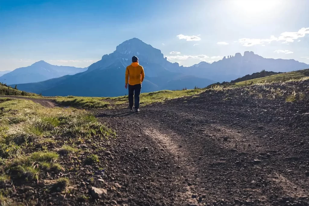
The start of the trail up McGillivray Ridge is easy to miss.
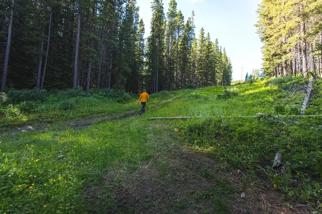
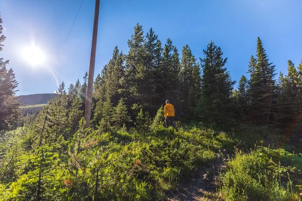
A junction with a more defined double track. Turn right here to ascend a small hill before following the power lines (one is visible in the distance if you look closely) up the steep slope.
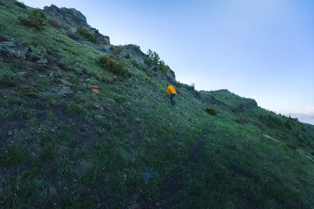
Bushwacking below the power lines. A trail becomes more defined once out of the cutblock, but for the most part its prettymuch a bushwack. Fortunately the power lines make it easy to stay on target.
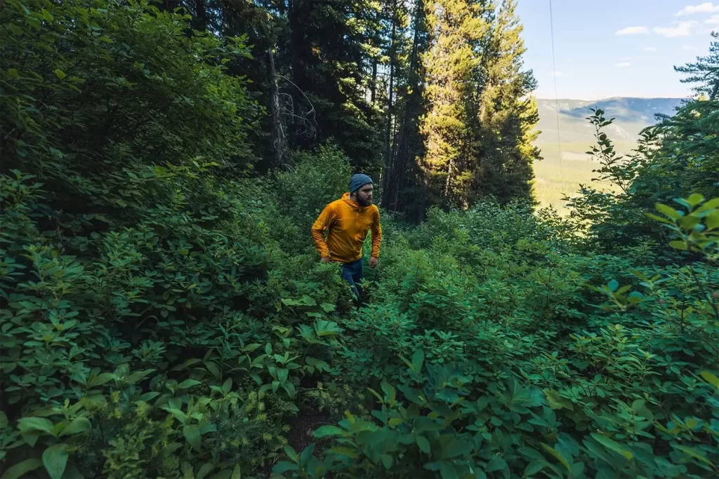
As dense as the foliage looks (and it is) the trail is fortunately mostly pretty easy to follow by this point. As the slope gets steeper the trail eventually heads into the woods to the left to switchback up more gently.
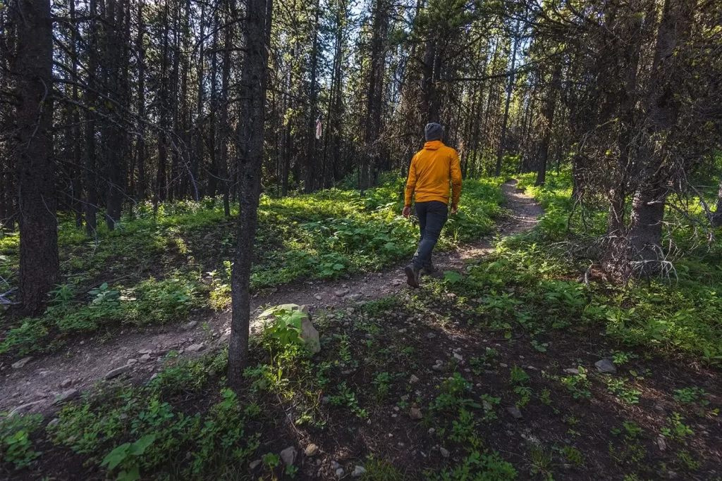
Turn right when the trail joins a singletrack making its way along the ridge.
Once the easy-to-follow singletrack crosses back through the power lines, turn left to continue following the power lines uphill. I initially continued along the singletrack hoping it would lead uphill as well but it didn’t.
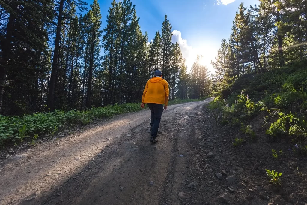
After continuing to follow the power lines, the trail meets up with an old access road for a repeater station. This is the trail now.
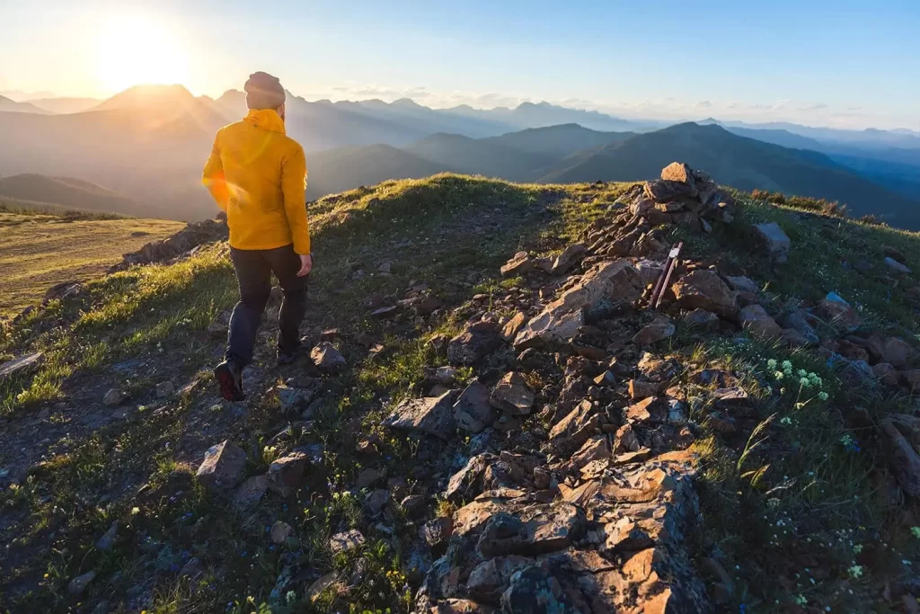
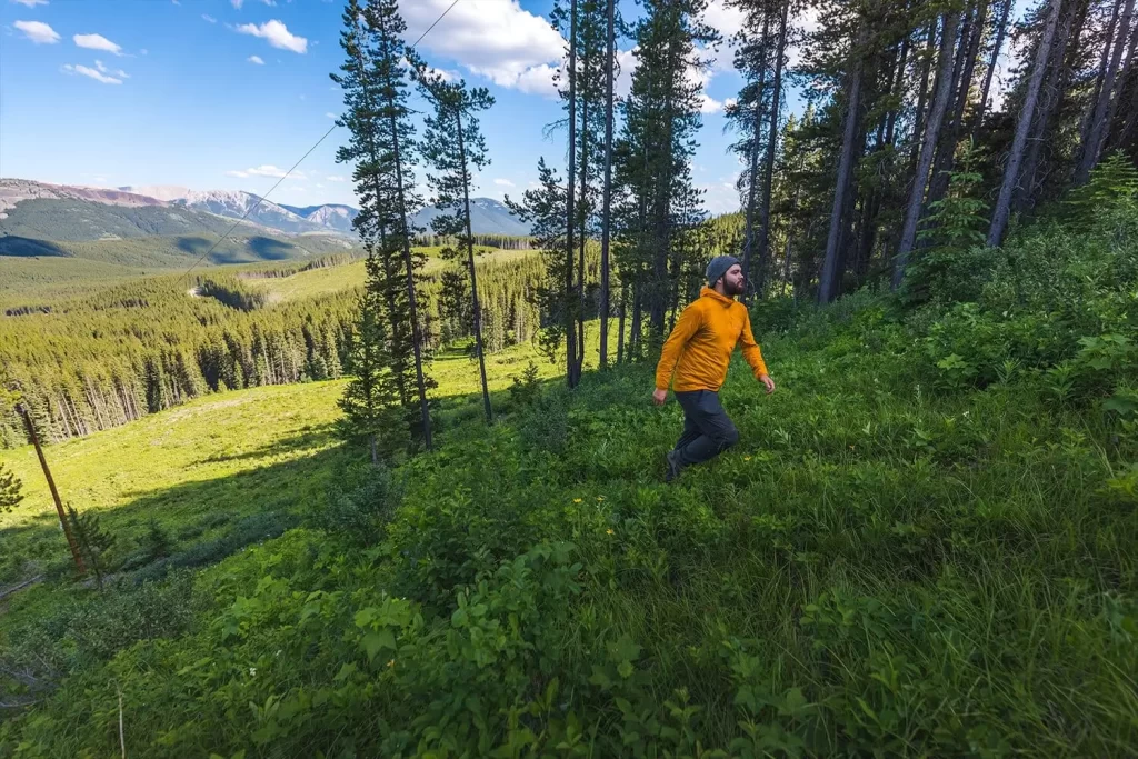
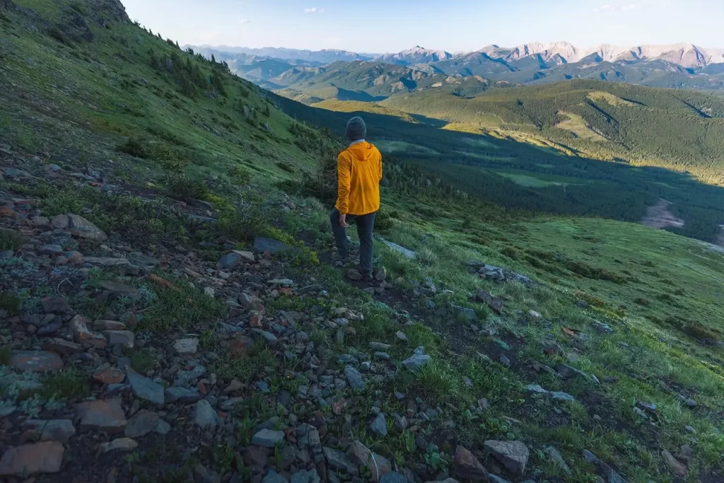
Incredible views of the Crowsnest Pass opening up behind me.
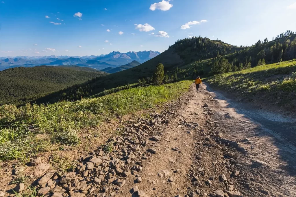
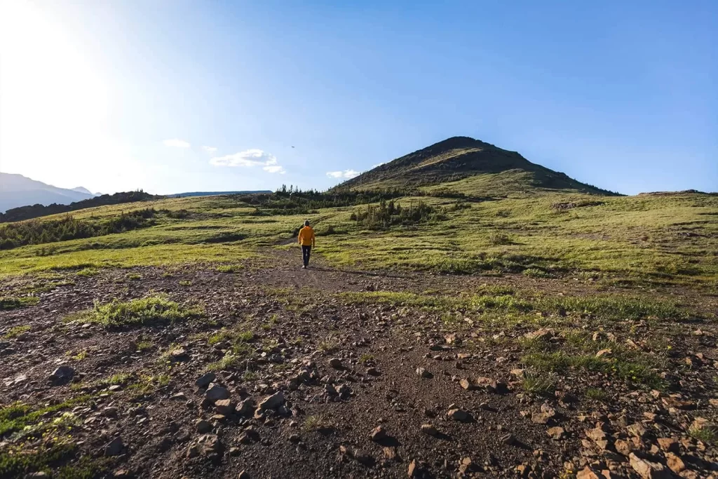
The road splits in two – the left option heading up to the repeater station. Continue straight towards the false summit at right.
Mt Tecumseh, Crowsnest Mountain, and the Seven Sisters looking impressive in the distance. I’m following the access road as it curves around to the west.
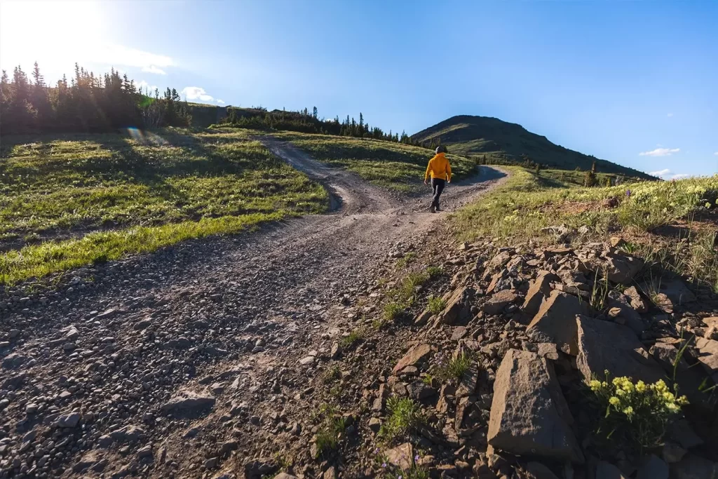
An older more primitive road breaks off from the acess road heading up McGillivray Ridge.
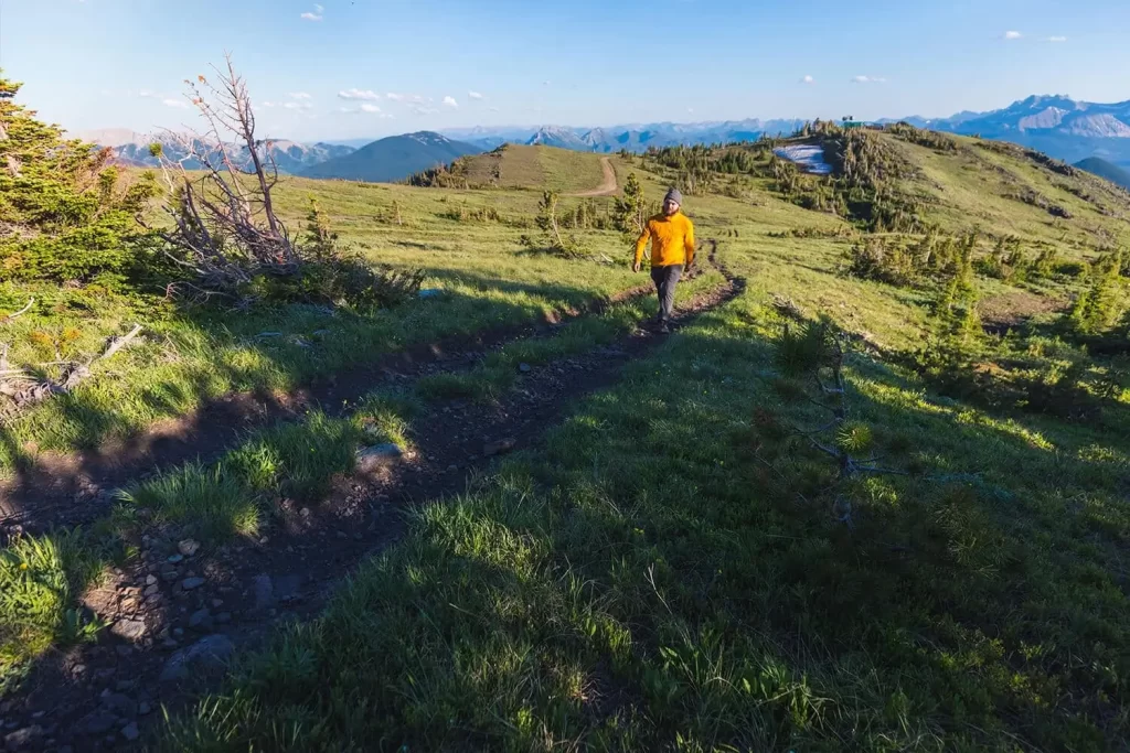
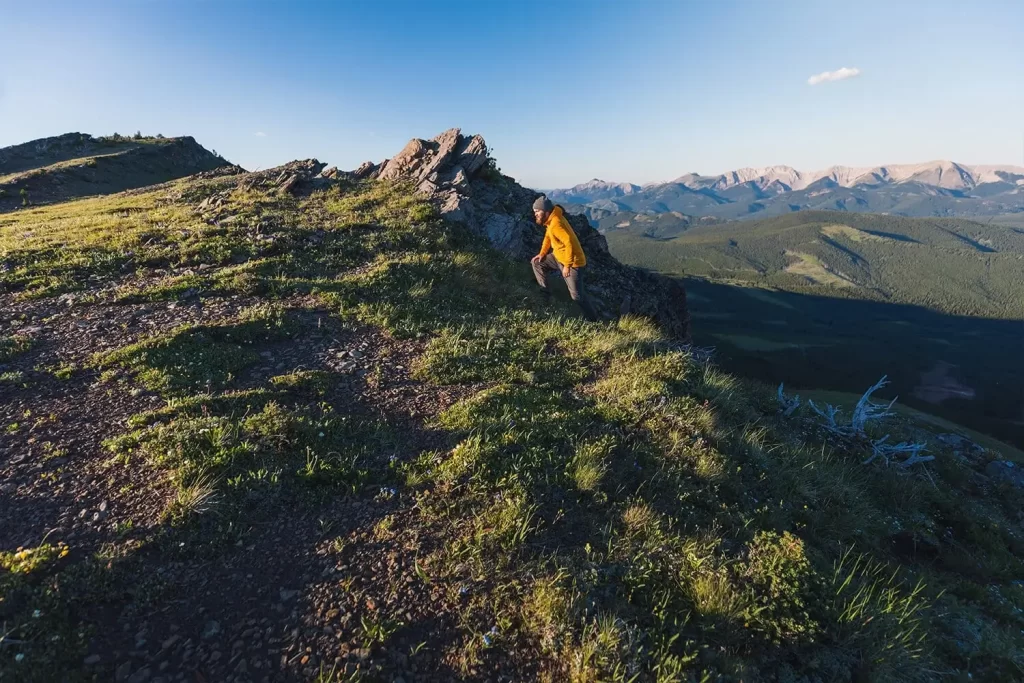
The repeater station is visible behind me at right. The primitive road turns into doubletrack turns into singletrack as it makes its way long the right side of the ridge crest.
Great views to the east as I walk in the shadow of the ridge crest. Look out for the way up to ascend the ridge on the left, as the singletrack just keeps on going and eventually fades away.
A faint trail leads up onto the ridge crest, potentially involving a little scrambling.
Up the ridge crest. As I climbed up I startled a gorgeous stag who was hanging out at the top, but failed to get my camera out in time.
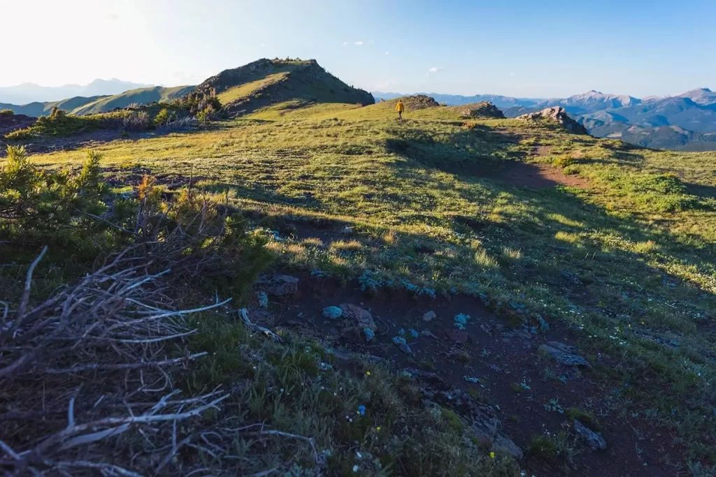
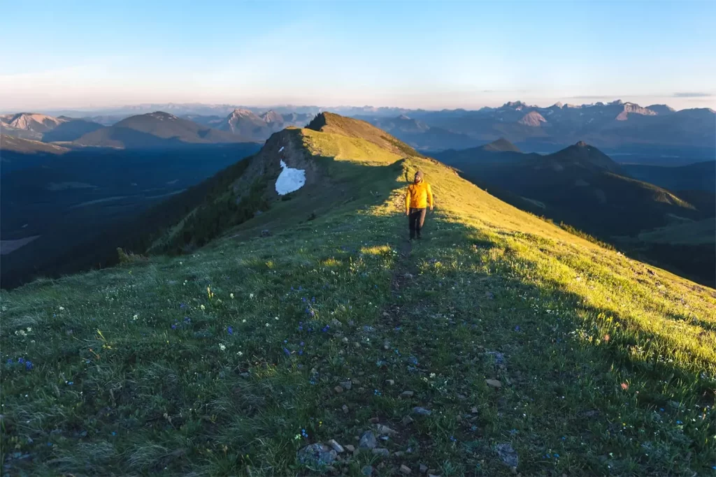
Continuing up along the plateau-like top of the ridge towards the false summit ahead. This time keep left of the ridge crest visible in the distance and stay on top of the ridge.
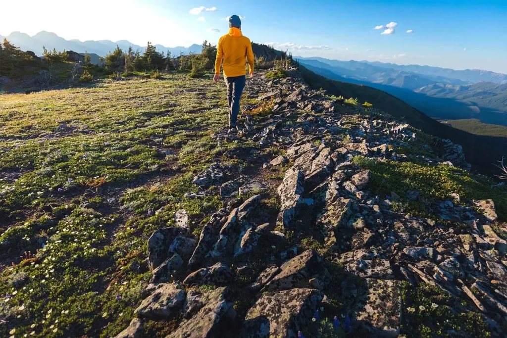
Following the ridgeline as it becomes increasingly rocky.
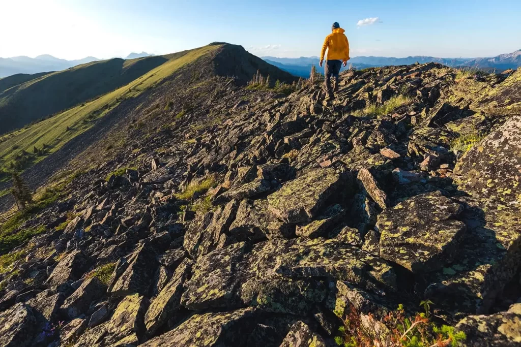
Balance and good routefinding is important on the rocky stretch of ridgeline pictured here. If you’re not comfortable walking along the spine of the ridge it’s easy to duck down to the left a bit. The summit of McGillivray Ridge is visible ahead.
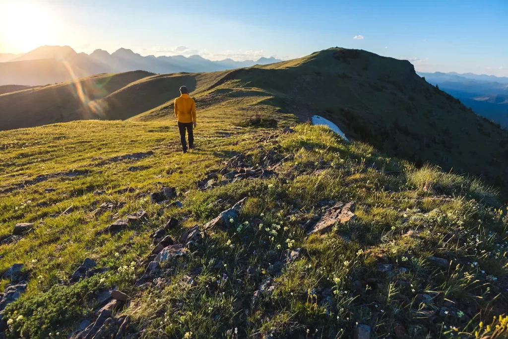
After the rocky section it’s an easy stroll up the last grassy bit before the summit.
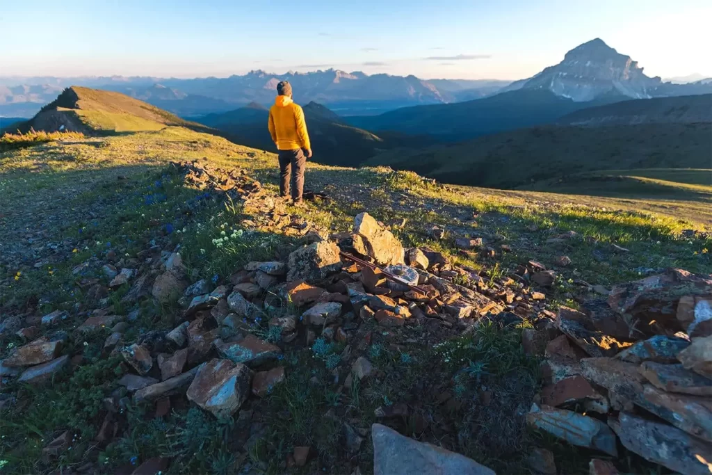
The summit of McGillivray Ridge.
Recommended Hiking Gear


Water is a must whenever I’m hiking, especially if the sun is going to be out. My favourite water filter I’ve used is the Katadyn BeFree 0.6L, which unlike other water filters I’ve used packs up really small and lightweight. For hikes where I know there won’t be any readily available water sources along the way, I make sure to bring my own. The Hydrapak Stow 1L bottle is my go-to, for the same reason that it’s made of a soft plastic that folds up and doesn’t take up any more extra space than necessary in my pack. Finally, Aquatabs are another great option for purifying water, with one tablet being suitable for one litre of water. I previously used the Grayl water filter while travelling internationally, and though I found its hard body more convenient for day to day use and easier to drink from, it has a little too much bulk for my fast-and-light style of hiking.


The secret to all my photos of gorgeous sunset and sunrise mountaintop views? A lot of hiking in the dark. And let me speak from personal experience when I say that the last thing that you want to happen when hiking is to be caught in the dark without a headlamp. I used the Black Diamond Spot 400 for years and it worked great – until I lost it on top of a mountain somewhere. The only downside to it was having to worry about the batteries dying, though there’s also a slightly more expensive version that has a rechargeable battery. Nowadays I’m using the Petzl Actik Core, which is a bit pricier than the more budget-friendly Black Diamond, but is also brighter, more comfortable (in my opinion), and has a hybrid power system that is rechargeable but can also take AAA batteries if needed.
You won’t see me using trekking poles on shorter hikes often – but on long hikes and backpacking trips, as well as certain scrambles, they are an absolute lifesaver. I’ve invested in a high quality ultra-lightweight pair of MSR DynaLock Ascent carbon poles which, while pricey, I don’t regret one bit. If you’re not entirely sure how much use you’re going to get out of a pair of trekking poles, the best budget-friendly option would be the Trekology Trek Z 2.0. Amazon does sell a lot of cheaper Made in China-style trekking poles for cheaper, but these usually are much much heavier and not worth buying.
All the best and most long-lasting cables and power banks I’ve ever owned have been Anker. I once had a phone cable from them that lasted me over three years of daily use! That’s why I keep an Anker PowerCore Essential 20K power bank on me. Like many people I use my phone for a lot of stuff when hiking (checking in with family, using online maps, taking photos, flying my drone) so I like to be prepared for that low battery warning by having a backup power source on me just in case.


The only socks I ever buy for myself are from Darn Tough, and I almost always make sure to wear them when hiking. After years of having no problems only wearing these comfortable and rugged socks for hikes, I accidentally wore a pair of no-name socks on a hike last year and ended up with blisters on both feet. Safe to say I’m back to sticking with the Darn Tough. And the best part? They have a lifetime guarantee, meaning that if they ever wear out you can send them back for a brand new pair. For hiking footwear I go between a pair of lightweight approach shoes for quick and dirty mountain ascents or anything involving scrambling and more heavy-duty boots for longer treks. I’ve worn a couple different versions of the lightweight but super durable Arc’teryx Konseal FL 2 approach shoes for a few years now and am very impressed with the durability. I also really like the thick toecap that keeps me protected every time I stumble into a root or large rock. For longer, tougher, or muddier treks I rely on my LOWA Camino EVO GTX, which I find insanely comfortable and made of very high quality.


I wear my Ar’teryx Gamma Lightweight Pants on every single hike I go on, and on many days when I’m not hiking. After several years of abuse they are still holding together extraordinarily well, with only a few small holes from where I’ve fallen down and some slight stains from being repeatedly coated with mud. They’re lightweight, breathable, and super comfortable. For lightweight and breathable hiking tops I’m a big fan of both the Patagonia Capilene Shirt and the MEC Core Shirt. My Arc’teryx Squamish Hoody shows up in a lot of my photos. It’s super lightweight and packable, and does a great job of cutting the wind while also being pretty breathable. I also have an Arc’teryx Atom Hoody and Arc’teryx Beta LT that I pull out for cooler or wetter conditions.
I hope you enjoyed this guide to hiking McGillivray Ridge in the Crowsnest Pass! Feel free to leave any questions in the comment section below or to contact me directly via social media.