
The small city of Duncan, located at the mouth of the Cowichan Valley, does not feature prominently on most lists of must-visit tourist destinations on Vancouver Island. Despite its relatively close proximity to Victoria and location right off of Highway 1, hikes here are quiet and frequented mostly by locals. However, the area surrounding Duncan is home to spectacular ocean views, rushing waterfalls, and lookouts with beautiful panoramas over the warm Cowichan Valley.
Continue reading this blog post for everything you need to know to experience these awesome Duncan hikes for yourself, including distance, elevation gain, how to get there, the best time to visit, and lots of photos of my experience.
Tips for Hiking Near Duncan
When in the outdoors it’s important to avoid harmful practices such as disturbing plants or rock-stacking, or removing any natural object from flowers to rocks, as it’s important to leave the environment as natural as possible for the animals and for fellow hikers to enjoy in perpetuity. As many flowers as there are, there are few enough that if we all took one, then there wouldn’t be any left. Take only photos, leave only footprints.
I also highly recommend reading up on Leave No Trace principles before heading anywhere into the outdoors in general. Following these important principles basically means doing your best to leave beautiful places like these Duncan hikes as good (if not better) than you found them, both for their preservation and for the enjoyment of other visitors.
Upper Banon Creek Falls
Distance: 2.4 km / 1.5 mi
Elevation Gain: 130 m / 426 ft
Hiking Time: 1 hr
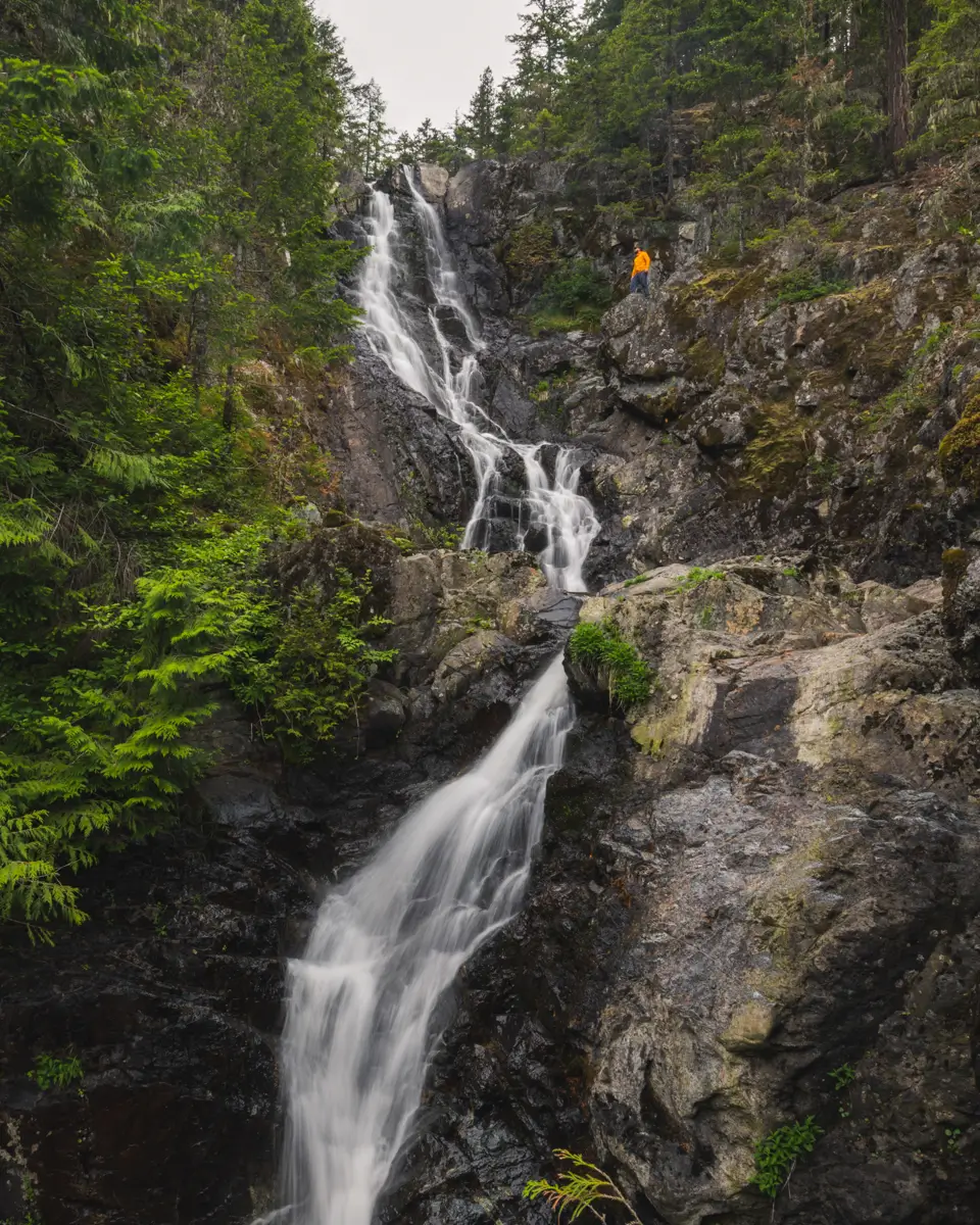
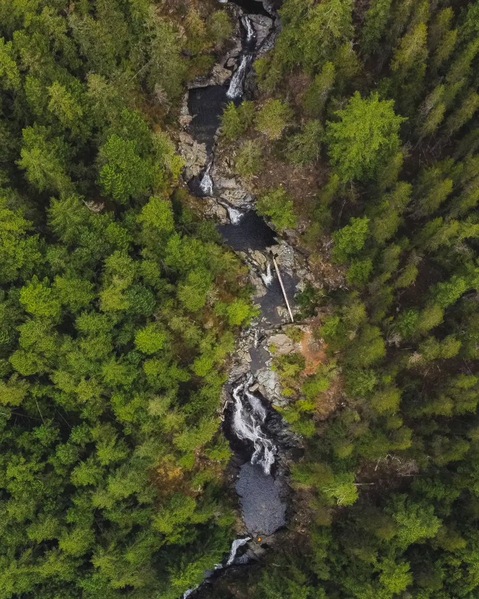
Upper Banon Creek Falls is a gorgeous Vancouver Island waterfall not far from Chemainus, just north of Duncan. Though the walk to this stunning waterfall is relatively short, it is pretty steep and sure to get your heart pumping. The waterfall has only become well-known over the past few years, and what was once a vague route through the forest from a logging road has now become a clearly-defined well-booted trail. That said, while the trail is now difficult to lose, it is still steeper and rougher than any official maintained trail, with plenty of roots to step over and deadfall to climb over. During the winter months the roar of Upper Banon Creek Falls is deafening as it swells with rainwater, eventually calming in the summer months. Despite the beauty of Upper Banon Creek Falls, it’s still not as well-known as many other Vancouver Island waterfalls so you’re likely to have it all to yourself.
Stoney Hill
Distance: 3.4 km / 2.1 mi
Elevation Gain: 108 m / 354 ft
Hiking Time: 45 mins-1 hr
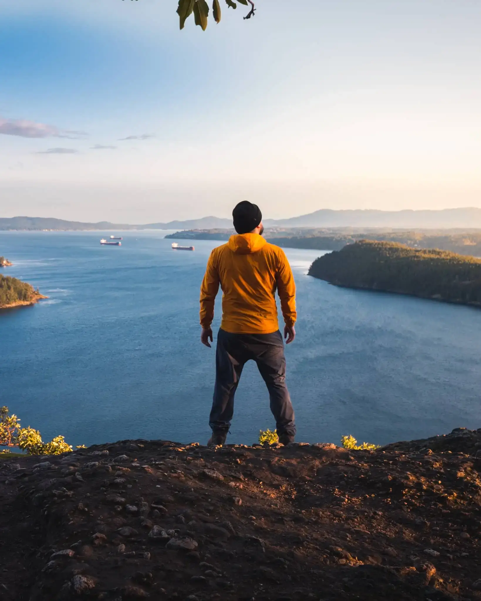
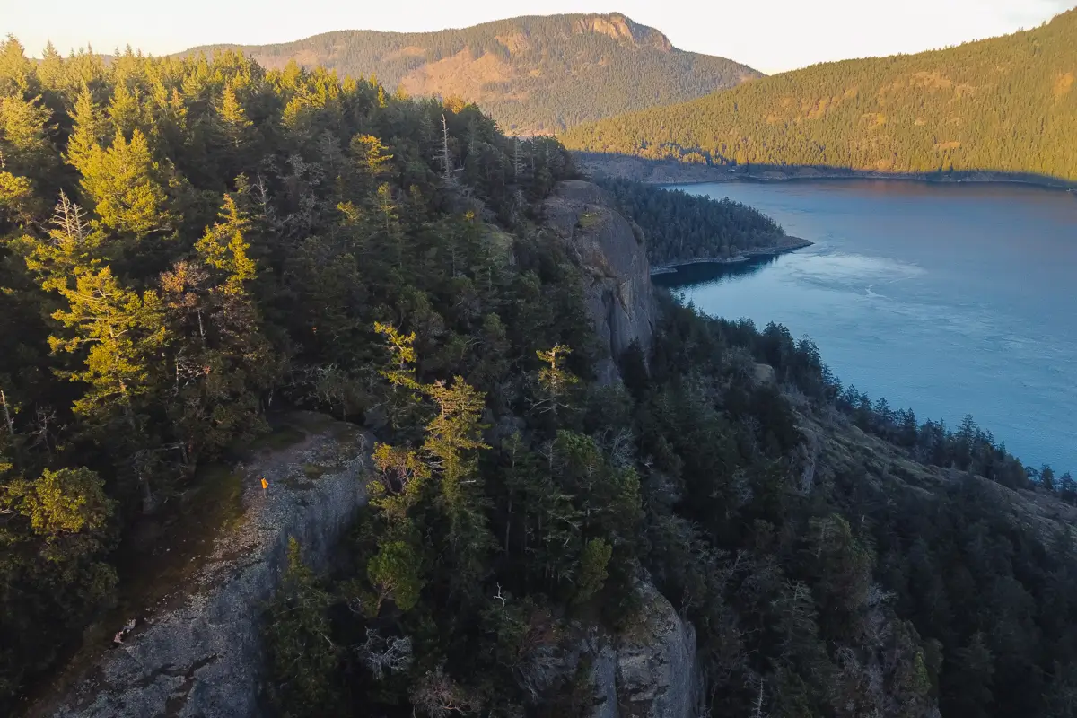
I’m still surprised that this Vancouver Island hike isn’t more popular, mostly seeing only locals on its trails. The Stoney Hill hike is a loop trail that leads along the top of rocky bluffs overlooking Sansum Narrows, with Saltspring Island across the water and the Saanich Peninsula visible in the very distance. It offers some of the most magnificent views that can be had on Southern Vancouver Island, and is one of my absolute favourite hikes near Duncan.
Most people choose to hike the Stoney Hill loop counter-clockwise, but having hiked the trail multiple times in each direction, I can say that hiking it clockwise is far superior, and that’s what I recommend here. Hiking Stoney Hill counter-clockwise means that the views only get more stunning and panoramic as the hike progresses, whereas hiking the more popular counterclockwise route starts off with stunning views that progressively less interesting as it goes on, with the last section of trail eneding up feeling boring.
Mt Tzouhalem Viewpoint
Distance: 6 km / 3.7 mi
Elevation Gain: 243 m / 797 ft
Hiking Time: 1.5-2 hrs
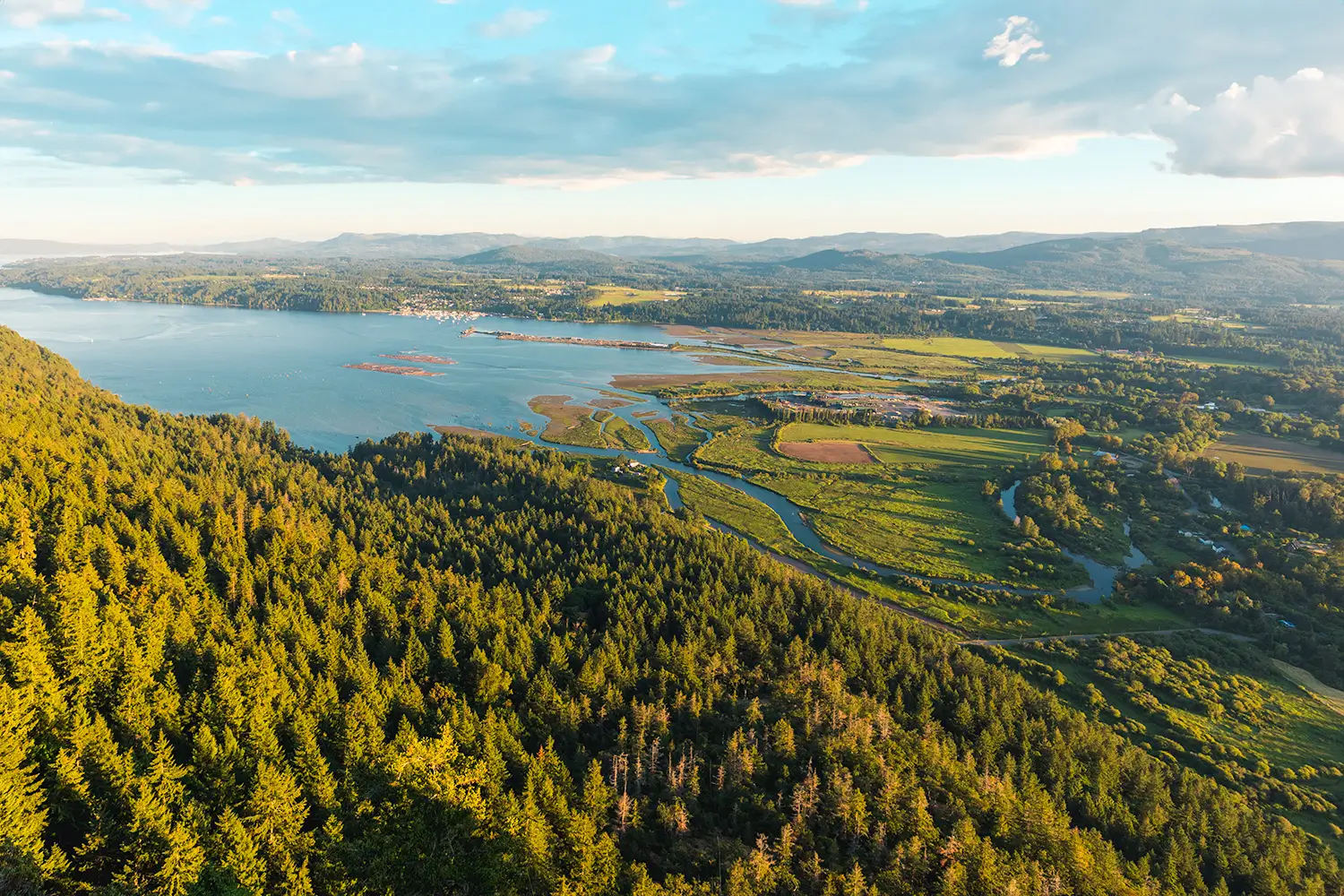
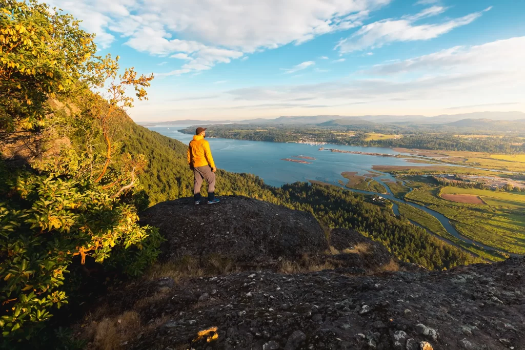
Tzouhalem is an iconic mountain that rises recognizably to the northeast of Duncan. If you’re a resident of Vancouver Island it’s likely you’ve driven past this fantastic southern Vancouver island hike many times. That’s not to say that Mt Tzouhalem is a local secret by any means – it’s one of the most popular areas in the region for outdoor recreation, with a myriad of hiking and mountain biking trails to be explored. One of the best and most popular trails on Mt Tzouhalem is the one that leads to a fantastic panoramic overlook of the Cowichan Valley. This viewpoint is often referred to as the Cross Viewpoint in reference to the large white cross that was formerly erected on the spot. Mt Tzouhalem is not only one of the best hikes near Duncan, but the views from the top make it one of my favourite hikes on southern Vancouver Island.
Old Baldy Mountain
Distance: 3.4 km / 2.1 mi
Elevation Gain: 200 m / 656 ft
Hiking Time: 45 mins-1 hr
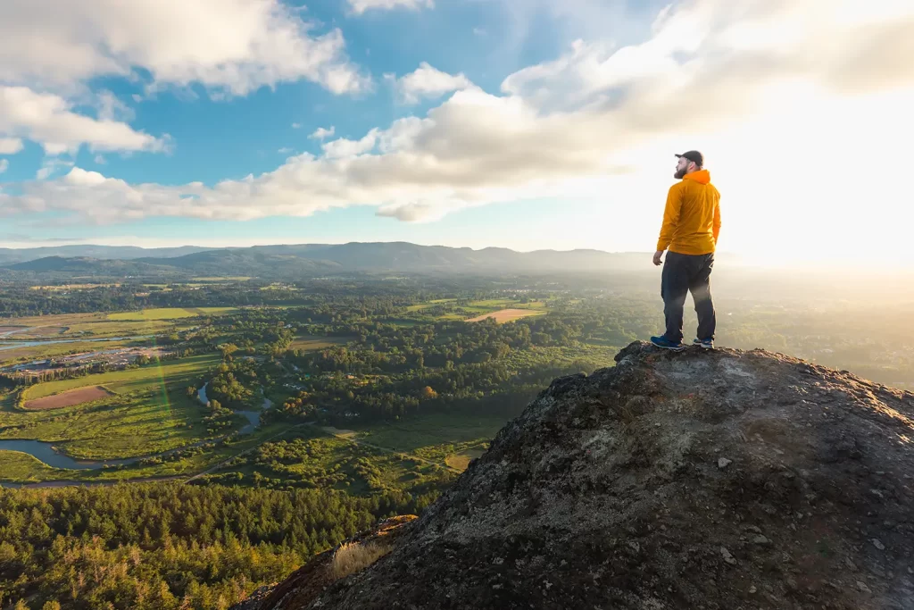
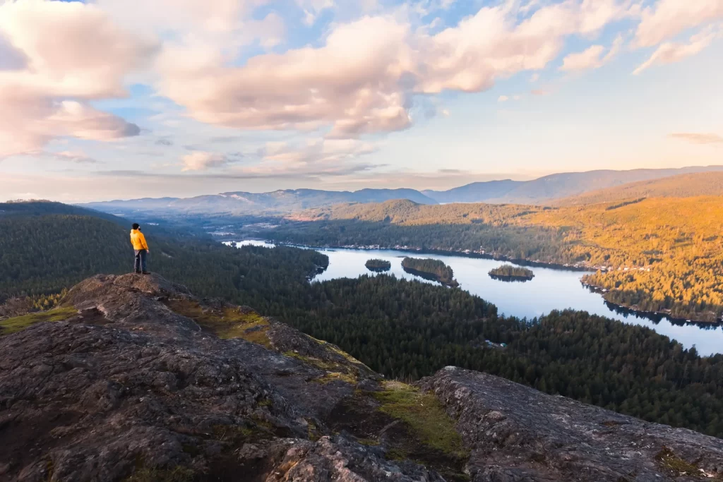
Old Baldy Mountain has some of the best views of any hike in southern Vancouver Island, with the top revealing an expansive panorama south over Shawnigan Lake and north towards the entire surrounding Cowichan Valley and its peaks as well as the ocean to the east. Views from the hike on the way up are nil, and the trail itself is fairly boring, heading somewhat steeply in a fairly straight line through uninteresting forest. Fortunately the short duration and the rewarding summit more than make up for the interesting journey. The hike up Old Baldy Mountain is one I recommend to Vancouver Island hikers time and time again, and is a must-do hike for anyone in the area.
Recommended Hiking Gear


Water is a must whenever I’m hiking, especially if the sun is going to be out. My favourite water filter I’ve used is the Katadyn BeFree 0.6L, which unlike other water filters I’ve used packs up really small and lightweight. For hikes where I know there won’t be any readily available water sources along the way, I make sure to bring my own. The Hydrapak Stow 1L bottle is my go-to, for the same reason that it’s made of a soft plastic that folds up and doesn’t take up any more extra space than necessary in my pack. Finally, Aquatabs are another great option for purifying water, with one tablet being suitable for one litre of water. I previously used the Grayl water filter while travelling internationally, and though I found its hard body more convenient for day to day use and easier to drink from, it has a little too much bulk for my fast-and-light style of hiking.


The secret to all my photos of gorgeous sunset and sunrise mountaintop views? A lot of hiking in the dark. And let me speak from personal experience when I say that the last thing that you want to happen when hiking is to be caught in the dark without a headlamp. I used the Black Diamond Spot 400 for years and it worked great – until I lost it on top of a mountain somewhere. The only downside to it was having to worry about the batteries dying, though there’s also a slightly more expensive version that has a rechargeable battery. Nowadays I’m using the Petzl Actik Core, which is a bit pricier than the more budget-friendly Black Diamond, but is also brighter, more comfortable (in my opinion), and has a hybrid power system that is rechargeable but can also take AAA batteries if needed.
You won’t see me using trekking poles on shorter hikes often – but on long hikes and backpacking trips, as well as certain scrambles, they are an absolute lifesaver. I’ve invested in a high quality ultra-lightweight pair of MSR DynaLock Ascent carbon poles which, while pricey, I don’t regret one bit. If you’re not entirely sure how much use you’re going to get out of a pair of trekking poles, the best budget-friendly option would be the Trekology Trek Z 2.0. Amazon does sell a lot of cheaper Made in China-style trekking poles for cheaper, but these usually are much much heavier and not worth buying.
All the best and most long-lasting cables and power banks I’ve ever owned have been Anker. I once had a phone cable from them that lasted me over three years of daily use! That’s why I keep an Anker PowerCore Essential 20K power bank on me. Like many people I use my phone for a lot of stuff when hiking (checking in with family, using online maps, taking photos, flying my drone) so I like to be prepared for that low battery warning by having a backup power source on me just in case.


The only socks I ever buy for myself are from Darn Tough, and I almost always make sure to wear them when hiking. After years of having no problems only wearing these comfortable and rugged socks for hikes, I accidentally wore a pair of no-name socks on a hike last year and ended up with blisters on both feet. Safe to say I’m back to sticking with the Darn Tough. And the best part? They have a lifetime guarantee, meaning that if they ever wear out you can send them back for a brand new pair. For hiking footwear I go between a pair of lightweight approach shoes for quick and dirty mountain ascents or anything involving scrambling and more heavy-duty boots for longer treks. I’ve worn a couple different versions of the lightweight but super durable Arc’teryx Konseal FL 2 approach shoes for a few years now and am very impressed with the durability. I also really like the thick toecap that keeps me protected every time I stumble into a root or large rock. For longer, tougher, or muddier treks I rely on my LOWA Camino EVO GTX, which I find insanely comfortable and made of very high quality.


I wear my Ar’teryx Gamma Lightweight Pants on every single hike I go on, and on many days when I’m not hiking. After several years of abuse they are still holding together extraordinarily well, with only a few small holes from where I’ve fallen down and some slight stains from being repeatedly coated with mud. They’re lightweight, breathable, and super comfortable. For lightweight and breathable hiking tops I’m a big fan of both the Patagonia Capilene Shirt and the MEC Core Shirt. My Arc’teryx Squamish Hoody shows up in a lot of my photos. It’s super lightweight and packable, and does a great job of cutting the wind while also being pretty breathable. I also have an Arc’teryx Atom Hoody and Arc’teryx Beta LT that I pull out for cooler or wetter conditions.