
One of the most iconic mountains in the Alberta Rockies, Mt Rundle is a long massif that stretches over 12 km between the towns of Canmore and Banff. If you’ve ever driven between the two you’ll have definitely seen it as the highway is directly east of the mountain and provides scenic views the entire way. The actual summit of Mt Rundle is accomplished via a 10-hour grind from Banff, but the far more popular and accessible East End of Rundle – locally known as EEOR (pronounced like the Winnie the Pooh character) starts from near Canmore and grinds straight up to the distinct easternmost peak of the mountain. From the summit of EEOR hikers see fantastic views to the south into both the Bow Valley and the Spray Valley, with the distinct Ha Ling Peak (another great local hike) jutting out across Whiteman’s Gap which connects the two valleys. To the north Mt Rundle’s ridgeline stretches upwards connecting the many jutting peaks of Rundle, including the distant summit 400m higher. It’s actually possible to traverse the entire massif, but it’s a long and technical trip that requires advanced mountaineering skills.
While EEOR is not a super long hike (the consistently steep grade means that you get up surprisingly fast), it is made challenging by long sections of scree slog as well as several sections of mild scrambling, especially near the summit. As a result of not being an official Kananaskis Country hike, the trail is very braided and takes a million different parallel routes up the mountain, meaning some decision-making is required in order to pick the route that’s best for you. The trail has no signs or reliable flagging, so I highly suggest downloading a GPS track ahead of time (I recommend using either the GaiaGPS, CanTopo, or AllTrails apps) to make sure you’re generally on track, but I don’t recommend sticking to it religiously. There were plenty of times that the GPS track I used suggested I take a particular path when I could see an easier, safer, or more convenient alternative with my eyes.
I cover the gear I usually bring with me hiking at the bottom of this post, but I also wanted to take a moment to cover what I think you should bring specifically for this hike. First off, you really want trekking poles – they’ll make the EEOR hike easier on the way up, but especially on the way down when you’re making your way back down the steep scree slopes. Second, though I didn’t wear a climbing helmet when I did the EEOR hike, that’s because I knew I’d be the first one on the mountain for sunrise and wasn’t worried about hikers above me knocking loose rocks onto me. I probably should have still worn a helmet. If you’re doing the EEOR hike during the day like a sane and responsible person, you’ll definitely be sharing the trail with other hikers, and once you reach the scramble section near the end of the hike, loose rock coming down is a real risk (not to mention just falling and hitting your head).
Continue reading this blog post for everything you need to know to experience the EEOR (East End of Rundle) hike in Kananaskis Country for yourself, including distance, elevation gain, how to get there, the best time to visit, and lots of photos of my experience.
Note: The EEOR (East End of Rundle) hike is located in Kananaskis Country, meaning that a valid park pass is required. Day passes can only be purchased online and are per day per vehicle, but if you’re staying six days or longer, it’s more cost-effective to just buy an annual pass instead.
When hiking it’s important to avoid harmful practices such as disturbing plants or rock-stacking, or removing any natural object from flowers to rocks, as it’s important to leave the environment as natural as possible for the animals and for fellow hikers to enjoy in perpetuity. As many flowers as there are, there are few enough that if we all took one, then there wouldn’t be any left. Take only photos, leave only footprints.
If you haven’t heard of Leave No Trace principles, they’re also really essential to read up on before heading anywhere into the outdoors in general. Following these important principles basically means doing your best to leave beautiful places like EEOR (East End of Rundle) as good (if not better) than you found them, both for their preservation and for the enjoyment of other visitors.
EEOR (East End of Rundle) Round Trip Details
Distance: 5.7 KM / 3.5 MI
Elevation Gain: 857 M / 2811 FT
Hiking Time: 3-4 HRS
Hiking & Safety Tips
- Prepare for the possibility of wildlife encounters. Bear spray is a must whenever travelling in bear country, as well as learning how to use it. Though your chance of an aggressive bear encounter is low, it is always better to be prepared with bear spray. Bear bells are proven to be an ineffective bear deterrent, and are actively discouraged by Parks Canada. The best way to let bears know you’re around is simply to use your voice. Make sure to keep a respectful distance from wildlife and never feed the animals. It may seem kind but it doesn’t just kill wildlife and put people in danger, it’s also in many cases illegal.
- Research current trail conditions and make sure you are well-informed about the route before you leave, and assess if it is within your capability. Be aware of what time it gets dark and check the weather forecast. Make sure to tell someone where you’re going and when you expect to return. Every year as more and more people try hiking for the first time, the number of rescues goes up. Being prepared is the best defense.
- Pack everything you need for a successful hike, including enough water and energy-rich snacks. Remember to pack out everything you pack in though – don’t expect to find a convenient garbage can halfway up the trail. Bring appropriate layers (remember you’ll warm up once you start hiking) and sun protection. Hiking poles and a climbing helmet are highly recommended for this hike, particularly the later sections where it gets into scrambling territory. In addition to not leaving any garbage on the trail yourself, I highly recommend bringing a garbage bag and collecting any trash that you do see on the trail. You’re guaranteed to make the hike up EEOR (East End of Rundle) a more enjoyable experience for the next person.
How to Get to EEOR (East End of Rundle) Trailhead
The East End of Rundle hike is one of the closest hikes to Canmore, only about twenty minutes from town. It’s forty minutes from Banff or an hour and a half from Calgary. From downtown Canmore, drive west onto 8 Ave and follow it south as it crosses the Bow River and eventually turn left when it reaches Three Sisters Drive. When Three Sisters Drive forks a couple minutes later, turn right onto Spray Lakes Road as the gravel road climbs up along the side of Mt Rundle and passes alongside two reservoirs. Look out for the large obvious parking area on the right side of the road – it’s impossible to miss.
Click here to open the exact trailhead location in Google Maps.
Hiking EEOR (East End of Rundle)
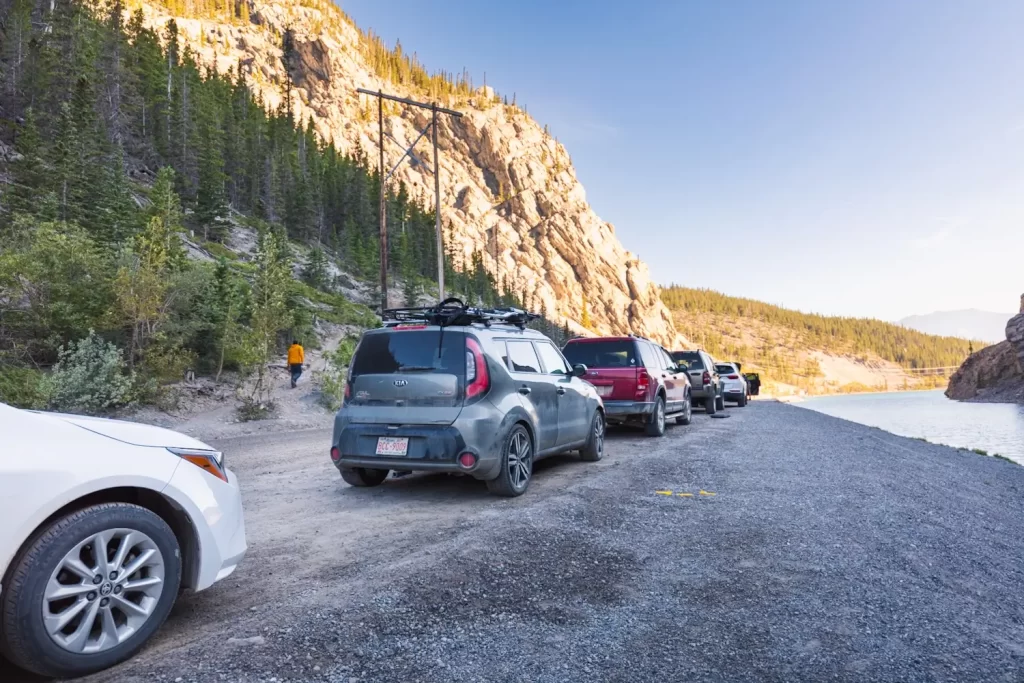
The unmarked start of the trail up EEOR I just under the power lines visible in the photo. It’s sometimes possible to park off of the road near the trailhead, but as it fills up quickly you may have to walk up the hill from the Ha Ling parking lot.
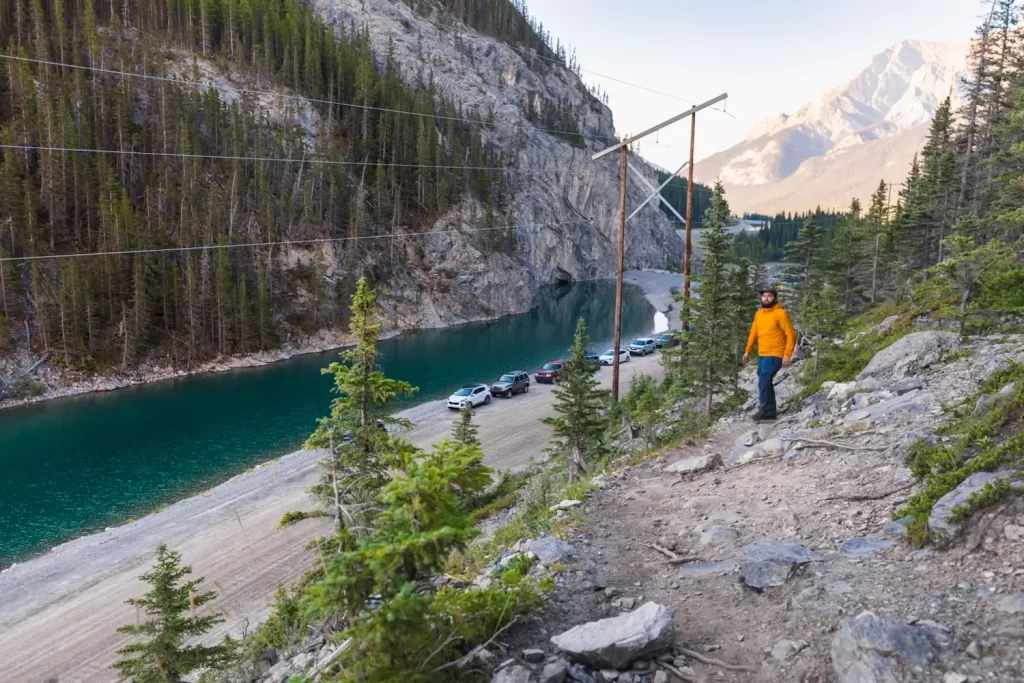
The already rocky and footy trail heads up above White Man’s Pond.
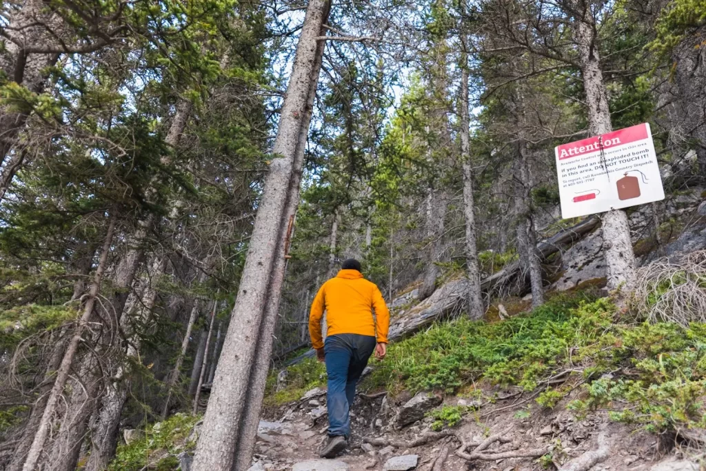
All good hikes begin with a sign warning hikers not to touch the bombs.
The path is easy to follow for most of the way, with different branches just going around obstacles in different ways but eventually reconnecting.
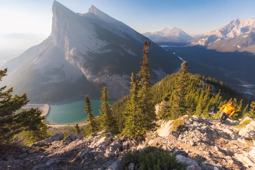
In the distance above Spray Lakes Reservoir are Old Goat Mountain and Mt Nestor.
One of the first real obstacles is this slab that has been worn super slippery over the years. It’s possible to shimmy up it but you can also go around it on either the right or the left.
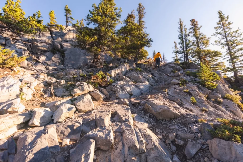
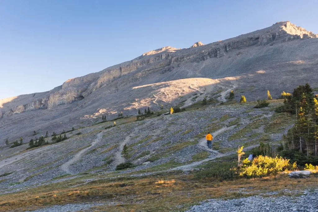
Especially where the mountainside gets rocky it can be hard to follow a distinct path. Having a GPS track is useful for keeping on track but for the most part it’s a choose-your-own-adventure.
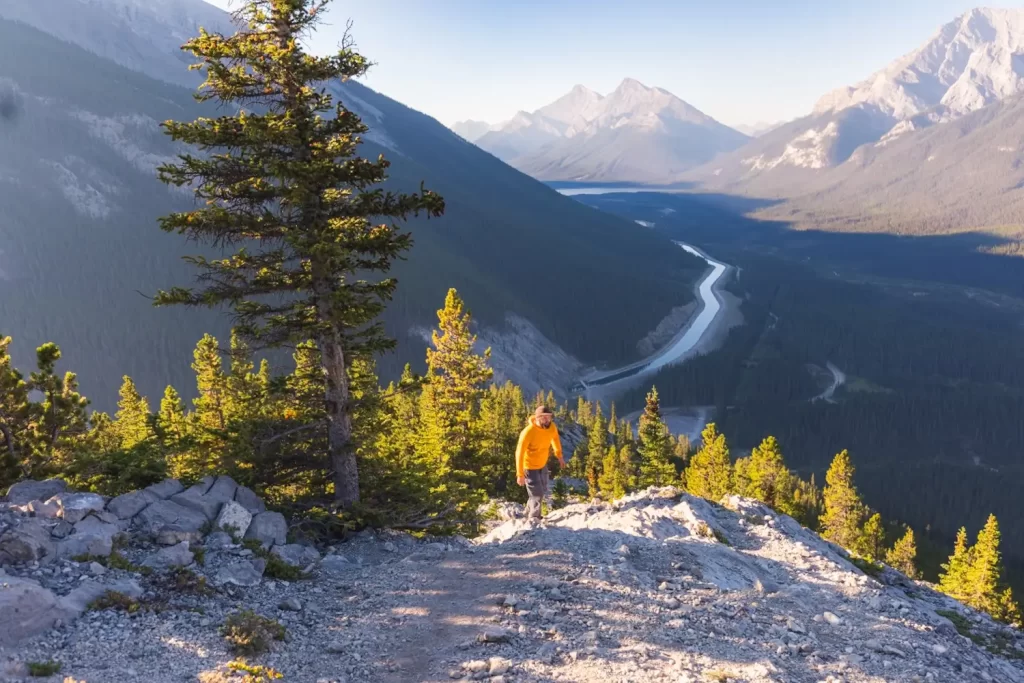
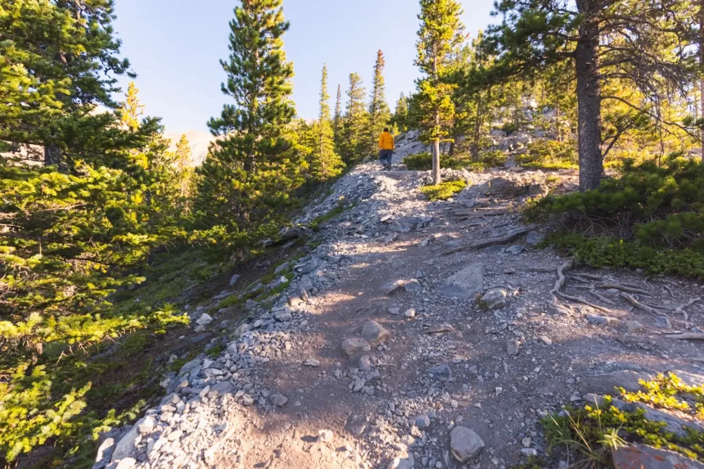
There’s plenty more elevation to go until the tree line is reached. Fortunately the steep grade makes it go by pretty quickly.
There are plenty of steep sections that I wouldn’t really consider scrambling. Though I did end up using my hands a little as I made my way up the rocks it was just for balance and not to actually pull myself up.
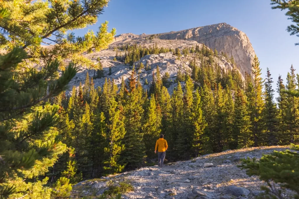
Keeping generally to the right guarantees fantastic views of White Man’s Pond and Ha Ling Peak just before and just after the tree line.
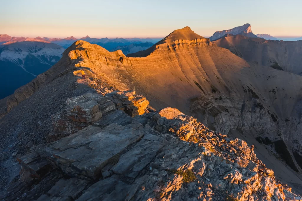
Once past the tree line the way(s) up to the summit, visible top right, are obvious. From here is where I would largely disregard the GPS track. You can tell by looking which of the paths is best, and it’s not always the route the GPS track takes.
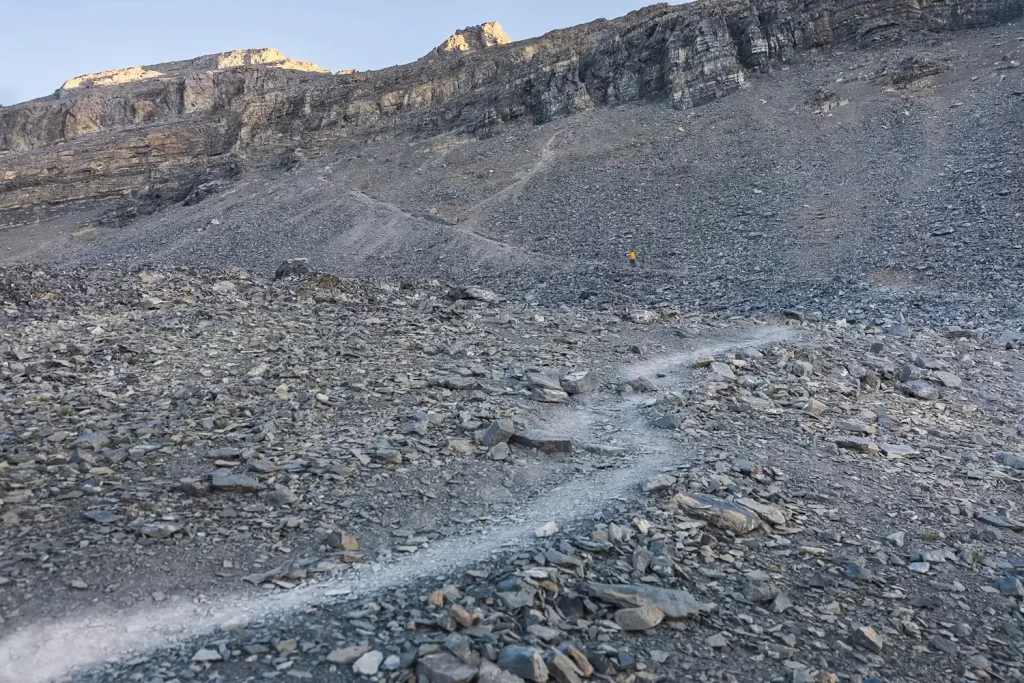
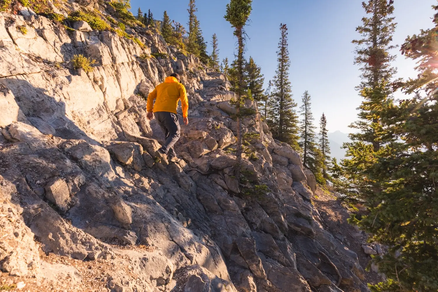
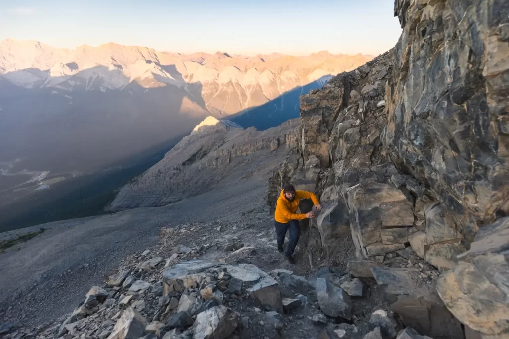
The steep uphill slog through the scree is the least fun part of the hike up EEOR, but fortunately it’s over pretty fast. As the scree trail approaches the blocky scramble up to the summit ridge it gets very steep. Hiking poles and a helmet would be useful around this point.
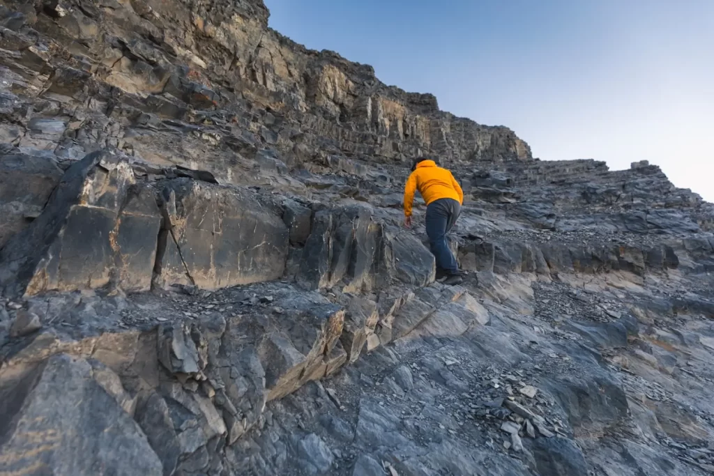
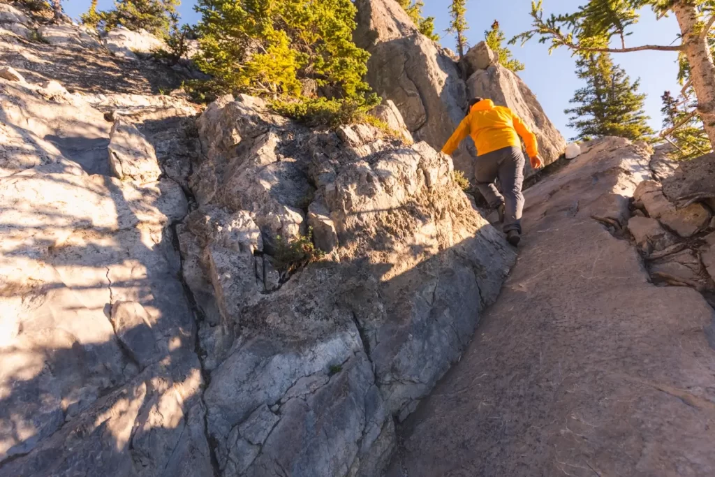
Note the stone wall at the top with the series of smaller ledges below it. It’s important to scramble up to just below “the wall” to get onto the safest path up to the summit. From here to the summit is about ten minutes.
The path near “the wall” is easy and safe to walk on. The path isn’t visible from below, so there’s plenty of footprint evidence of people trying to traverse along the lower ledges not realizing that the safer path is just a couple meters above. The lower ledges are covered in slippery ball bearing scree that I would get off of as soon as possible.
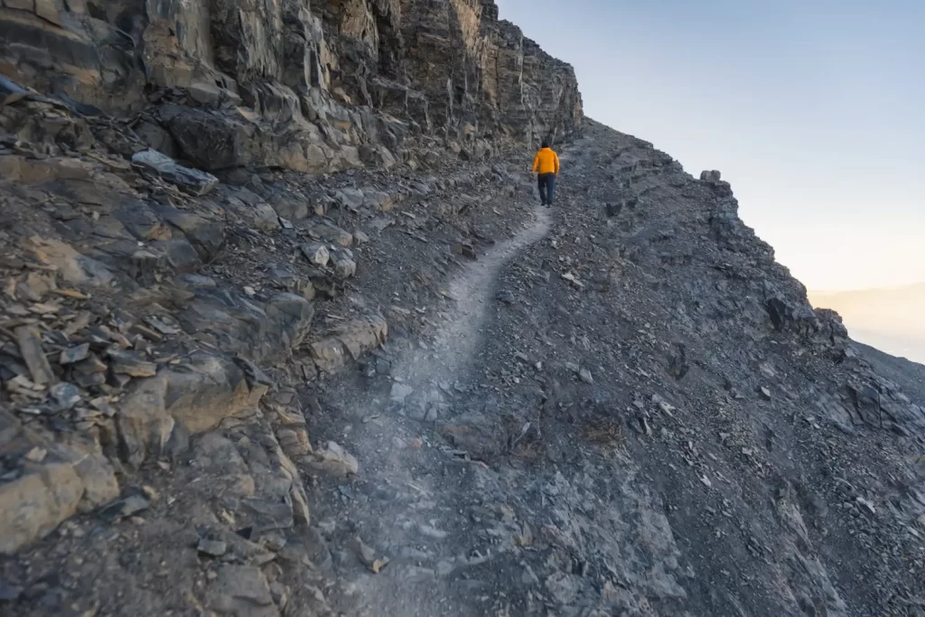
The trail continues following up alongside “the wall”, getting quite steep. Fortunately all the blocks sticking out are the perfect angle to easily stabilize and pull yourself up as you walk, making this part pretty fun.
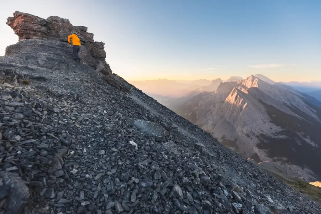
The final couple minutes of the EEOR hike are along a mellow trail through scree that heads up to the short and easy scramble up the summit block.
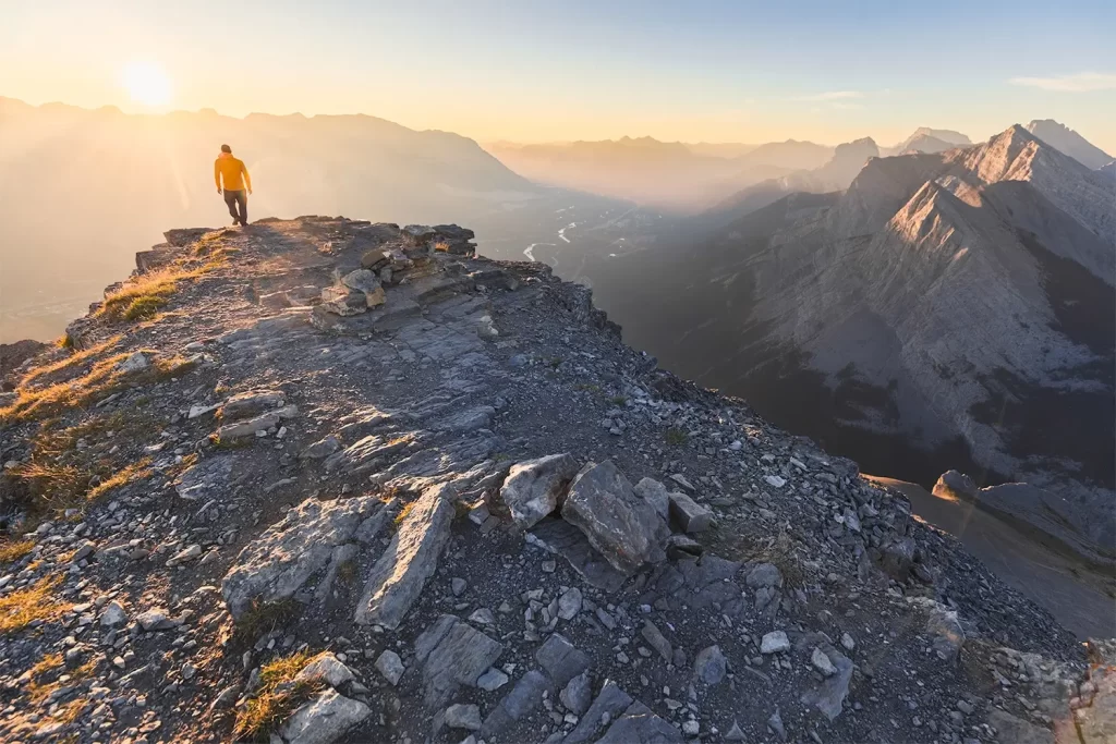
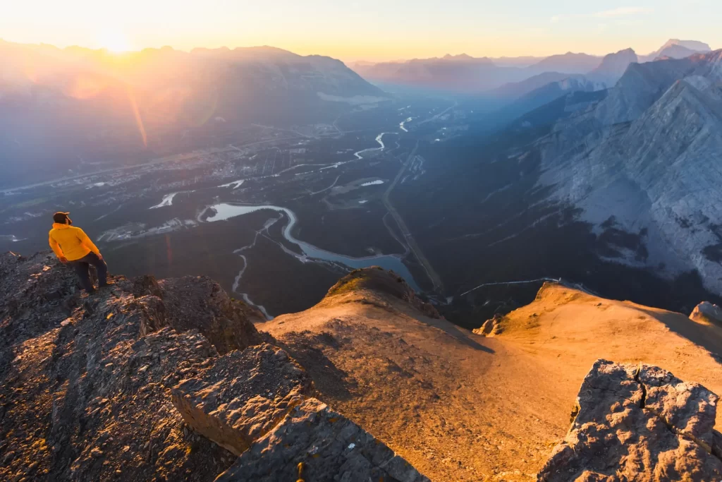
On top of EEOR looking out over the Bow Valley below.
Recommended Hiking Gear


Water is a must whenever I’m hiking, especially if the sun is going to be out. My favourite water filter I’ve used is the Katadyn BeFree 0.6L, which unlike other water filters I’ve used packs up really small and lightweight. For hikes where I know there won’t be any readily available water sources along the way, I make sure to bring my own. The Hydrapak Stow 1L bottle is my go-to, for the same reason that it’s made of a soft plastic that folds up and doesn’t take up any more extra space than necessary in my pack. Finally, Aquatabs are another great option for purifying water, with one tablet being suitable for one litre of water. I previously used the Grayl water filter while travelling internationally, and though I found its hard body more convenient for day to day use and easier to drink from, it has a little too much bulk for my fast-and-light style of hiking.


The secret to all my photos of gorgeous sunset and sunrise mountaintop views? A lot of hiking in the dark. And let me speak from personal experience when I say that the last thing that you want to happen when hiking is to be caught in the dark without a headlamp. I used the Black Diamond Spot 400 for years and it worked great – until I lost it on top of a mountain somewhere. The only downside to it was having to worry about the batteries dying, though there’s also a slightly more expensive version that has a rechargeable battery. Nowadays I’m using the Petzl Actik Core, which is a bit pricier than the more budget-friendly Black Diamond, but is also brighter, more comfortable (in my opinion), and has a hybrid power system that is rechargeable but can also take AAA batteries if needed.
You won’t see me using trekking poles on shorter hikes often – but on long hikes and backpacking trips, as well as certain scrambles, they are an absolute lifesaver. I’ve invested in a high quality ultra-lightweight pair of MSR DynaLock Ascent carbon poles which, while pricey, I don’t regret one bit. If you’re not entirely sure how much use you’re going to get out of a pair of trekking poles, the best budget-friendly option would be the Trekology Trek Z 2.0. Amazon does sell a lot of cheaper Made in China-style trekking poles for cheaper, but these usually are much much heavier and not worth buying.
All the best and most long-lasting cables and power banks I’ve ever owned have been Anker. I once had a phone cable from them that lasted me over three years of daily use! That’s why I keep an Anker PowerCore Essential 20K power bank on me. Like many people I use my phone for a lot of stuff when hiking (checking in with family, using online maps, taking photos, flying my drone) so I like to be prepared for that low battery warning by having a backup power source on me just in case.


The only socks I ever buy for myself are from Darn Tough, and I almost always make sure to wear them when hiking. After years of having no problems only wearing these comfortable and rugged socks for hikes, I accidentally wore a pair of no-name socks on a hike last year and ended up with blisters on both feet. Safe to say I’m back to sticking with the Darn Tough. And the best part? They have a lifetime guarantee, meaning that if they ever wear out you can send them back for a brand new pair. For hiking footwear I go between a pair of lightweight approach shoes for quick and dirty mountain ascents or anything involving scrambling and more heavy-duty boots for longer treks. I’ve worn a couple different versions of the lightweight but super durable Arc’teryx Konseal FL 2 approach shoes for a few years now and am very impressed with the durability. I also really like the thick toecap that keeps me protected every time I stumble into a root or large rock. For longer, tougher, or muddier treks I rely on my LOWA Camino EVO GTX, which I find insanely comfortable and made of very high quality.


I wear my Ar’teryx Gamma Lightweight Pants on every single hike I go on, and on many days when I’m not hiking. After several years of abuse they are still holding together extraordinarily well, with only a few small holes from where I’ve fallen down and some slight stains from being repeatedly coated with mud. They’re lightweight, breathable, and super comfortable. For lightweight and breathable hiking tops I’m a big fan of both the Patagonia Capilene Shirt and the MEC Core Shirt. My Arc’teryx Squamish Hoody shows up in a lot of my photos. It’s super lightweight and packable, and does a great job of cutting the wind while also being pretty breathable. I also have an Arc’teryx Atom Hoody and Arc’teryx Beta LT that I pull out for cooler or wetter conditions.
I hope you enjoyed this guide to hiking EEOR (East End of Rundle) near Canmore! Feel free to leave any questions in the comment section below or to contact me directly via social media.