
In June of 2013 different factors conspired together to cause massive floods throughout the Kananaskis region. Gentle streams turned into roaring rivers that tore away trees and boulders, causing all kinds of erosion and damage. The trail meandering alongside Heart Creek was obliterated as the creek changed its course and destroyed bridges.
Nowadays, as before the flood, Heart Creek once again is a gentle (but cold) creek that cascades down from high in the Rockies. It’s hard to imagine it as a roaring river that once carved its way down the mountainside thousands of years ago. Fed by the melting glaciers that once buried the entire country, Heart Creek once pounded its way through stone, leaving steep canyon walls and waterfalls behind. Maybe in 2013 when the creek swelled it could have been easier to picture though, as the signs of its destruction were far more obvious.
Efforts were made to reroute the hiking trail to match the creek’s new path and the wooden bridges reconstructed. Still, the banks of the creek had been heavily eroded and uprooted trees were piled up everywhere. Vast amounts of sediment and debris had been carried downstream, blocking a culvert and leading to flooding along the highway. Flood mitigation projects to prevent similar damage from future events are still being worked on.
The hike up alongside Heart Creek is mostly pleasant and gentle, and perfect for all kinds of hikers. It’s only near the end of the trail that the canyon walls really start to dramatically rise up and close in, and the turnaround point for most hikers leaves out the much more dramatic and hard-to-access canyon views further up.
While further upstream Heart Creek does drop down a series of gorgeous waterfalls bounded in on either side by right canyon walls, this section of Heart Creek isn’t accessible by hiking alone, and parts of the canyon must be rappelled down. Discover Banff Tours offers a fantastic canyoneering experience through this part of the canyon. During the hike highlighted on this blog however, I chose to push just slightly further upstream than the typical hiking endpoint in order to get a glimpse of a couple of the beautiful and rarely-photographed Heart Creek waterfalls.
Continue reading this blog post for everything you need to know to experience the Heart Creek Canyon hike in Kananaskis Country for yourself, including distance, elevation gain, how to get there, the best time to visit, and lots of photos of my experience.
Note: The Heart Creek Canyon hike is located in Kananaskis Country, meaning that a valid park pass is required. Day passes can only be purchased online and are per day per vehicle, but if you’re staying six days or longer, it’s more cost-effective to just buy an annual pass instead.
Before visiting Kananaskis Country it’s essential to read up on the Alberta Parks rules that must be followed to avoid tickets and/or fines. Harmful practices that are illegal in Kananaskis Country include disturbing plants or rock-stacking, or removing any natural object from flowers to rocks, as it’s important to leave the environment as natural as possible for the animals and for fellow hikers to enjoy in perpetuity. As many flowers as there are, there are few enough that if we all took one, then there wouldn’t be any left. Take only photos, leave only footprints.
If you haven’t heard of Leave No Trace principles, they’re also really essential to read up on before heading anywhere into the outdoors in general. Following these important principles basically means doing your best to leave beautiful places like Heart Creek Canyon as good (if not better) than you found them, both for their preservation and for the enjoyment of other visitors.
Heart Canyon Round Trip Details
Distance: 5 KM / 3.1 MI
Elevation Gain: 313 M / 1027 FT
Hiking Time: 1.5-2 HRS
Hiking & Safety Tips
- Prepare for the possibility of wildlife encounters. Bear spray is a must whenever travelling in bear country, as well as learning how to use it. Though your chance of an aggressive bear encounter is low, it is always better to be prepared with bear spray. Bear bells are proven to be an ineffective bear deterrent, and are actively discouraged by Parks Canada. The best way to let bears know you’re around is simply to use your voice. Make sure to keep a respectful distance from wildlife and never feed the animals. It may seem kind but it doesn’t just kill wildlife and put people in danger, it’s also illegal.
- Research current trail conditions and make sure you are well-informed about the route before you leave, and assess if it is within your capability. Be aware of what time it gets dark and check the weather forecast. Make sure to tell someone where you’re going and when you expect to return. Every year as more and more people try hiking for the first time, the number of rescues goes up. Being prepared is the best defense.
- Pack everything you need for a successful hike, including enough water and energy-rich snacks. Remember to pack out everything you pack in though – don’t expect to find a convenient garbage can halfway up the trail. Bring appropriate layers (remember you’ll warm up once you start hiking) and sun protection. Hiking poles may be helpful but are not required. Inaddition to not leaving any garbage on the trail yourself, I highly recommend bringing a garbage bag and collecting any trash that you do see on the trail. You’re guaranteed to make the hike through Heart Creek Canyon a more enjoyable experience for the next person.
How to Get to Heart Creek Canyon Trailhead
The Heart Creek parking lot is accessible from Highway 1 15 minutes east of Canmore, and is one of the first turnoffs after entering the mountains if driving from the west. Look out for the intersection with signs for Lac Des Arcs, and get off the highway here, turning south towards the Heart Creek parking lot. The trailhead is an hour from Calgary, or half an hour from Banff.
Click here to open the exact trailhead location in Google Maps.
Hiking Heart Creek Canyon
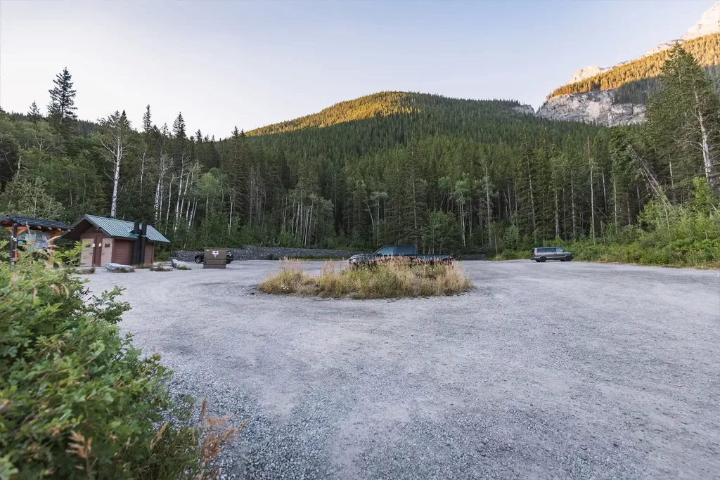
The Heart Creek parking lot is usually empty in the mornings but tends to fill up later during the day.
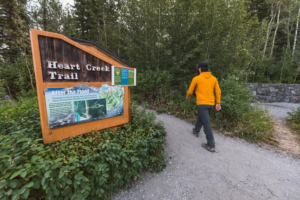
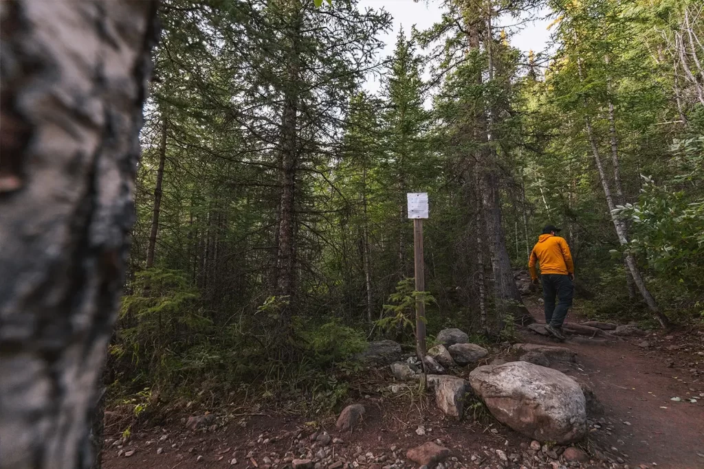
The trailhead for Heart Creek Canyon.
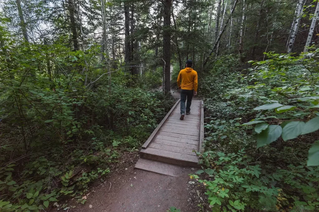
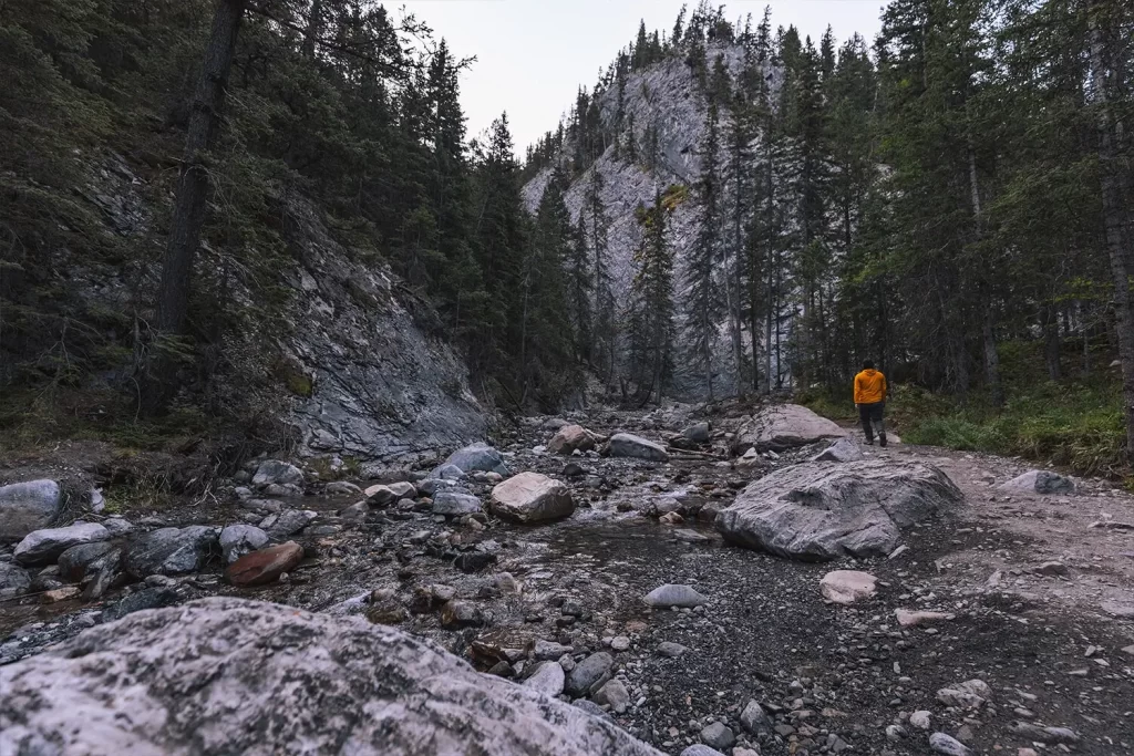
The hike leads through the woods and slowly gains some elevation. It was here that I got to see a small black bear just off the side of the trail.
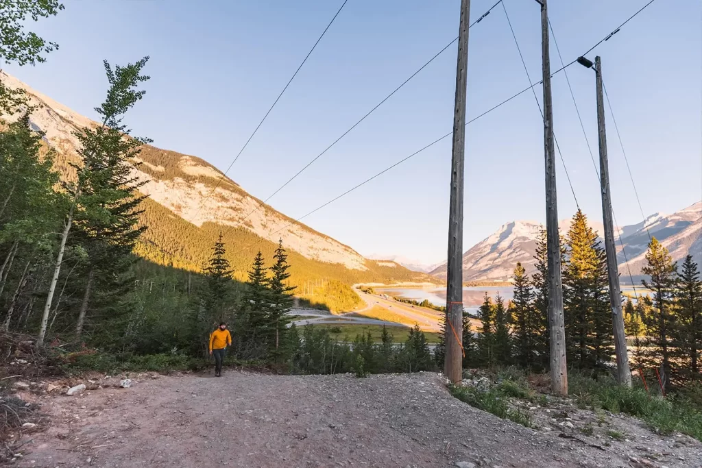
Decent views over the Bow Valley, especially in the morning light.
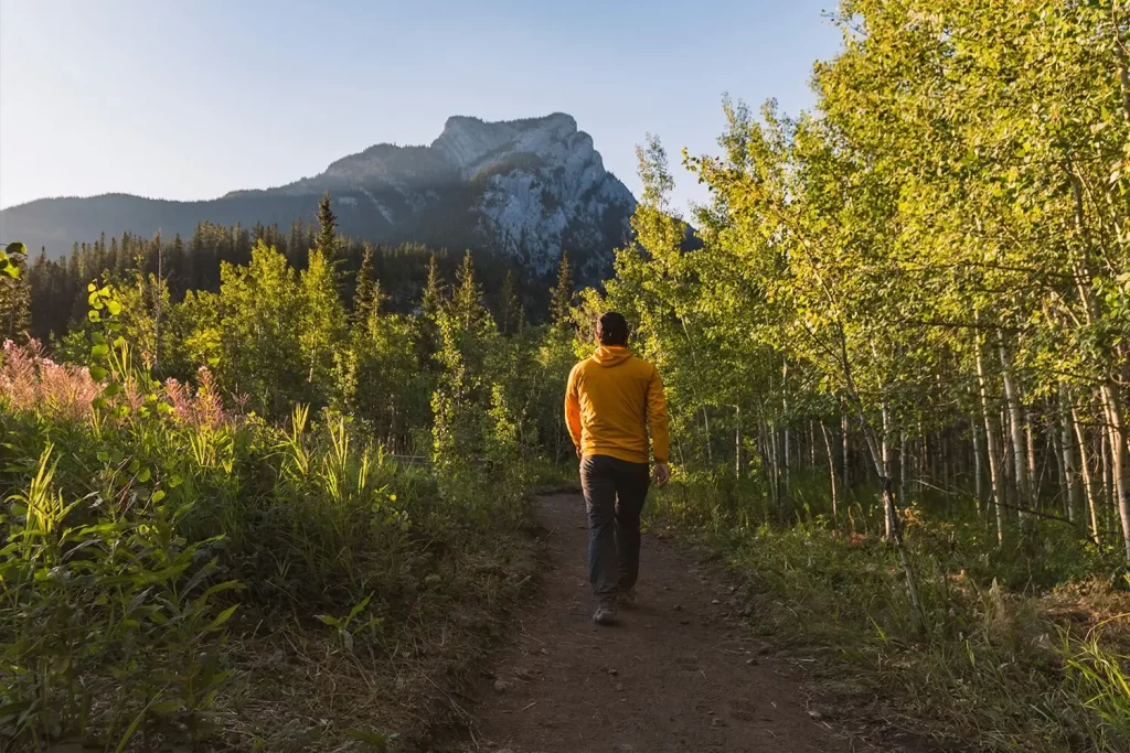
The trail turns towards Heart Mountain with its distinct peak.
Following the trail for Heart Creek. This intersection is where hikers intent on summitting Heart Mountain break off.
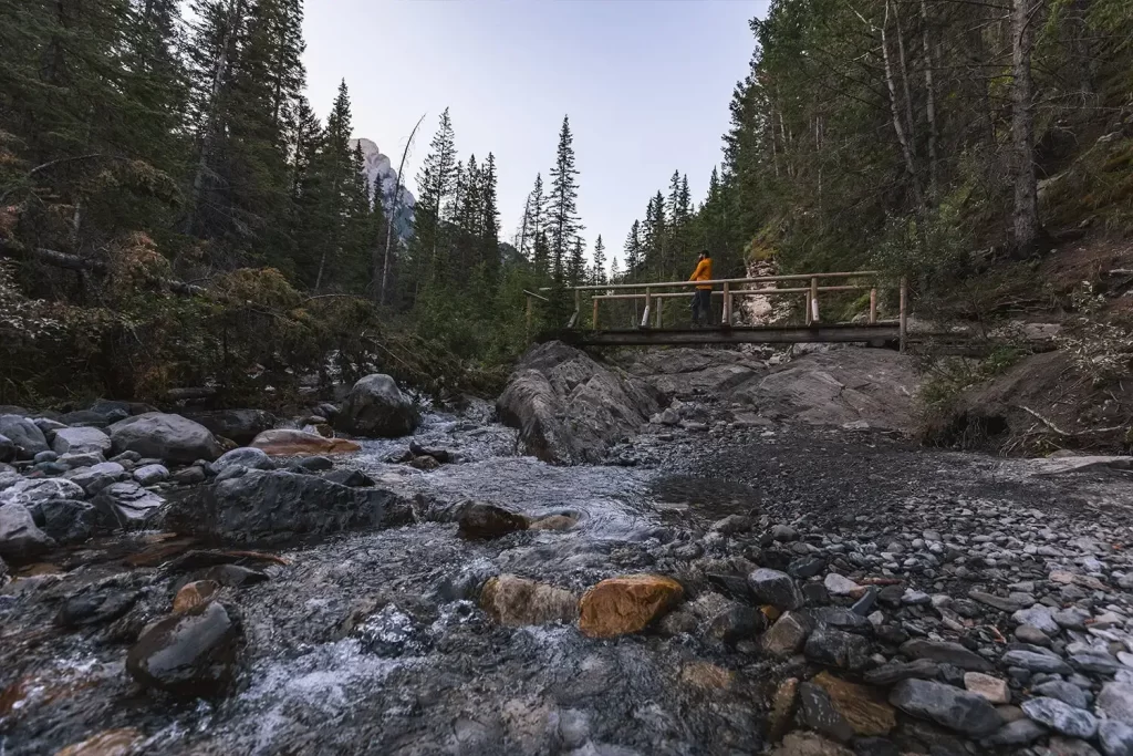
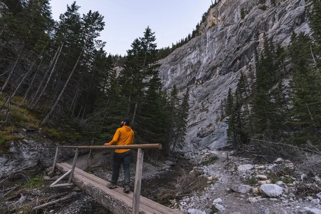
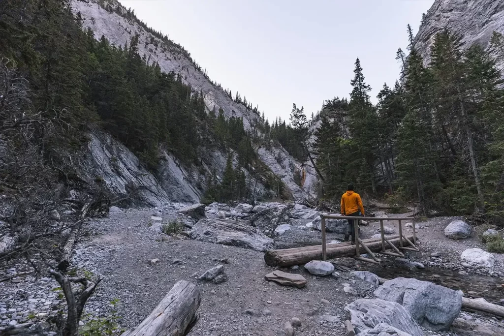
The first of several lovely bridges along the trail.
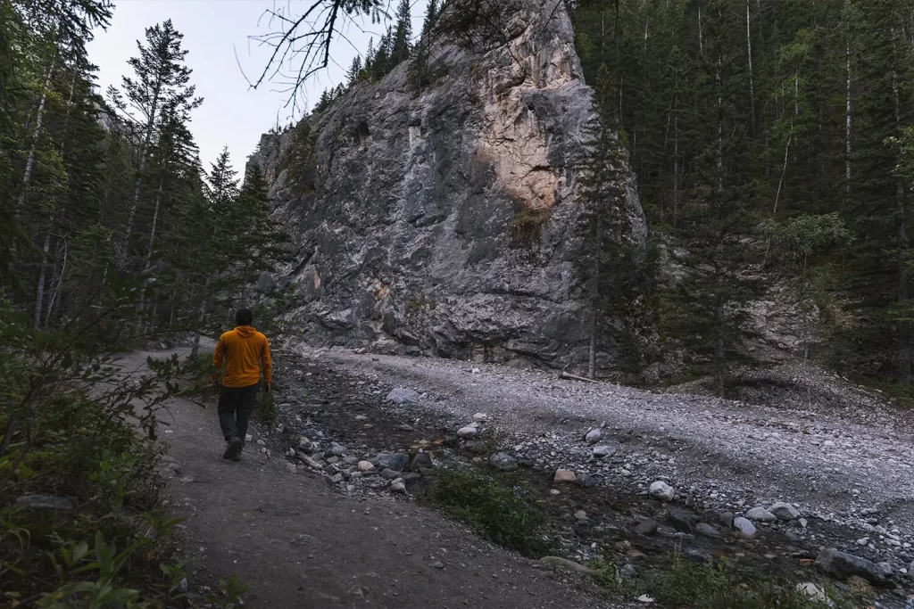
Canyon walls begin to rise on the sides of the calm creek.
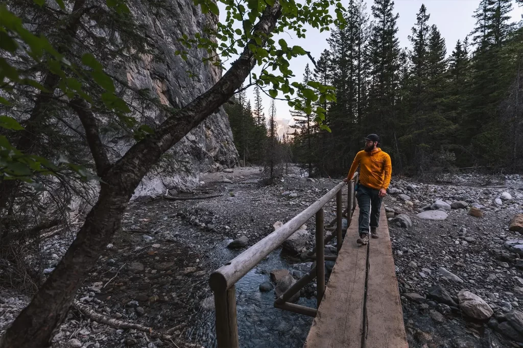
Another fun log bridge.
And another.
Approaching the end of the Heart Creek hike.
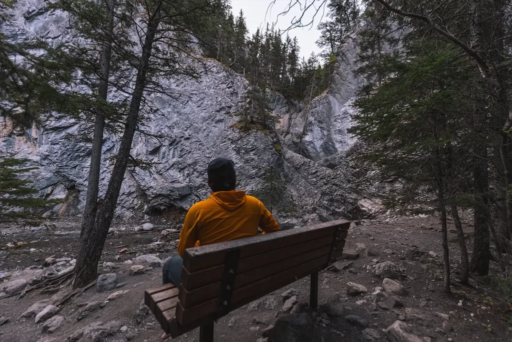
The usual endpoint of the Heart Creek canyon hike. Frustratingly it’s possible to hear a waterfall upstream on the other side of the rock walls, however it’s impossible to view it without a little work.
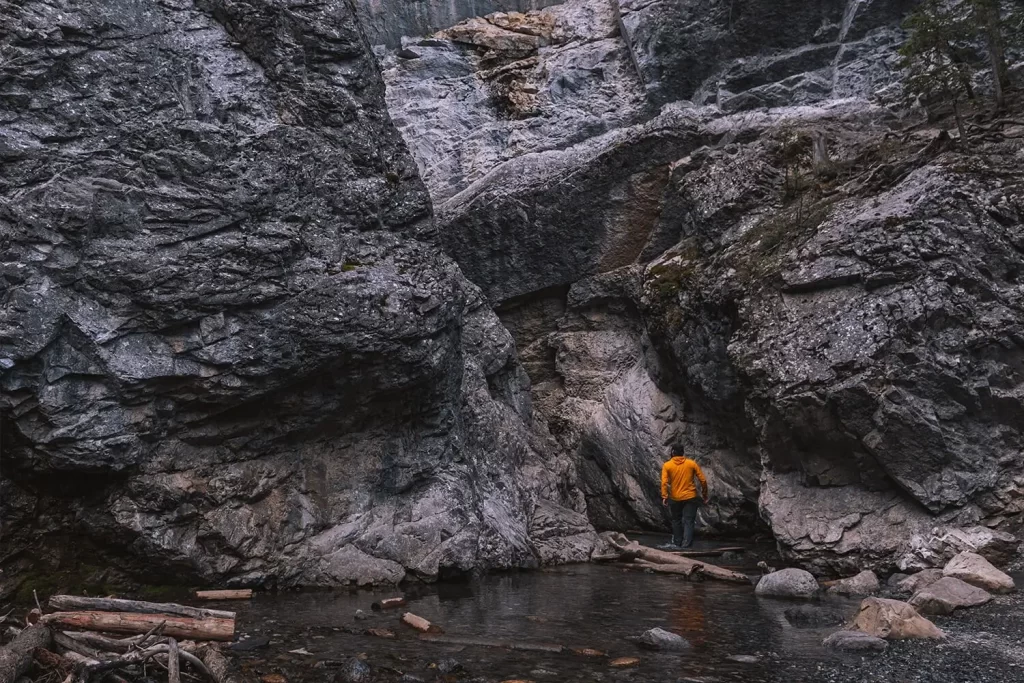
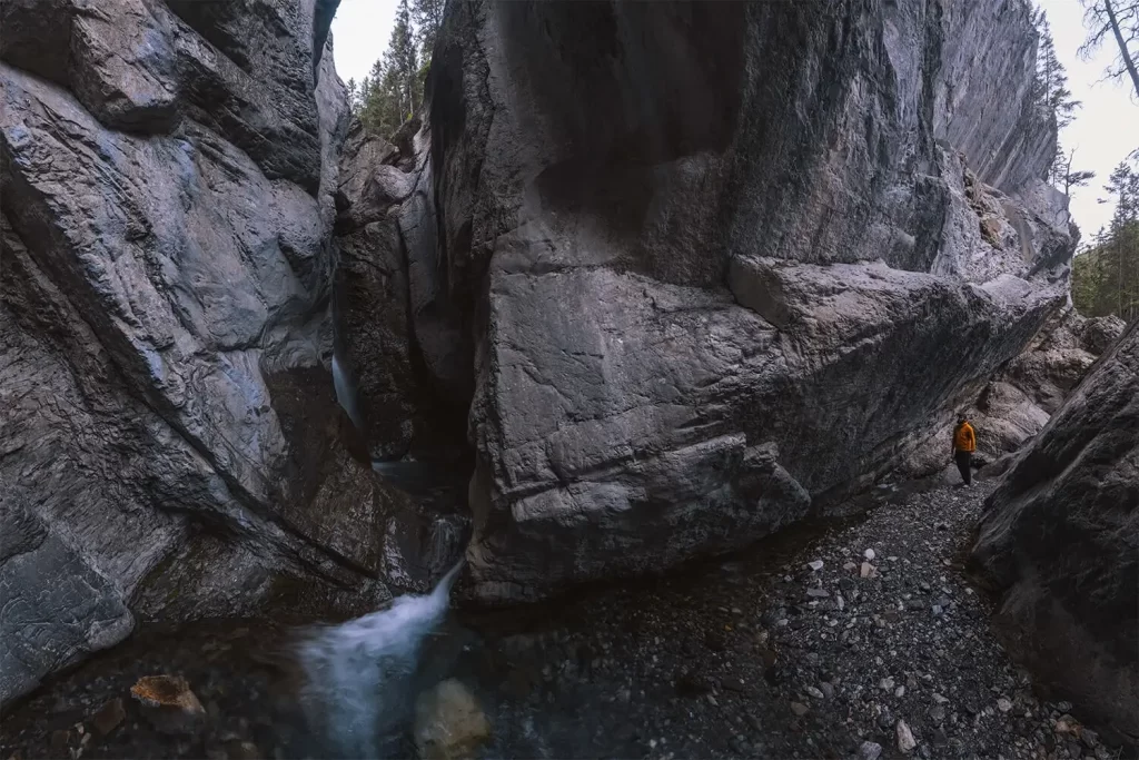
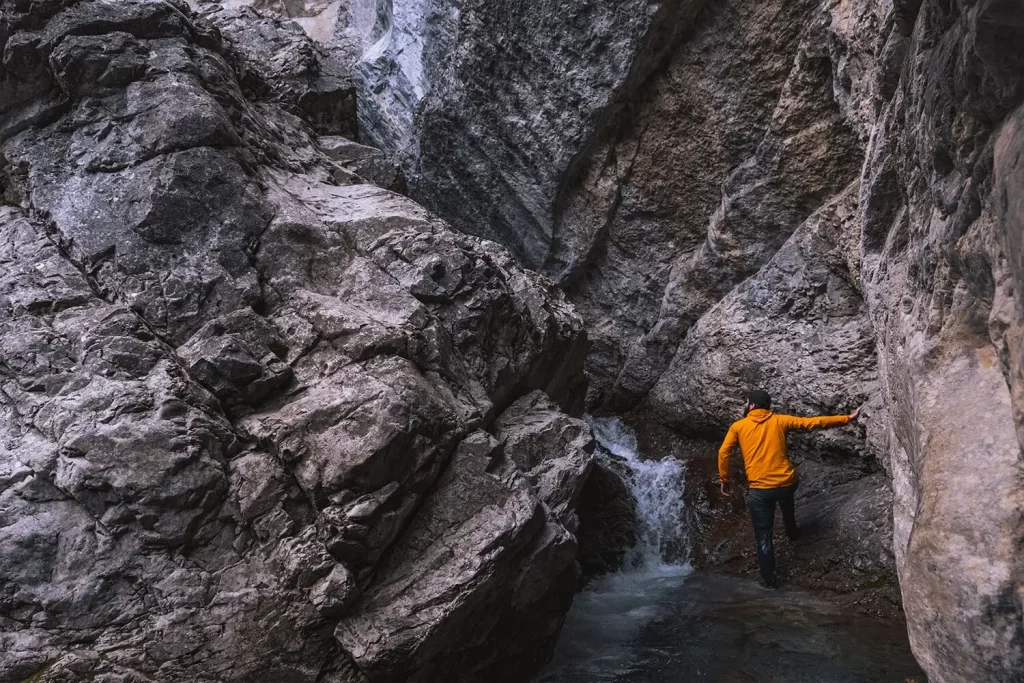
I decided to wade upstream in order to find the source of the roaring waterfall. This is some of the coldest water I’ve been in this time of year so I don’t recommend it for everyone. Instead – there is a faint scrambling trail up along the blocky stone wall to the right of here that is more accessible and offers glimpses of the waterfall from above.
Scrambling up these slippery rocks here was cold and difficult – especially while not wanting to get my expensive camera wet. In order to reach this point I had to wade up to my waist.
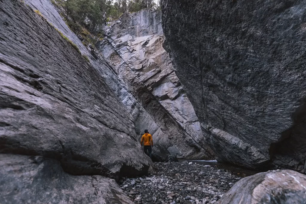
With steep rock walls like this it’s not surprising how challenging it is to see the waterfall.
A glimpse of a beautiful waterfall. I could have climbed slightly closer up another slippery step to get even closer, but I was wet enough.
Recommended Hiking Gear


Water is a must whenever I’m hiking, especially if the sun is going to be out. My favourite water filter I’ve used is the Katadyn BeFree 0.6L, which unlike other water filters I’ve used packs up really small and lightweight. For hikes where I know there won’t be any readily available water sources along the way, I make sure to bring my own. The Hydrapak Stow 1L bottle is my go-to, for the same reason that it’s made of a soft plastic that folds up and doesn’t take up any more extra space than necessary in my pack. Finally, Aquatabs are another great option for purifying water, with one tablet being suitable for one litre of water. I previously used the Grayl water filter while travelling internationally, and though I found its hard body more convenient for day to day use and easier to drink from, it has a little too much bulk for my fast-and-light style of hiking.


The secret to all my photos of gorgeous sunset and sunrise mountaintop views? A lot of hiking in the dark. And let me speak from personal experience when I say that the last thing that you want to happen when hiking is to be caught in the dark without a headlamp. I used the Black Diamond Spot 400 for years and it worked great – until I lost it on top of a mountain somewhere. The only downside to it was having to worry about the batteries dying, though there’s also a slightly more expensive version that has a rechargeable battery. Nowadays I’m using the Petzl Actik Core, which is a bit pricier than the more budget-friendly Black Diamond, but is also brighter, more comfortable (in my opinion), and has a hybrid power system that is rechargeable but can also take AAA batteries if needed.
You won’t see me using trekking poles on shorter hikes often – but on long hikes and backpacking trips, as well as certain scrambles, they are an absolute lifesaver. I’ve invested in a high quality ultra-lightweight pair of MSR DynaLock Ascent carbon poles which, while pricey, I don’t regret one bit. If you’re not entirely sure how much use you’re going to get out of a pair of trekking poles, the best budget-friendly option would be the Trekology Trek Z 2.0. Amazon does sell a lot of cheaper Made in China-style trekking poles for cheaper, but these usually are much much heavier and not worth buying.
All the best and most long-lasting cables and power banks I’ve ever owned have been Anker. I once had a phone cable from them that lasted me over three years of daily use! That’s why I keep an Anker PowerCore Essential 20K power bank on me. Like many people I use my phone for a lot of stuff when hiking (checking in with family, using online maps, taking photos, flying my drone) so I like to be prepared for that low battery warning by having a backup power source on me just in case.


The only socks I ever buy for myself are from Darn Tough, and I almost always make sure to wear them when hiking. After years of having no problems only wearing these comfortable and rugged socks for hikes, I accidentally wore a pair of no-name socks on a hike last year and ended up with blisters on both feet. Safe to say I’m back to sticking with the Darn Tough. And the best part? They have a lifetime guarantee, meaning that if they ever wear out you can send them back for a brand new pair. For hiking footwear I go between a pair of lightweight approach shoes for quick and dirty mountain ascents or anything involving scrambling and more heavy-duty boots for longer treks. I’ve worn a couple different versions of the lightweight but super durable Arc’teryx Konseal FL 2 approach shoes for a few years now and am very impressed with the durability. I also really like the thick toecap that keeps me protected every time I stumble into a root or large rock. For longer, tougher, or muddier treks I rely on my LOWA Camino EVO GTX, which I find insanely comfortable and made of very high quality.


I wear my Ar’teryx Gamma Lightweight Pants on every single hike I go on, and on many days when I’m not hiking. After several years of abuse they are still holding together extraordinarily well, with only a few small holes from where I’ve fallen down and some slight stains from being repeatedly coated with mud. They’re lightweight, breathable, and super comfortable. For lightweight and breathable hiking tops I’m a big fan of both the Patagonia Capilene Shirt and the MEC Core Shirt. My Arc’teryx Squamish Hoody shows up in a lot of my photos. It’s super lightweight and packable, and does a great job of cutting the wind while also being pretty breathable. I also have an Arc’teryx Atom Hoody and Arc’teryx Beta LT that I pull out for cooler or wetter conditions.
I hope you enjoyed this guide to hiking Heart Creek Canyon near Canmore! Feel free to leave any questions in the comment section below or to contact me directly via social media.