
Any visit to Waterton Lakes National Park is memorable for the park’s beautiful landscapes as well as its rich biodiversity, providing a home to populations of bears, mountain sheep, goats, and more. But Waterton is geologically significant as well, being home to some of the oldest exposed rock anywhere in the rockies. The rock layers that make up Waterton’s mountains are primarily sediments from an ancient sea that existed here 1,500 million years ago. It’s not uncommon to see rocks in the park that retain the gentle ripples one might find in sand or mud in shallow water today.
The red rock that is recognizable in many of Waterton’s mountains is called argillite, and though red and blue as the most common colours it actually comes in a variety of colours including yellow, purple, turquoise, white, and even black. The colour is a result of the chemicals that were in the water when the rock formed. red argillite is rich in iron, whereas green or blue argillite has more copper. It’s common nut just in Waterton but also in Castle Park and in Glacier National Park in the US.
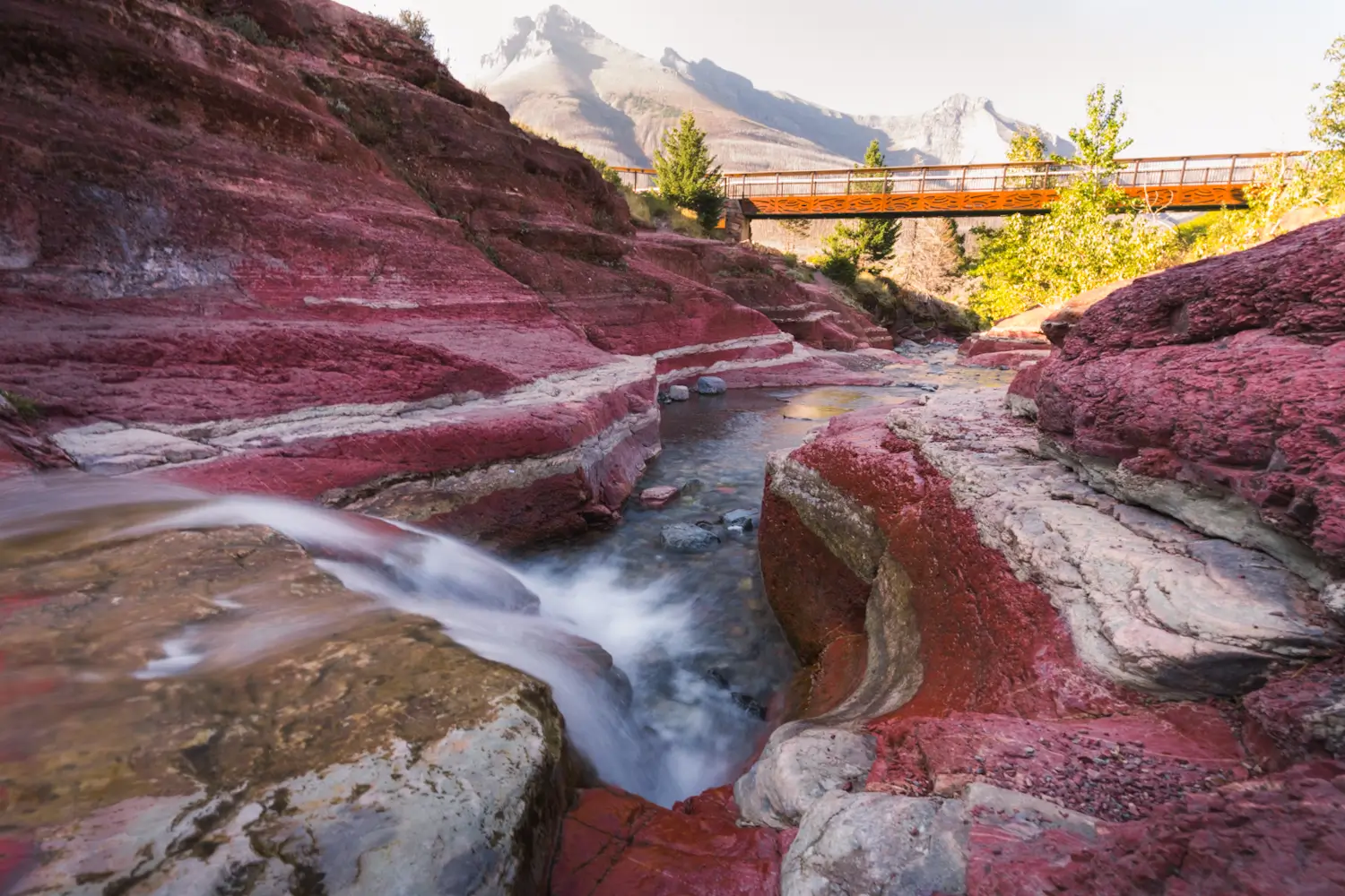
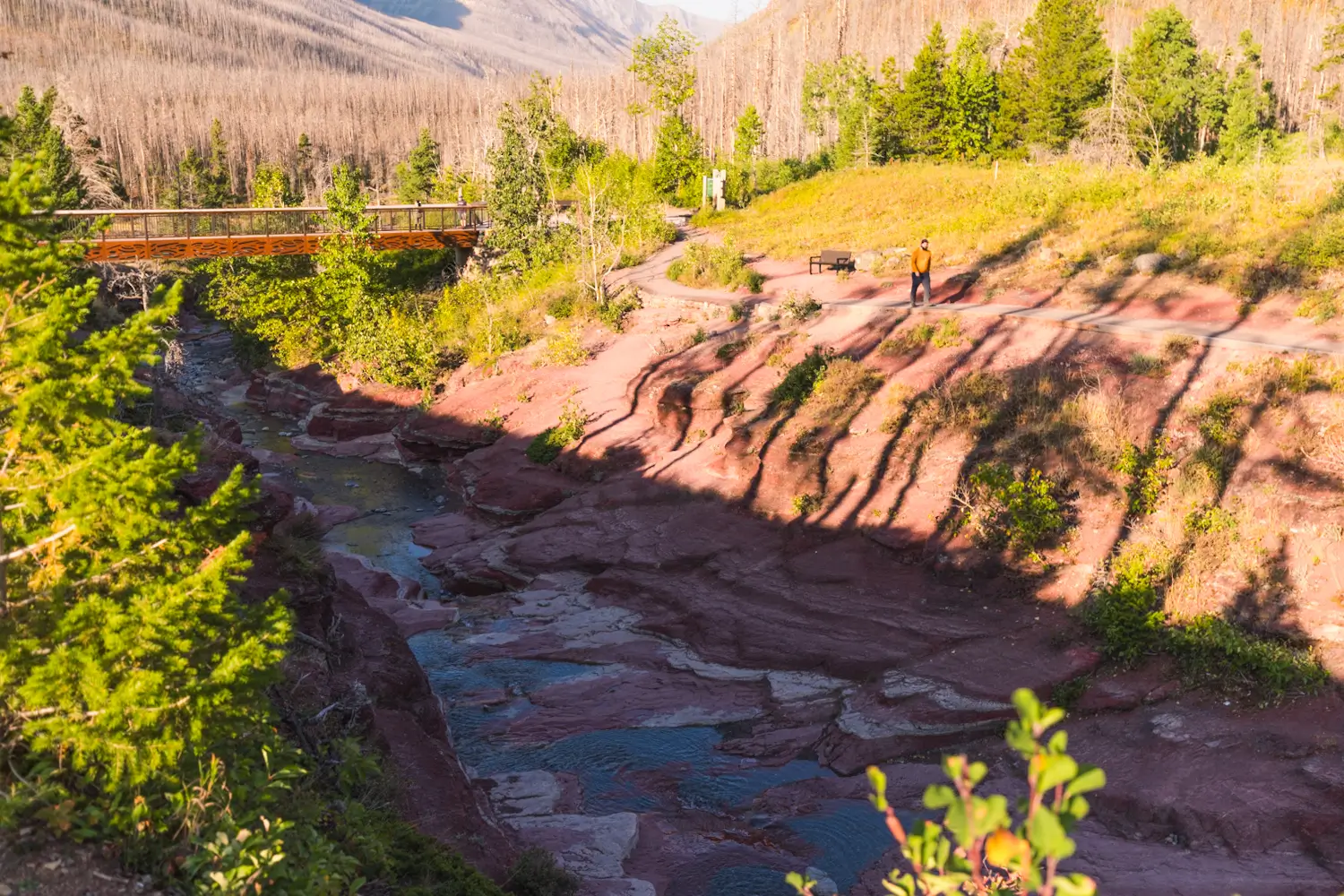
Though the distinct red rock which is predominant in Waterton’s landscape is visible in many of the mountains, the best place to see it up close is at Red Rock Canyon, a gorgeous slot canyon that is one of the best places to visit in Waterton. Easily accessible via a drive down the spectacular Red Rock Parkway (look for more red argillite in the mountains on the drive!), Red Rock Canyon requires no hiking skills to visit. A short trail loops around the edge of the canyon offering fantastic views down, especially from the three bridges that cross, and is the recommended option for experiencing this beautiful site. It’s even possible to extend you walk into the woods to Blakiston Falls, one of the best waterfall hikes in Waterton. For those that are prepared, it’s also possible to walk up through Red Rock Canyon and see it from the inside, but you’d better be ready to get wet!
Continue reading this blog post for everything you need to know to experience Red Rock Canyon in Waterton for yourself, including distance, elevation gain, how to get there, the best time to visit, and lots of photos of my experience.
Note: Red Rock Canyon is located in Waterton Lakes National Park, meaning that a valid park pass is required. Day passes can be purchased at the park gates and are per day per person, but if you’re staying a week or longer, it’s more cost-effective to just buy an annual pass instead.
Before visiting Waterton Lakes National Park it’s essential to read up on the Parks Canada rules that must be followed to avoid tickets and/or fines. When hiking it’s important to avoid harmful practices such as disturbing plants or rock-stacking, or removing any natural object from flowers to rocks, as it’s important to leave the environment as natural as possible for the animals and for fellow hikers to enjoy in perpetuity. As many flowers as there are, there are few enough that if we all took one, then there wouldn’t be any left. If you’re after a souvenir to take home with you, there are tons of gift shops in the Waterton townsite to check out. Otherwise take only photos, leave only footprints.
If you haven’t heard of Leave No Trace principles, they’re also really essential to read up on before heading anywhere into the outdoors in general. Following these important principles basically means doing your best to leave beautiful places like Red Rock Canyon as good (if not better) than you found them, both for their preservation and for the enjoyment of other visitors.
Red Rock Canyon Round Trip Details
Canyon Upper Loop:
Distance: 1 kM / 0.6 mi
Elevation Gain: 50 m / 164 ft
Hiking Time: 20 Mins
Canyon Walk:
Distance: 1.2 kM / 0.8 mi
Elevation Gain: 30 m / 100 Ft
Hiking Time: 30-40 Mins
Hiking & Safety Tips
- Prepare for the possibility of wildlife encounters. Bear spray is a must whenever travelling in bear country, as well as learning how to use it. Though your chance of an aggressive bear encounter is low, it is always better to be prepared with bear spray. Bear bells are proven to be an ineffective bear deterrent, and are actively discouraged by Parks Canada. The best way to let bears know you’re around is simply to use your voice. Make sure to keep a respectful distance from wildlife and never feed the animals. It may seem kind but it doesn’t just kill wildlife and put people in danger, it’s also illegal.
- Research current trail conditions and make sure you are well-informed about the route before you leave, and assess if it is within your capability. Be aware of what time it gets dark and check the weather forecast. If you choose to walk up through Red Rock Canyon be aware of the risks of flash floods as well as debris falling down when it gets windy (and it does get windy). Make sure to tell someone where you’re going and when you expect to return. Every year as more and more people try hiking for the first time, the number of rescues goes up. Being prepared is the best defense.
- Pack everything you need for a successful hike, including enough water and energy-rich snacks. Remember to pack out everything you pack in though – don’t expect to find a convenient garbage can halfway up the trail. Bring appropriate layers (remember you’ll warm up once you start hiking) and sun protection. If you’re walking through the canyon it’s essential to bring footwear and clothing that you can get wet. You’ll be wading through water that’s anywhere from knee-deep to wist-deep. Hiking poles may be helpful but are not required. In addition to not leaving any garbage on the trail yourself, I highly recommend bringing a garbage bag and collecting any trash that you do see on the trail. You’re guaranteed to make the hike to Blakiston Falls a more enjoyable experience for the next person.
When to Visit Red Rock Canyon
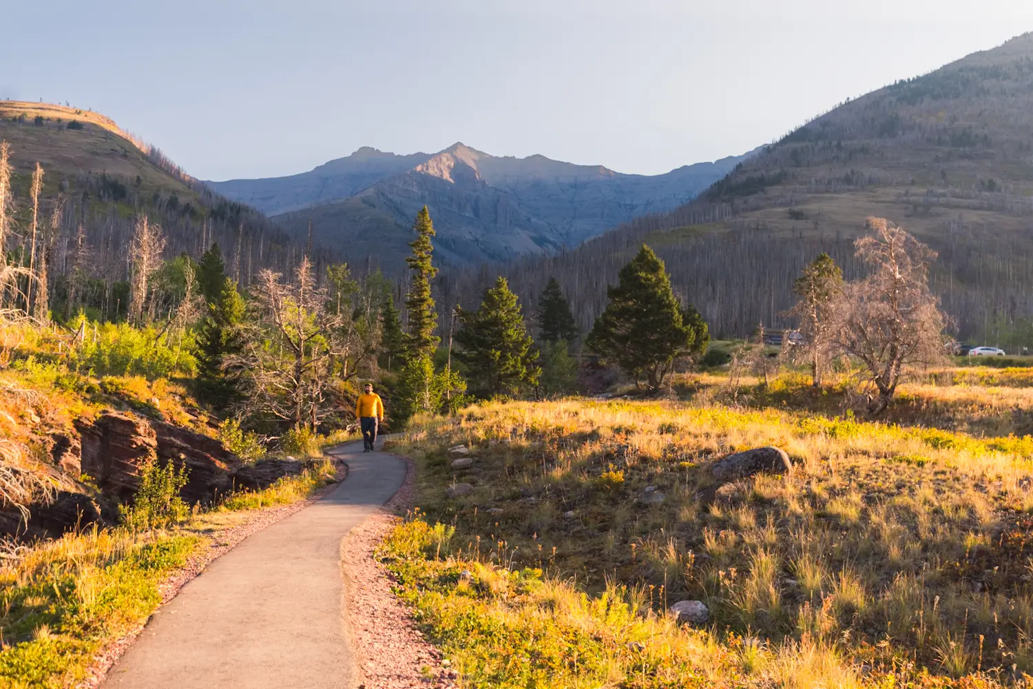
Red Rock Canyon is one of the most popular places to visit in Waterton Lakes National Park, and the area can get pretty busy with tourists on summer weekdays, though nothing like the crowds that hit Johnston Canyon in Banff. If you want to beat the crowds at Red Rock Canyon then I highly suggest visiting either in the morning or the evening. The forest surrounding the canyon was burned in the 2017 wildfire, leaving little shade during the middle of the day anyway. The short walk to Blakiston Falls from Red Rock Canyon is beautiful but similarly lacks any shade.
It’s also important to be aware of the Red Rock Parkway closure from October 31 to May 1, during which Red Rock Canyon is inaccessible unless you plan on walking or biking the 15km in. Like many creeks or streams in the rockies, Red Rock Creek is highest in the spring with melting snow but gets significantly lower as summer goes by. If you’re planning on walking up through Red Rock Canyon I would suggest waiting until later in the year to do so.
How to Get to Red Rock Canyon
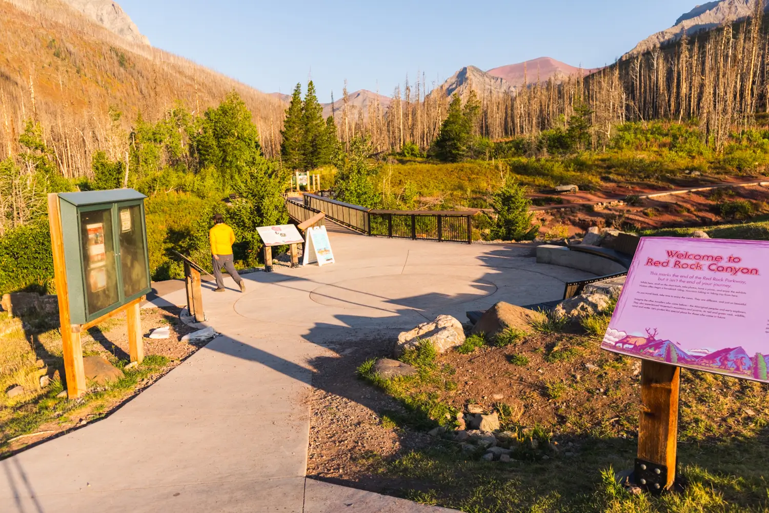
Red Rock Canyon is located at the very end of the Red Rock Parkway in Waterton Lakes National Park, and is about a half hour drive from the Waterton townsite. If you’re driving in from outside the park, it’ll be your very first right turn after entering the park gates. Follow the Red Rock Parkway for 15km and enjoy the beautiful views of the park. From the townsite take the same road you took to enter the park, passing by the Bear’s Hump trailhead on the left, then the golf course, then turn left immediately after a bridge to get onto the Red Rock Parkway. As mentioned above the Red Rock Parkway is closed from October 31 to May 1.
Waterton Lakes National Park is located just above the US border in the southeastern most corner of the Alberta Rockies, and forms half of an International Peace Park with Glacier National Park directly on the other side of the border. Driving here is three hours from Calgary, or an hour and a half from Lethbridge.
Click here to open the exact trailhead location in Google Maps.
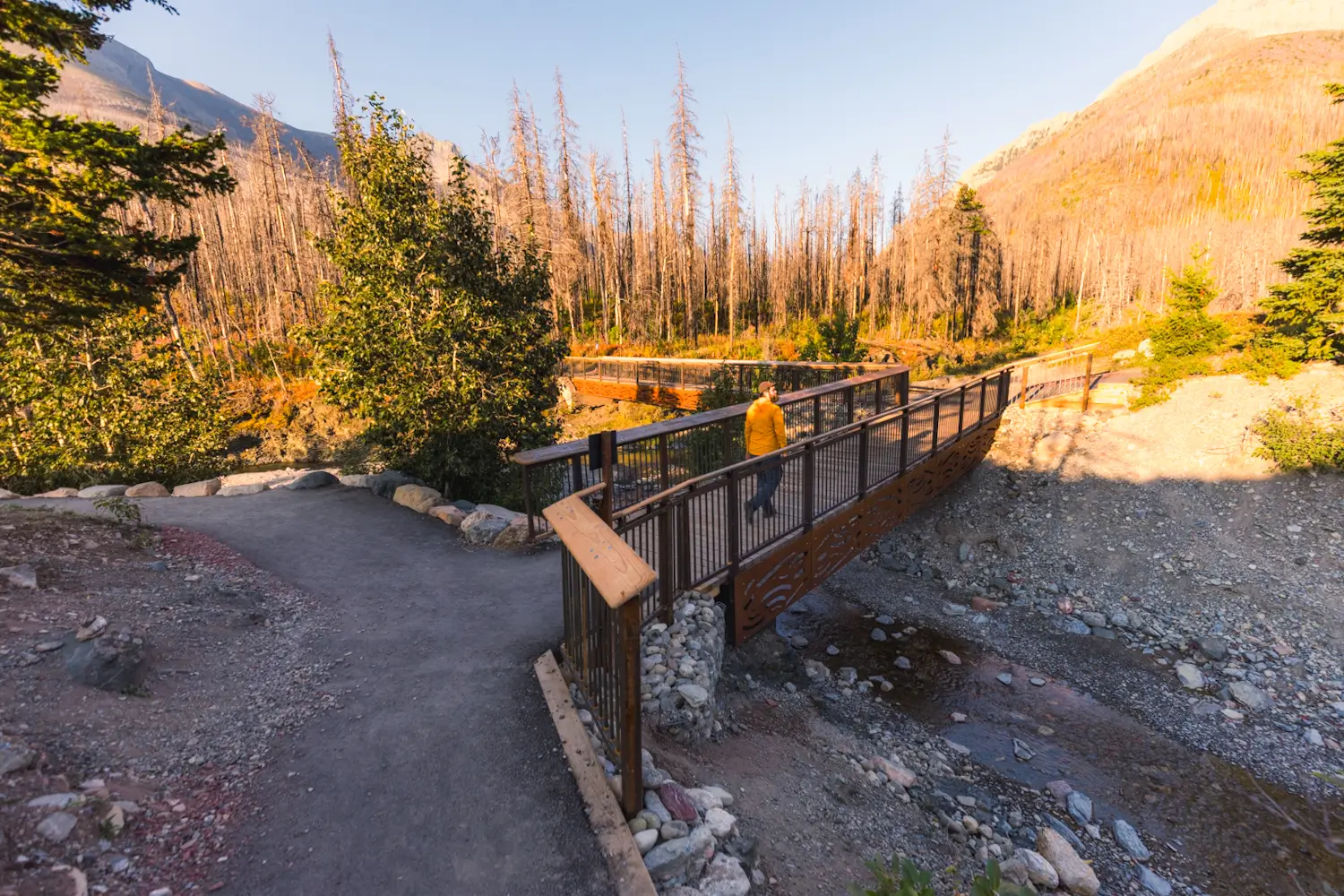
Red Rock Canyon Loop Trail
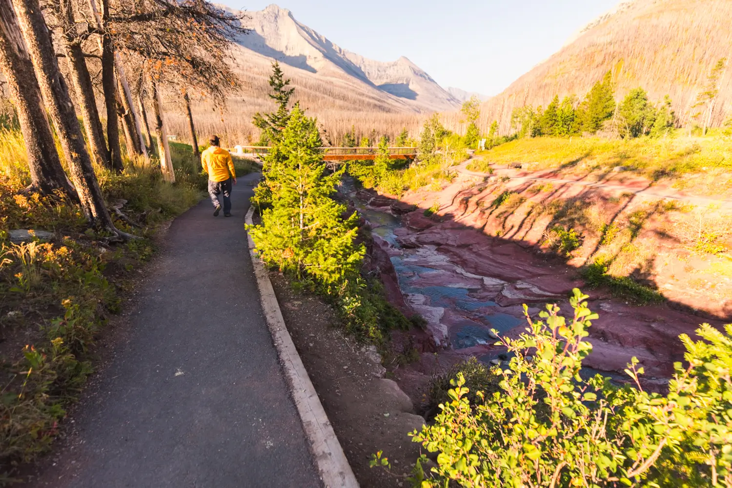
The parking lot is right next to the start of the walk along the canyon. There are three bridges across the canyon; one at the start right by the parking lot, one further up the canyon, and one further down the canyon. The trail connects all three bridges and runs on both sides of the canyon, making it easy to walk a loop. I chose to go counterclockwise, heading left to follow Red Rock Creek downstream to the end of the canyon before following it back up on the other side.
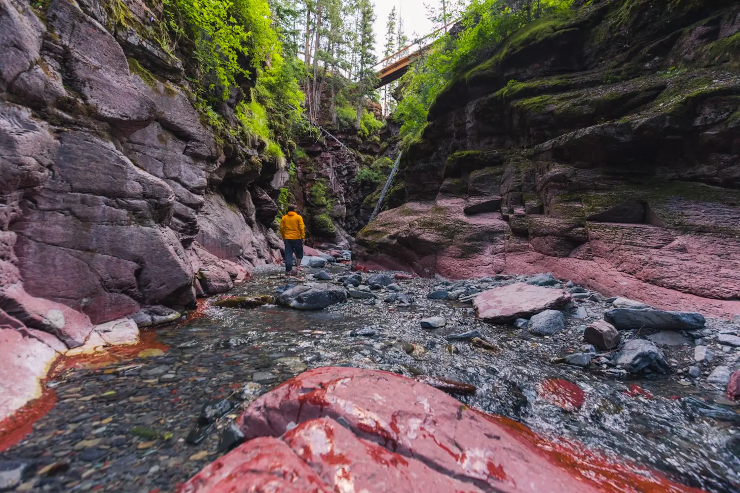
Heading downstream along the canyon. The parking lot can be seen in the background.
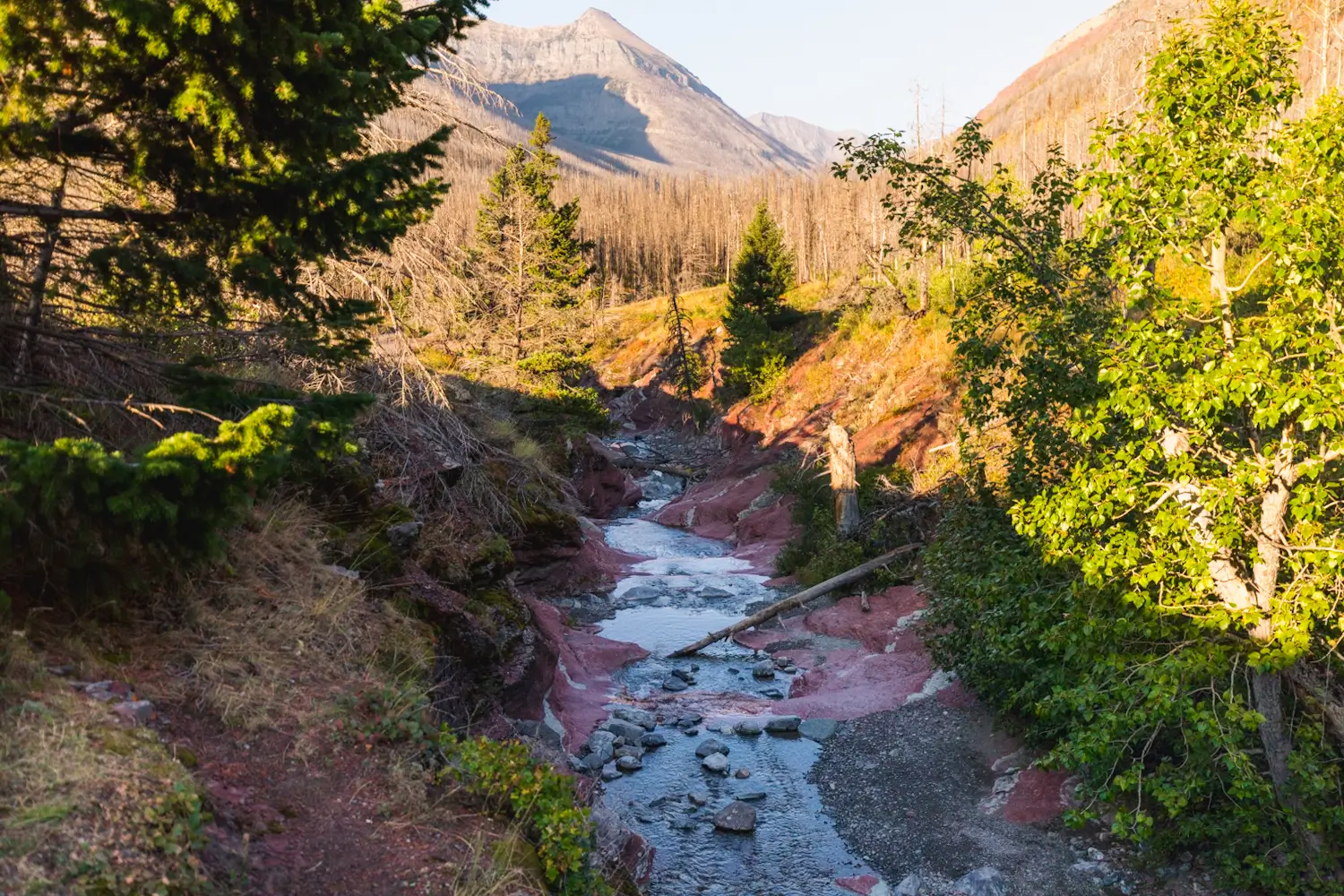
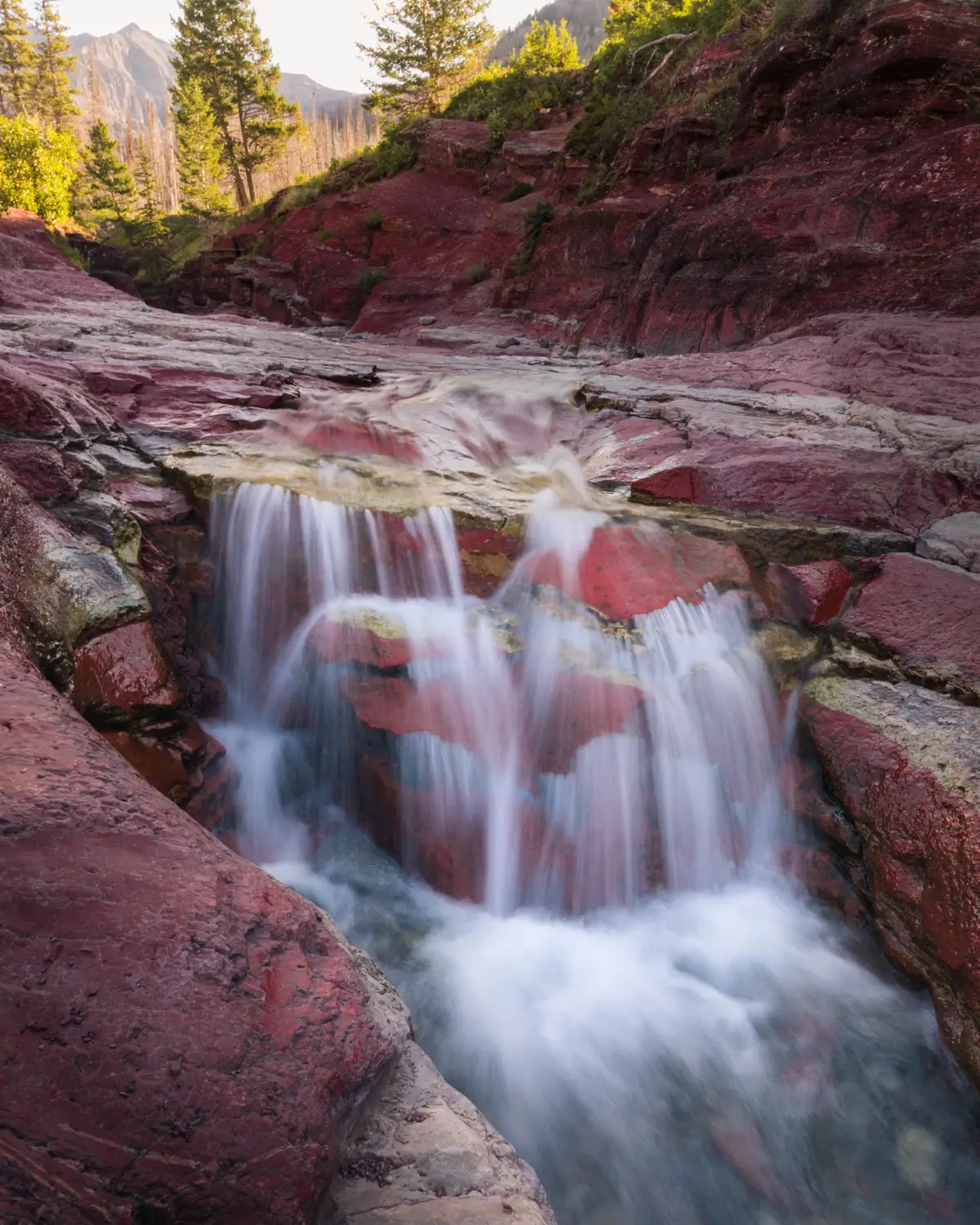
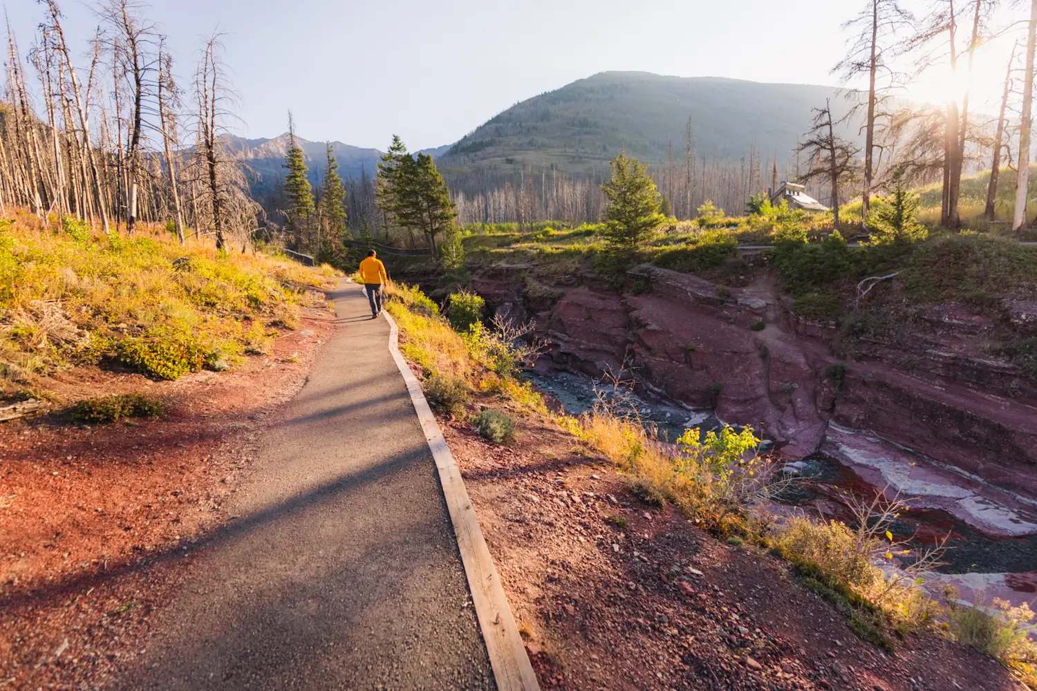
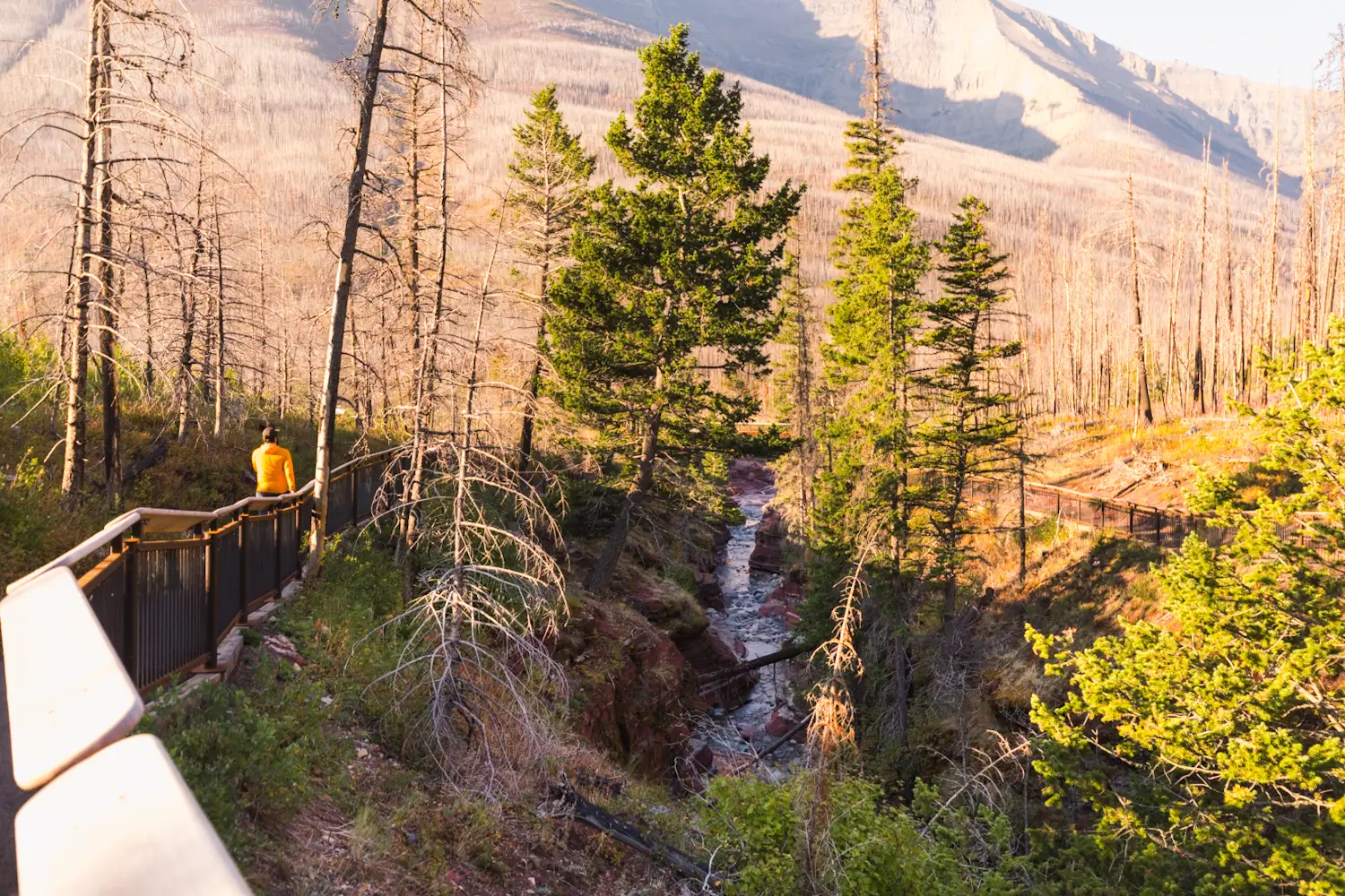
As you can see the canyon gets quite shallow here, though there are still a couple of tiny waterfalls. As I follow the canyon up from here it only gets deeper and more impressive. Note the massive burnt forest, with the only trees spared being the ones right next to Red Rock Creek
The bottom bridge is located pretty much where the canyon ends and just before it merges into Bauerman Creek. I crossed the bridge (only the first bridge) and began following the trail up the other side of Red Rock Canyon. Across the second bridge is the short hike to Blakiston Falls.
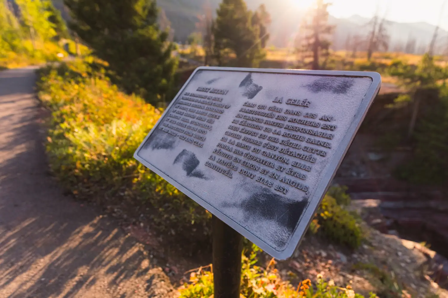
All along the Red Rock Canyon trail are informative signs.
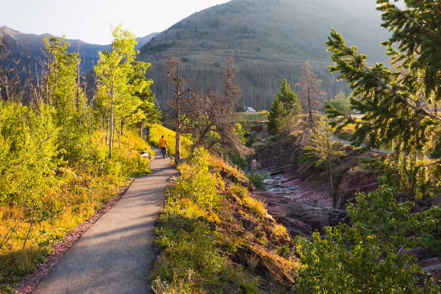
Walking back up Red Rock Canyon.
I didn’t cross the middle bridge and kept on the left side of the canyon, but of course it’s possible to cross here and do a figure-8 shape.
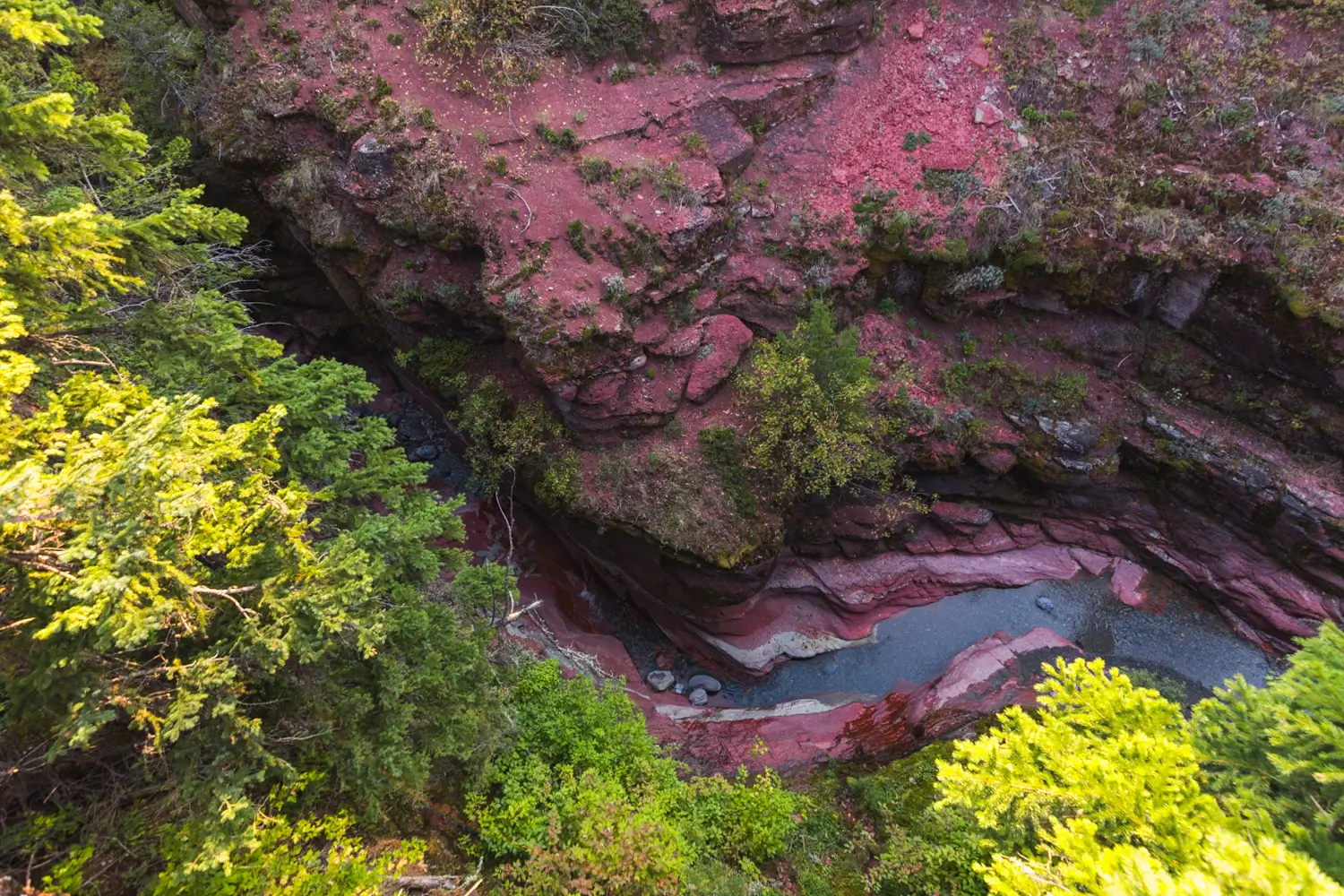
Looking down into what is now a much deeper canyon. Further down in this post is another photo taken from the exact section of canyon I’m looking down into here, providing a very different perspective.
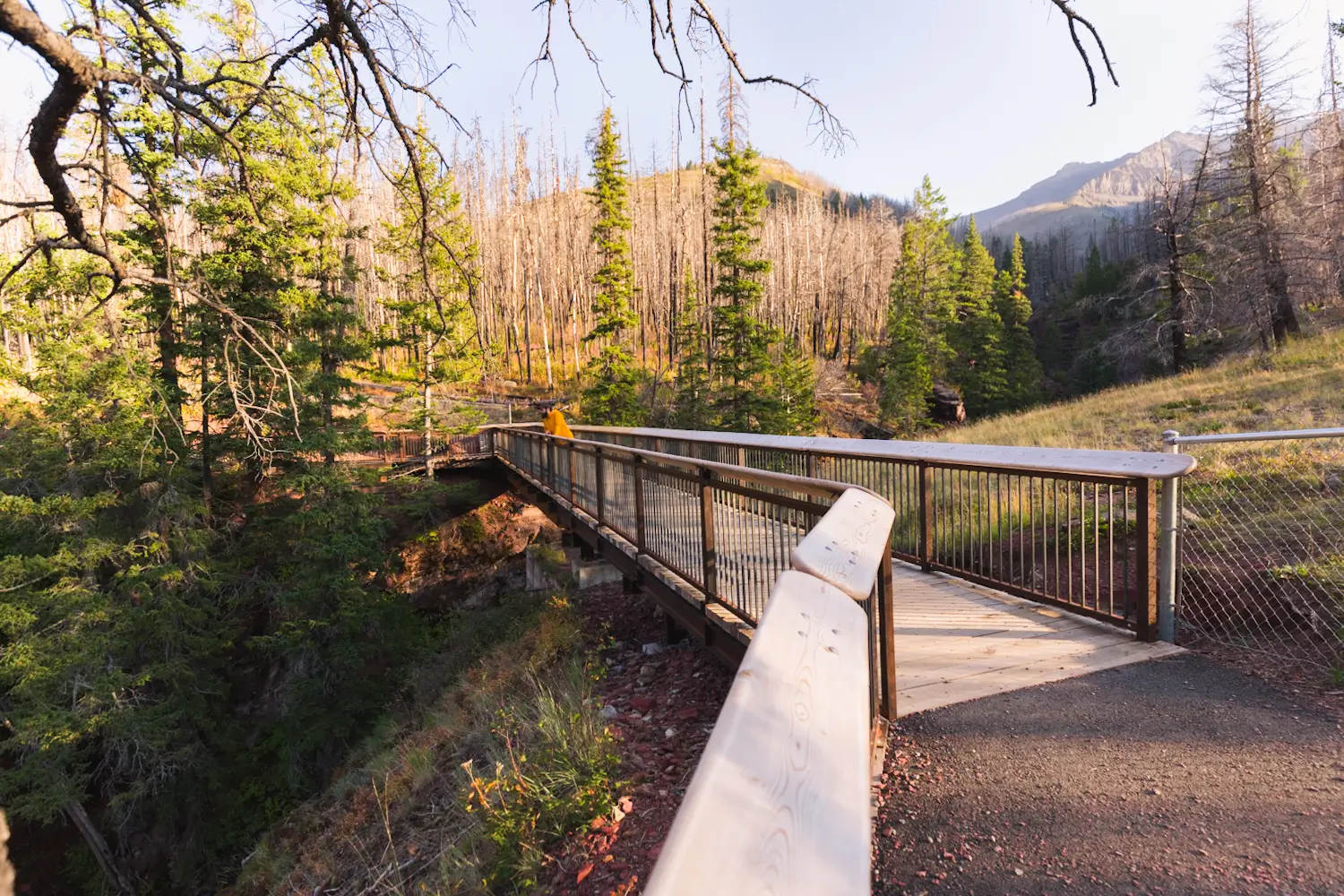
The final bridge crosses the deepest section of Red Rock Canyon. Views down into the canyon on either side from here are fantastic.
Walking back down. I forgot to take a picture but around here just after the bridge is a sign pointing out a large piece of red argillite with ripple patterns from when it was sea floor.
Returning to the bridge at the start of the Red Rock Canyon Trail. Just below the bridge are stairs leading down into the shallow section of the canyon where it’s possible to see the bright red rock up close. Make sure not to climb down into the canyon anywhere else so as not to trample plants and create unnecessary tracks.
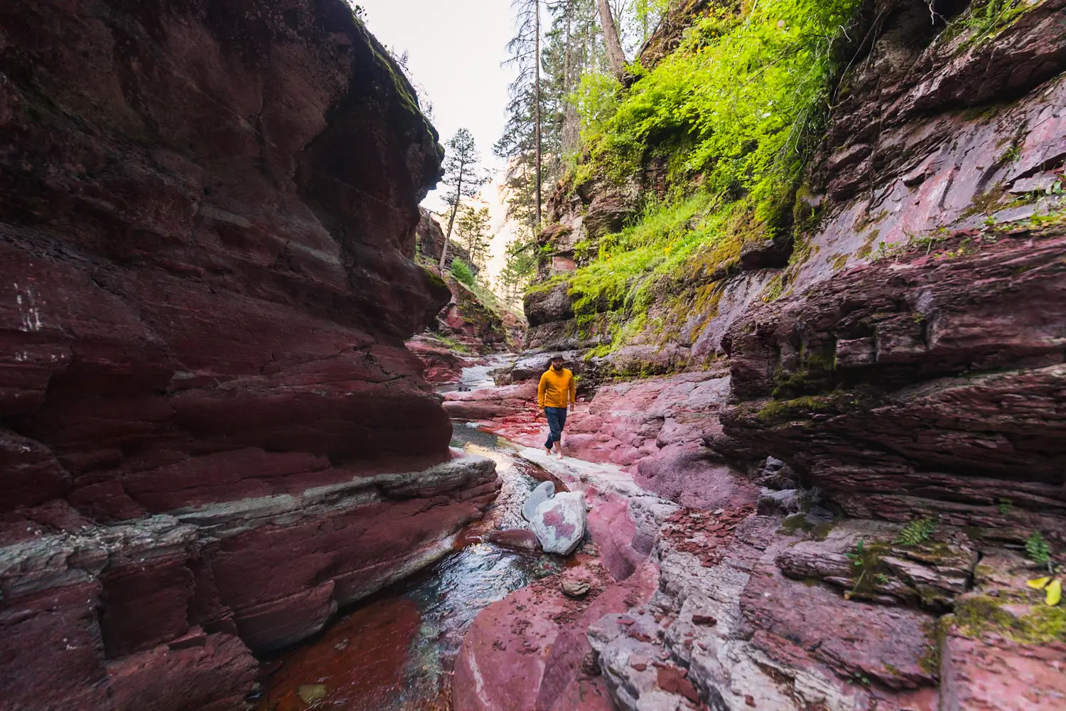
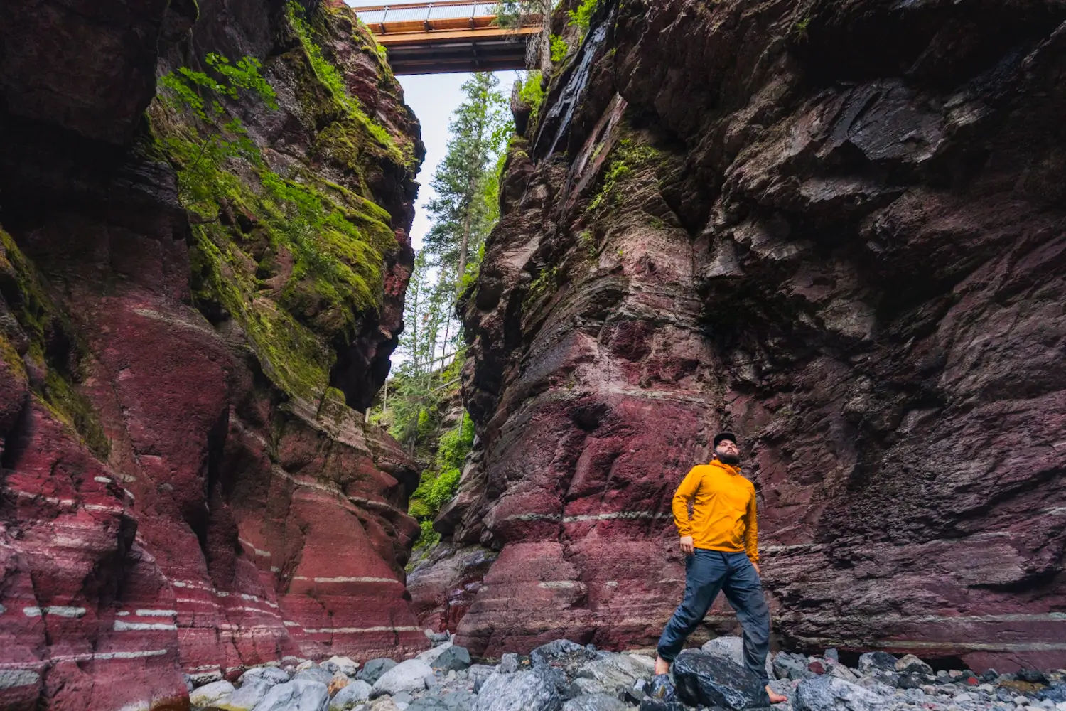
Entering Red Rock Canyon
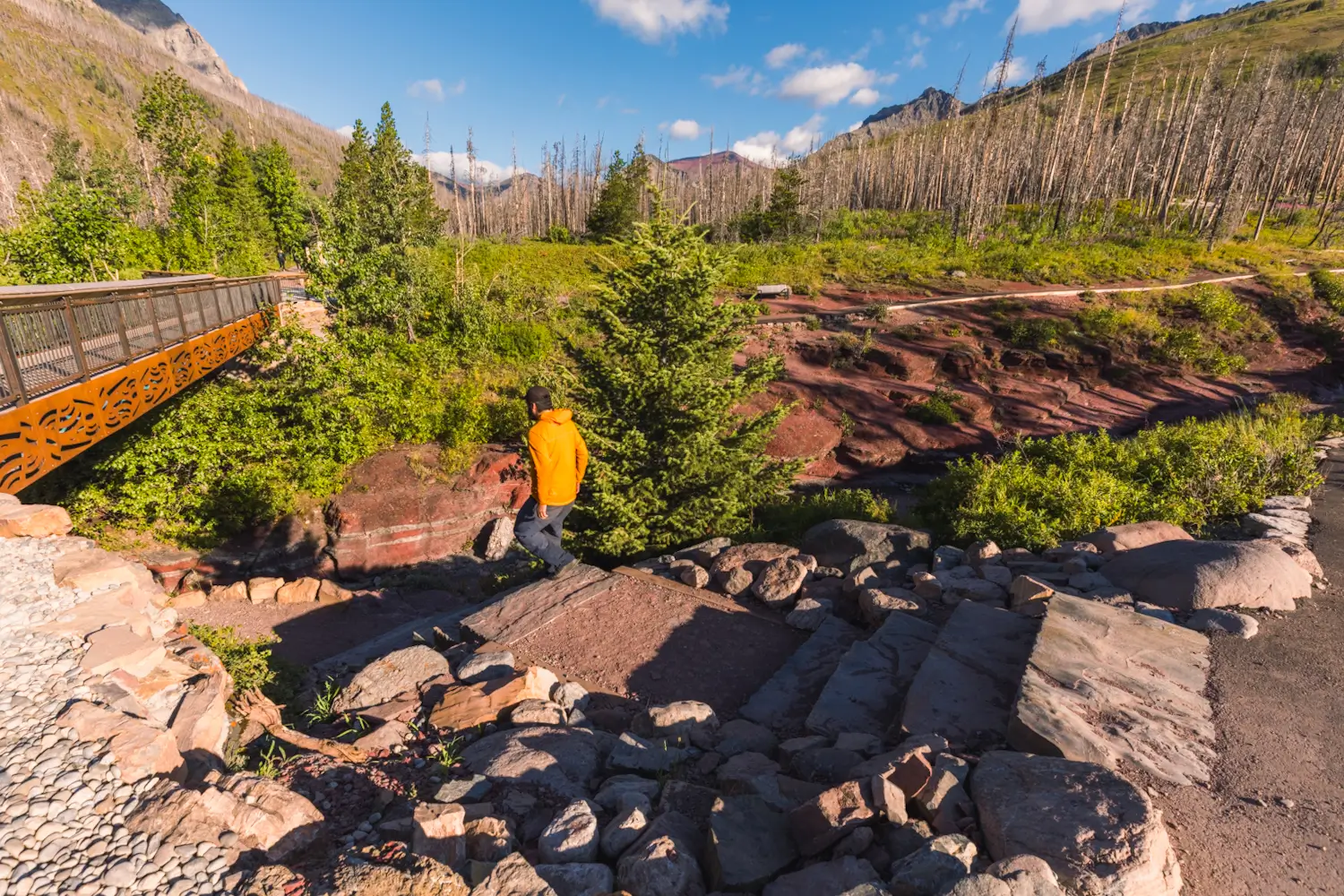
Stairs leading down into Red Rock Canyon next to the bridge.
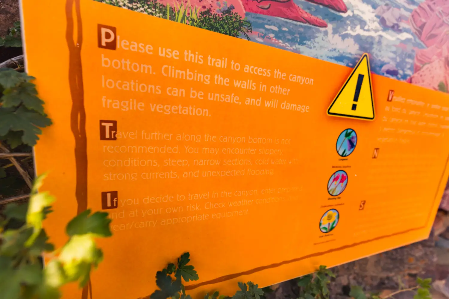
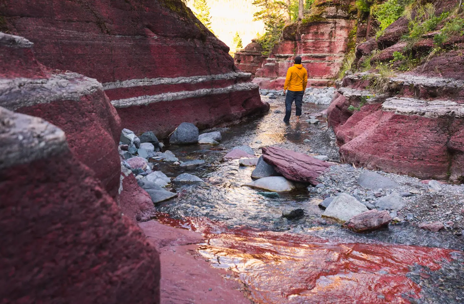
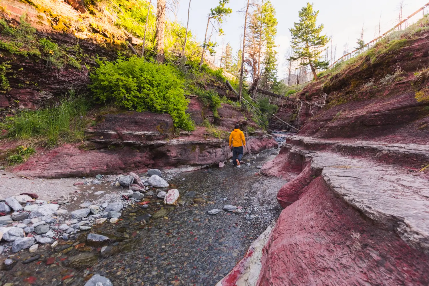
This sign recommends bringing appropriate equipment if continuing up through Red Rock Canyon, as well as warns of dangerous conditions. If water levels are high or it’s particularly windy I don’t advise walking up the canyon. I’ve seen a lot of people trying to explore up the canyon without wanting to get wet, and they’ve ended up clinging to vegetation along the sides of the canyon and edging along the steep slopes, and this is not only dangerous but also damages the canyon. Understand that there is no way to explore up the canyon while staying dry, and wear appropriate footwear. When I am exploring creeks and slot canyons I often wear watershoes, but any footwear you’re not scared to submerge will work. (Crocs work in a pinch!) I didn’t have my watershoes with me on the day I took these photos so I went barefoot, but because of cold water and painful rocks I don’t recommend it unless you have gross thickly calloused feet like me.
Walking up the shallow section of the canyon. People sometimes build rock dams here, which are really bad for things living in the water. Rock dams aside, there are usually enough stepping stones to keep your feet dry for the first little bit, but the changes several minutes up once the canyon gets deeper.
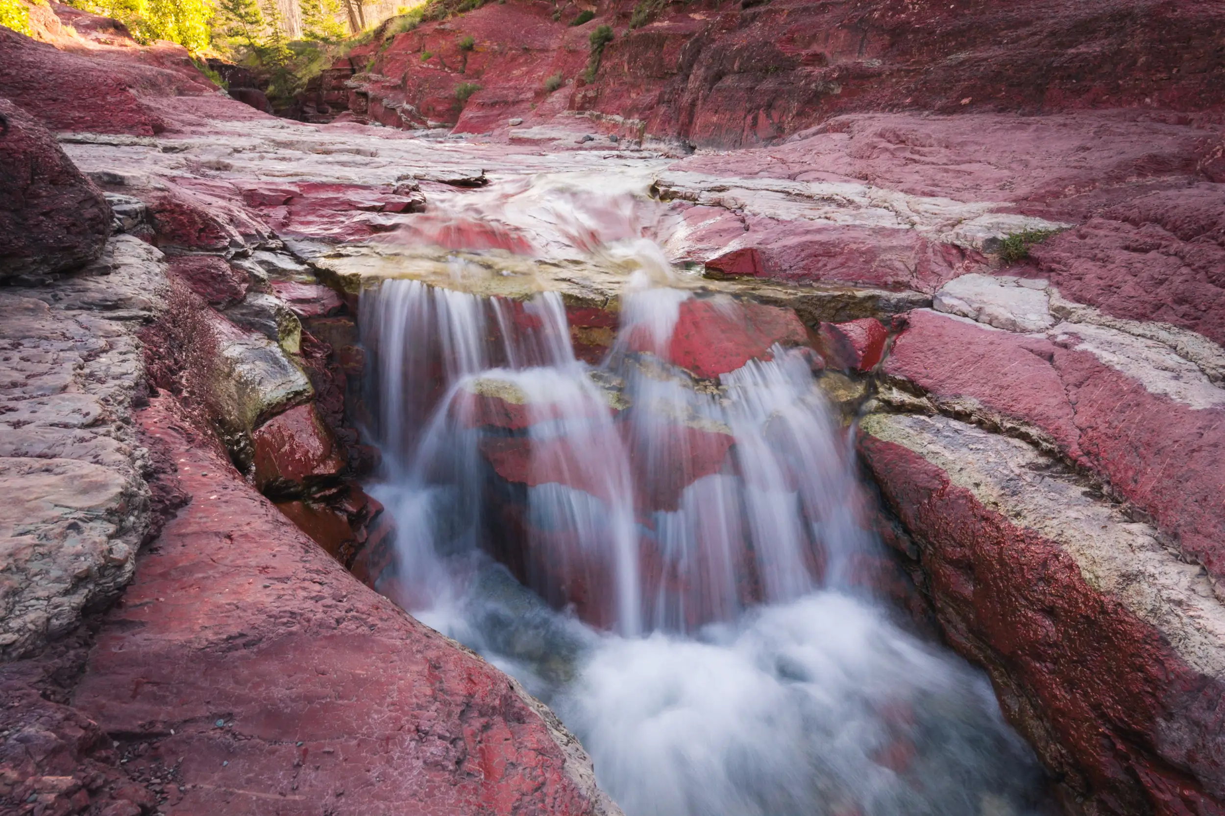
One of a few small little waterfalls in Red Rock Canyon.
The canyon gets a bit deeper. There are visible tracks from people who have scrambled up along the sides of the canyon here, which you shouldn’t do. If you don’t want to get wet and explore all the way up the canyon, I suggest stopping around here as getting wet is unavoidable not far around the corner anyway.
As you can see the water was pretty low when I visited, providing me a good number of stepping stones but earlier in the year there would be far fewer.
Scroll way back up to see the photo I took from above the canyon looking down to see this spot from a very different angle.
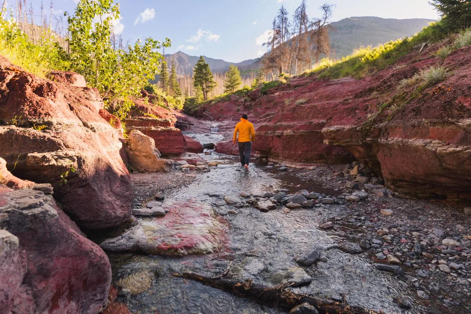
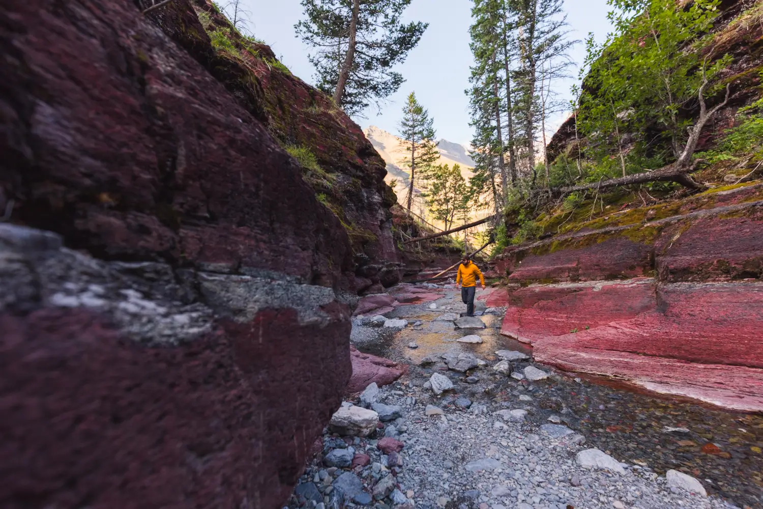
One of the most beautiful sections of Red Rock Canyon. There are plenty of sections like this where it’s easy to walk on dry rock alongside the shallow creek, but around every corner is a small pool of freezing water that there’s no way around wading through.
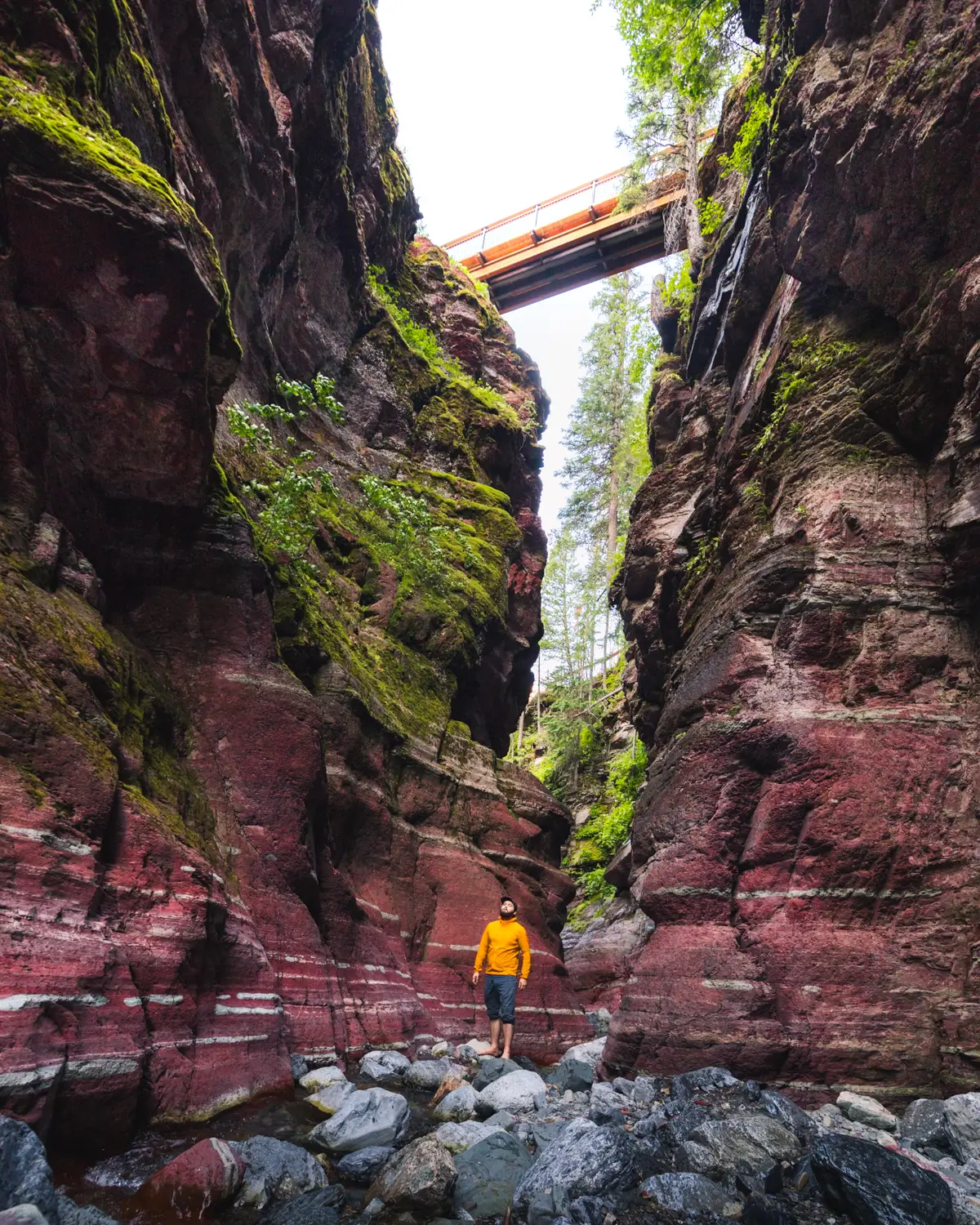
The upper bridge crosses Red Rock Canyon at around the deepest section.
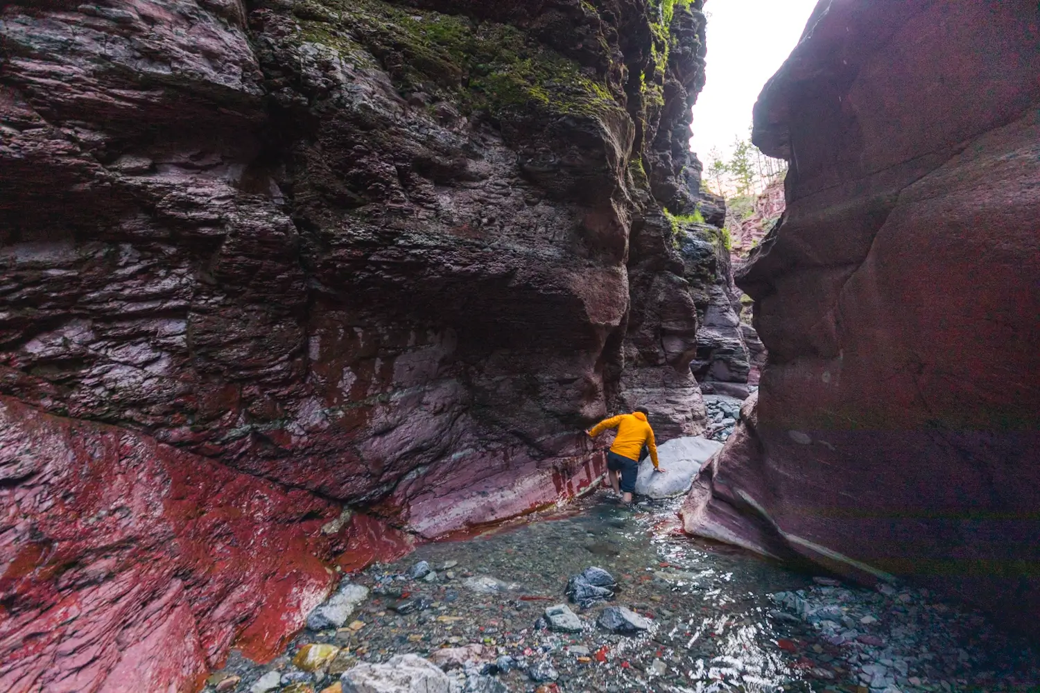
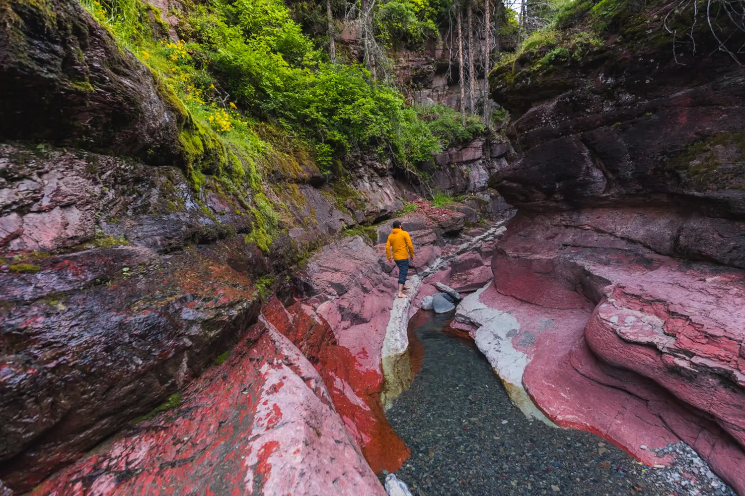
One of the sections that has to be waded through. The water here got to above my knees. After passing underneath the bridge continuing up the canyon requires more and more wading and the canyon gets less impressive, so I chose to stop here on this visit.
looking back at what’s probably the best section of Red Rock Canyon. The walls are so tall here, and the verdant moss contrasts beautifully with the red argillite.
Recommended Hiking Gear


Water is a must whenever I’m hiking, especially if the sun is going to be out. My favourite water filter I’ve used is the Katadyn BeFree 0.6L, which unlike other water filters I’ve used packs up really small and lightweight. For hikes where I know there won’t be any readily available water sources along the way, I make sure to bring my own. The Hydrapak Stow 1L bottle is my go-to, for the same reason that it’s made of a soft plastic that folds up and doesn’t take up any more extra space than necessary in my pack. Finally, Aquatabs are another great option for purifying water, with one tablet being suitable for one litre of water. I previously used the Grayl water filter while travelling internationally, and though I found its hard body more convenient for day to day use and easier to drink from, it has a little too much bulk for my fast-and-light style of hiking.


The secret to all my photos of gorgeous sunset and sunrise mountaintop views? A lot of hiking in the dark. And let me speak from personal experience when I say that the last thing that you want to happen when hiking is to be caught in the dark without a headlamp. I used the Black Diamond Spot 400 for years and it worked great – until I lost it on top of a mountain somewhere. The only downside to it was having to worry about the batteries dying, though there’s also a slightly more expensive version that has a rechargeable battery. Nowadays I’m using the Petzl Actik Core, which is a bit pricier than the more budget-friendly Black Diamond, but is also brighter, more comfortable (in my opinion), and has a hybrid power system that is rechargeable but can also take AAA batteries if needed.
You won’t see me using trekking poles on shorter hikes often – but on long hikes and backpacking trips, as well as certain scrambles, they are an absolute lifesaver. I’ve invested in a high quality ultra-lightweight pair of MSR DynaLock Ascent carbon poles which, while pricey, I don’t regret one bit. If you’re not entirely sure how much use you’re going to get out of a pair of trekking poles, the best budget-friendly option would be the Trekology Trek Z 2.0. Amazon does sell a lot of cheaper Made in China-style trekking poles for cheaper, but these usually are much much heavier and not worth buying.
All the best and most long-lasting cables and power banks I’ve ever owned have been Anker. I once had a phone cable from them that lasted me over three years of daily use! That’s why I keep an Anker PowerCore Essential 20K power bank on me. Like many people I use my phone for a lot of stuff when hiking (checking in with family, using online maps, taking photos, flying my drone) so I like to be prepared for that low battery warning by having a backup power source on me just in case.


The only socks I ever buy for myself are from Darn Tough, and I almost always make sure to wear them when hiking. After years of having no problems only wearing these comfortable and rugged socks for hikes, I accidentally wore a pair of no-name socks on a hike last year and ended up with blisters on both feet. Safe to say I’m back to sticking with the Darn Tough. And the best part? They have a lifetime guarantee, meaning that if they ever wear out you can send them back for a brand new pair. For hiking footwear I go between a pair of lightweight approach shoes for quick and dirty mountain ascents or anything involving scrambling and more heavy-duty boots for longer treks. I’ve worn a couple different versions of the lightweight but super durable Arc’teryx Konseal FL 2 approach shoes for a few years now and am very impressed with the durability. I also really like the thick toecap that keeps me protected every time I stumble into a root or large rock. For longer, tougher, or muddier treks I rely on my LOWA Camino EVO GTX, which I find insanely comfortable and made of very high quality.


I wear my Ar’teryx Gamma Lightweight Pants on every single hike I go on, and on many days when I’m not hiking. After several years of abuse they are still holding together extraordinarily well, with only a few small holes from where I’ve fallen down and some slight stains from being repeatedly coated with mud. They’re lightweight, breathable, and super comfortable. For lightweight and breathable hiking tops I’m a big fan of both the Patagonia Capilene Shirt and the MEC Core Shirt. My Arc’teryx Squamish Hoody shows up in a lot of my photos. It’s super lightweight and packable, and does a great job of cutting the wind while also being pretty breathable. I also have an Arc’teryx Atom Hoody and Arc’teryx Beta LT that I pull out for cooler or wetter conditions.
I hope you enjoyed this guide to Red Rock Canyon in Waterton Lakes National Park! Feel free to leave any questions in the comment section below or to contact me directly via social media.