
Contrary to autocorrect’s input on the subject, Grassi Lakes is spelled with an i , not a y. Named for Lawrence Grassi, the Italian coal miner who was known for his mountaineering exploits and trail building in the region, these crystal-clear aquamarine twin lakes are a must-see sight near Canmore. Originally named Twin Lakes, the trail up was built by Lawrence Grassi while local coal miners were on strike in 1924 and 1925. Tucked in the valley between Ha Ling Peak and EEOR, the two Grassi Lakes are like shining emerald gems. The short hike is one of the most popular things to do in the Bow Valley, and the trail leading up to Grassi Lakes also reveals spectacular views of Grassi Falls as well as over the valley below.
The Grassi Lakes hike is also one of the easiest and most accessible hikes near Canmore. There are actually two ways to get up to the lakes from the Grassi Lakes trailhead. The lower trail is the steeper one, utilizing wooden stairs to climb up close to the majestic Grassi Falls. This trail is by the far the more scenic, but it is usually pretty wet, and is closed in winter. The upper trail is technically an old access road, meaning that it’s wide and heads up at a consistent grade. There aren’t really any views until the top, but unlike the lower trail the upper trail is likeable year-round and by almost anyone. Most people choose to do the Grassi Lakes hike as a loop, taking one trail up and the other down. Which direction you go is up to you.
Continue reading this blog post for everything you need to know to experience the Grassi Lakes hike in Kananaskis Country for yourself, including distance, elevation gain, how to get there, the best time to visit, and lots of photos of my experience.
Note: The Grassi Lakes hike is located in Kananaskis Country, meaning that a valid park pass is required. Day passes can only be purchased online and are per day per vehicle, but if you’re staying six days or longer, it’s more cost-effective to just buy an annual pass instead.
When hiking it’s important to avoid harmful practices such as disturbing plants or rock-stacking, or removing any natural object from flowers to rocks, as it’s important to leave the environment as natural as possible for the animals and for fellow hikers to enjoy in perpetuity. As many flowers as there are, there are few enough that if we all took one, then there wouldn’t be any left. Take only photos, leave only footprints.
If you haven’t heard of Leave No Trace principles, they’re also really essential to read up on before heading anywhere into the outdoors in general. Following these important principles basically means doing your best to leave beautiful places like Grassi Lakes as good (if not better) than you found them, both for their preservation and for the enjoyment of other visitors.
Grassi Lakes Round Trip Details
Distance: 3.8 KM / 2.4 MI
Elevation Gain: 187 M / 614 FT
Hiking Time: 1-1.5 HRS
Hiking & Safety Tips
- Prepare for the possibility of wildlife encounters. Bear spray is a must whenever travelling in bear country, as well as learning how to use it. Though your chance of an aggressive bear encounter is low, it is always better to be prepared with bear spray. Bear bells are proven to be an ineffective bear deterrent, and are actively discouraged by Parks Canada. The best way to let bears know you’re around is simply to use your voice. Make sure to keep a respectful distance from wildlife and never feed the animals. It may seem kind but it doesn’t just kill wildlife and put people in danger, it’s also in many cases illegal.
- Research current trail conditions and make sure you are well-informed about the route before you leave, and assess if it is within your capability. Be aware of what time it gets dark and check the weather forecast. Make sure to tell someone where you’re going and when you expect to return. Every year as more and more people try hiking for the first time, the number of rescues goes up. Being prepared is the best defense.
- Pack everything you need for a successful hike, including enough water and energy-rich snacks. Remember to pack out everything you pack in though – don’t expect to find a convenient garbage can halfway up the trail. Bring appropriate layers (remember you’ll warm up once you start hiking) and sun protection. Hiking poles may be helpful but are not required. In addition to not leaving any garbage on the trail yourself, I highly recommend bringing a garbage bag and collecting any trash that you do see on the trail. You’re guaranteed to make the hike to Grassi Lakes a more enjoyable experience for the next person.
How to Get to Grassi Lakes Trailhead
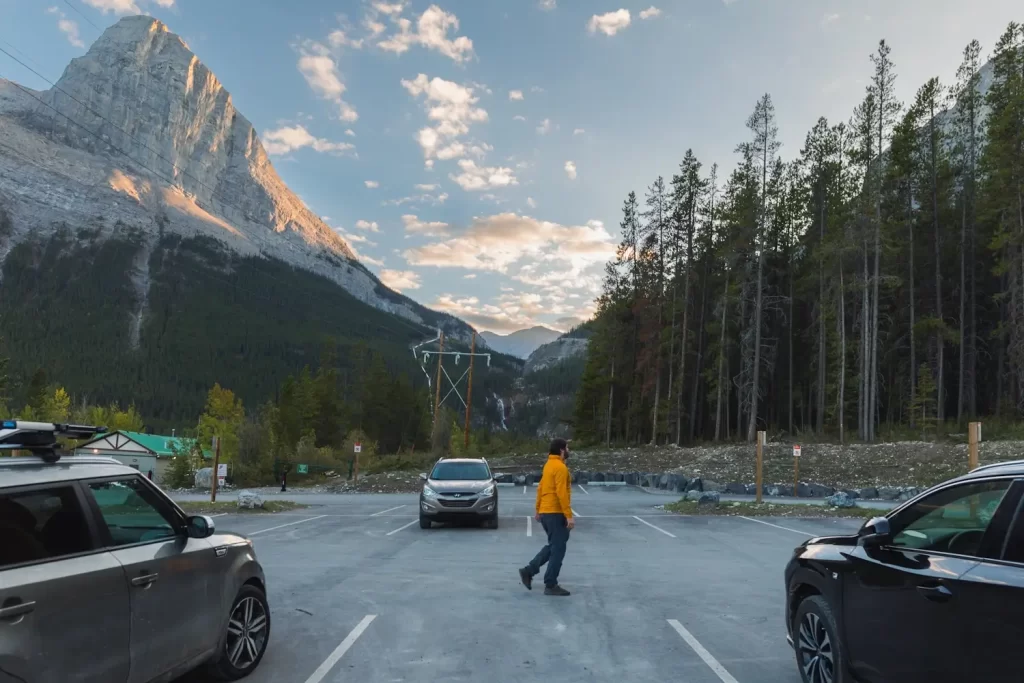
The Grassi Lakes trailhead is bout fifteen minutes from canmore, just before the trailheads for Ha Ling Peak and EEOR. It’s forty minutes from Banff or an hour and a half from Calgary. From downtown Canmore, drive west onto 8 Ave and follow it south as it crosses the Bow River and eventually turn left when it reaches Three Sisters Drive. When Three Sisters Drive forks a couple minutes later, turn right onto Spray Lakes Road. Follow the road for a few kilometres as it rounds the Canmore Reservoir. You’ll see a large overflow on the right hand side of the road – to get to the main parking lot immediately turn left onto the narrow downhill road which leads right to the parking lot a minute later.
Click here to open the exact trailhead location in Google Maps.
Hiking to Grassi Lakes
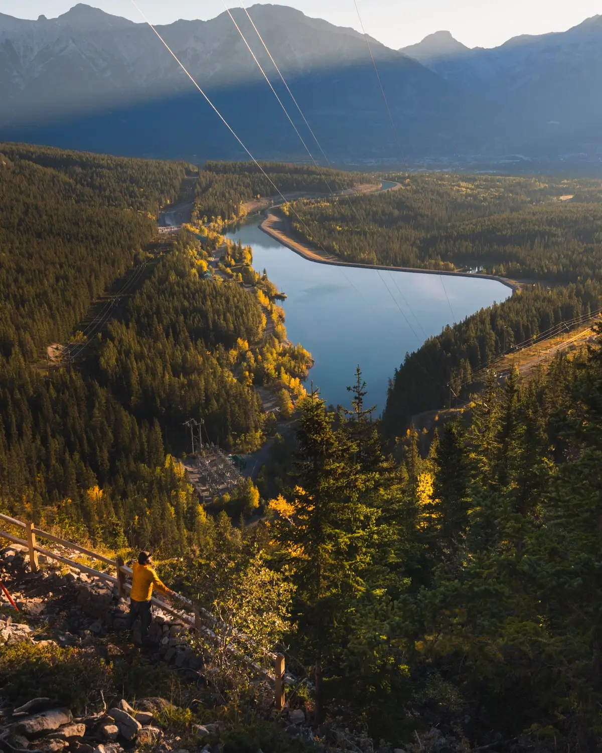
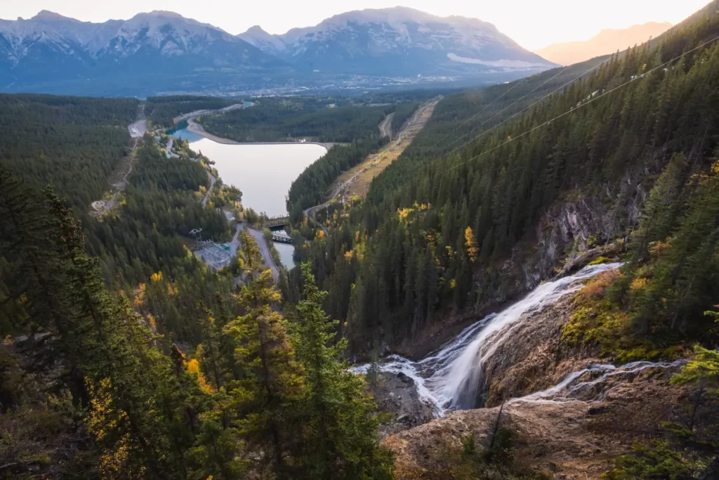
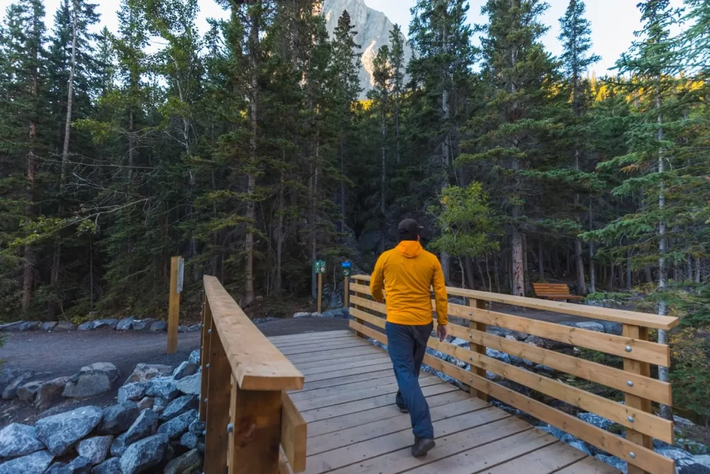
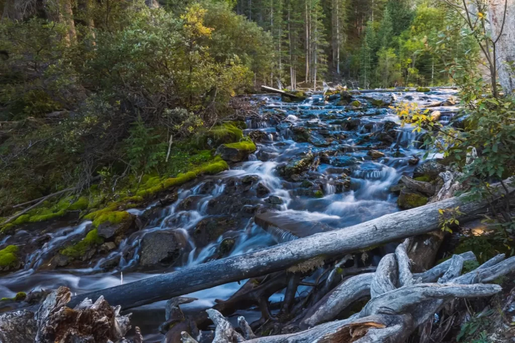
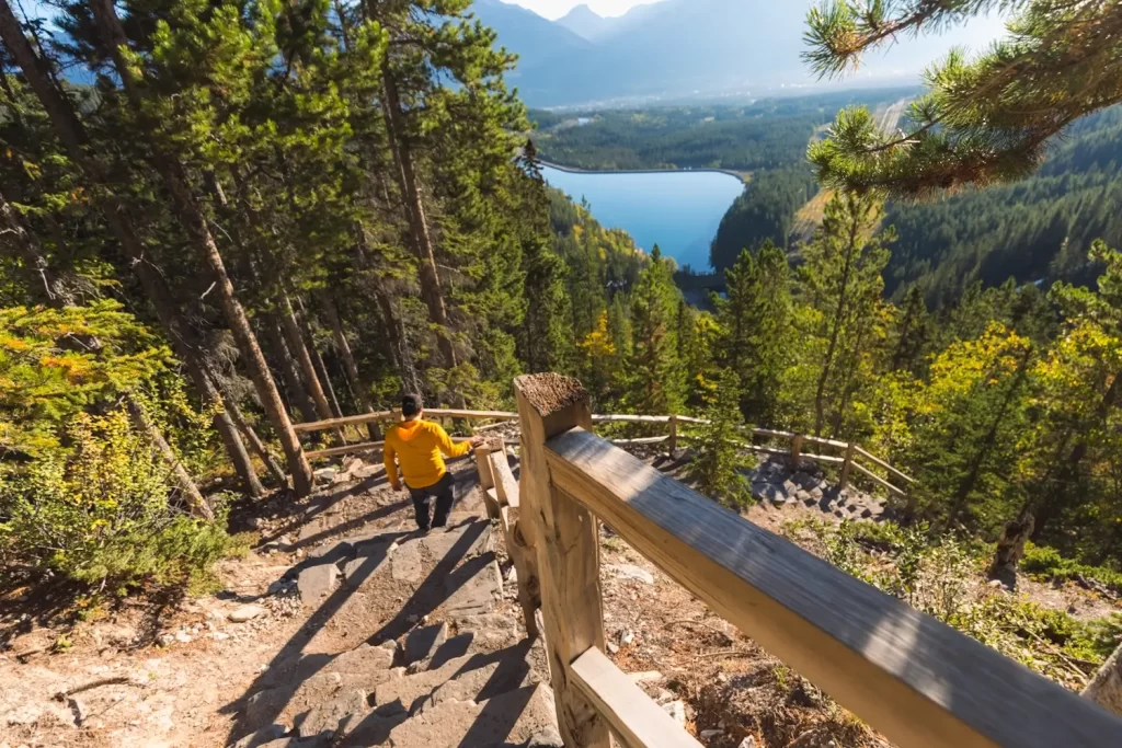
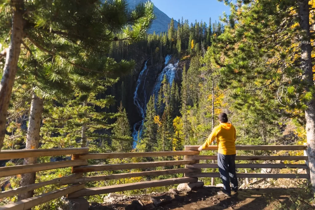
The Spray Hydroelectric Plant is visible near the base of Grassi Falls from the start of the hike at the Grassi Lakes trailhead. From here the path winds around to the top of the falls.
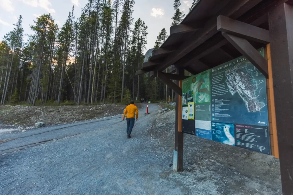
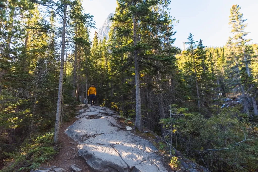
The start of the Grassi Lakes hike.
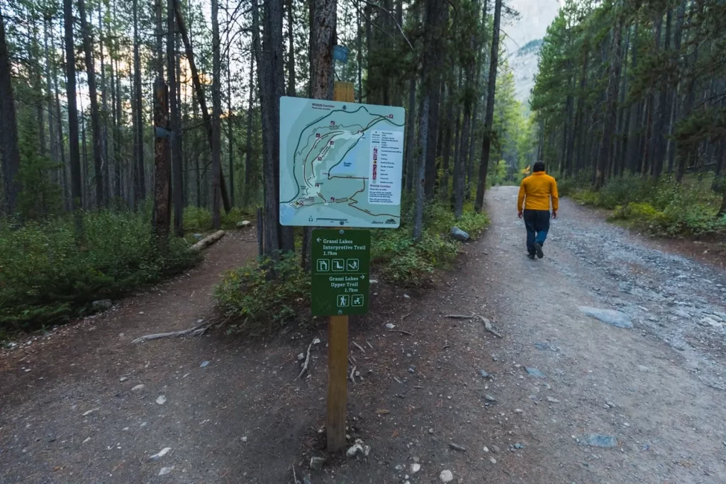
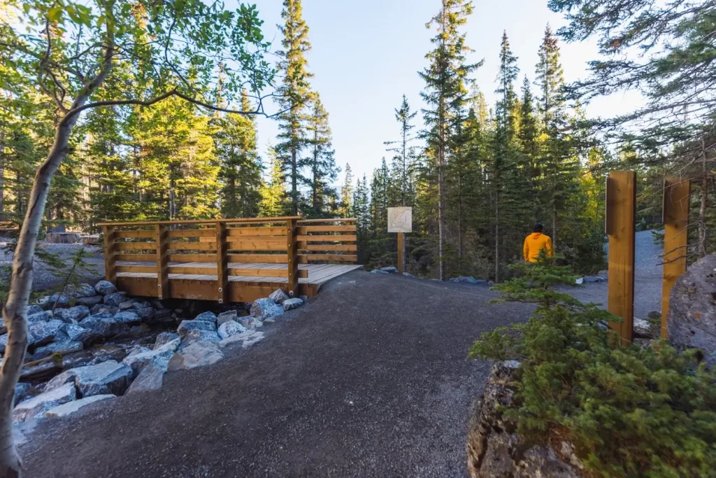
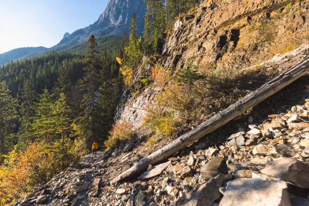
Almost immediately the trail splits into the Upper Trail and the lower Interpretive Trail. The upper trail is far easier as it’s an old access road which gradually gains elevation to Grassi Lakes. The lower trail is more challenging, but the far more scenic and rewarding one, providing views of Grassi Falls and the Bow Valley, Many people use both trails to turn the hike into a loop, but which direction you choose to go is up to you. I went up the easy trail because I was hiking early in the morning and wanted to wait until the sun was up to hike down the more scenic trail. In the winter only the easy Upper Trail is open.
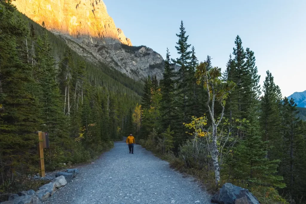
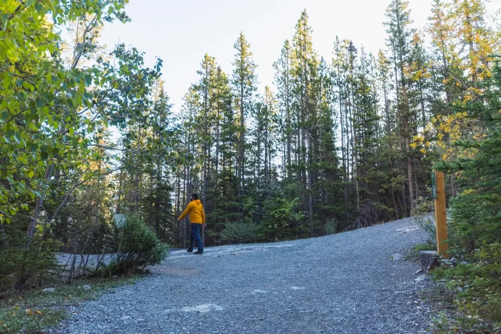
There aren’t really any views back down into the Bow Valley from the Upper Trail, but there good views up towards the surrounding peaks. Behind me here is EEOR, another great Canmore hike/scramble.
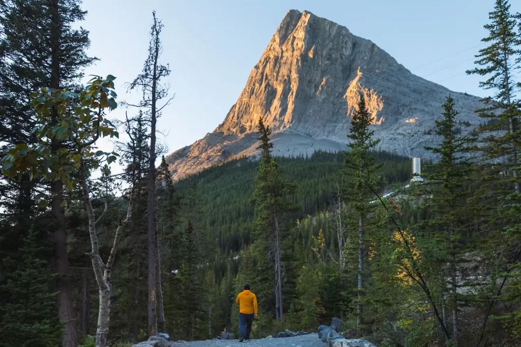
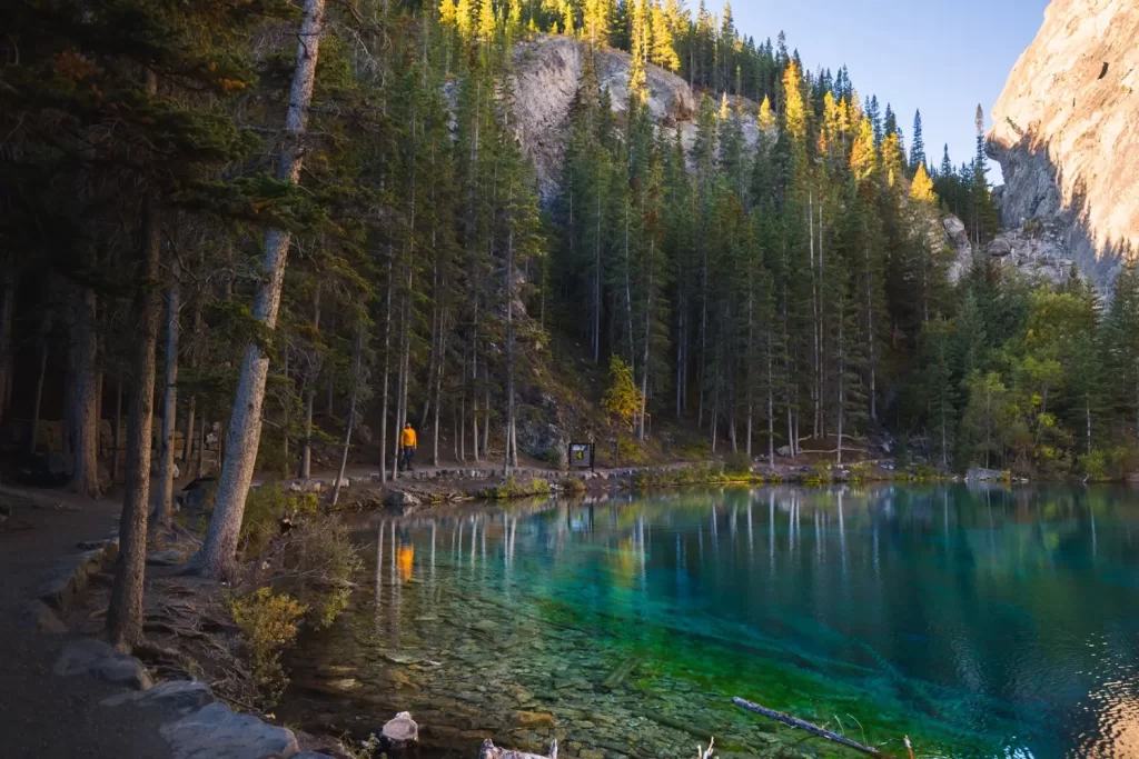
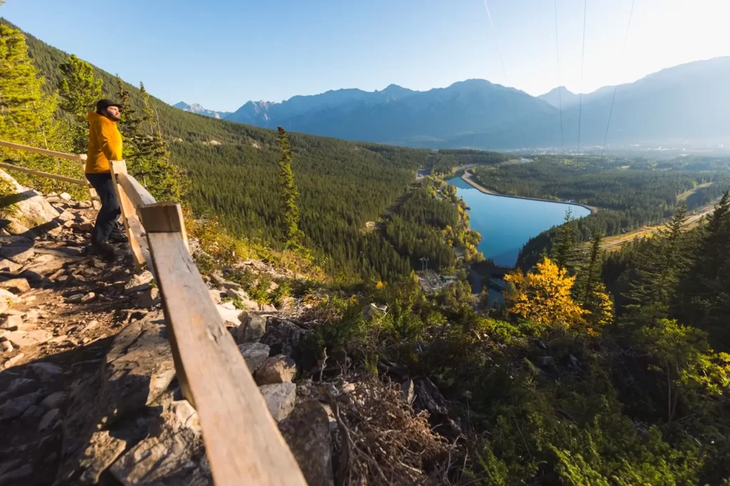
The trail curves around the side of the valley, eventually heading straight towards the pyramid-looking Ha Ling Peak. At this point I’m a minute away from Grassi Lakes. Right around the time the trail reaches the lakes, there is a viewpoint on the left side of the trail.
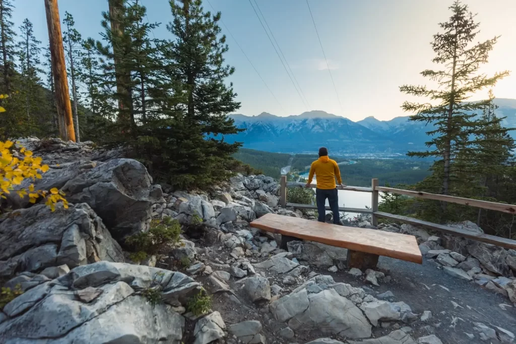
The viewpoint down over the Canmore Reservoir into the Bow Valley is just past the power lines seen at left, and a worthwhile detour before walking around Grassi Lakes.
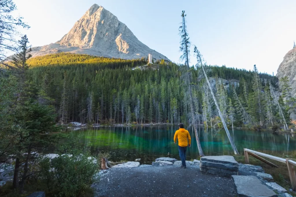
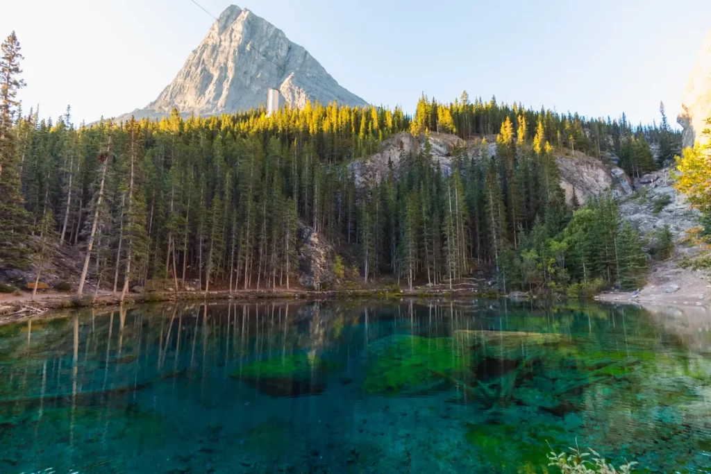
Views from the lower Grassi Lake. Note the huge metal pipe connecting the reservoirs above and below Grassi Lakes, feeding the Spray Hydroelectric Plant. The silver tower is a surge tower, which helps even out the flow of water.
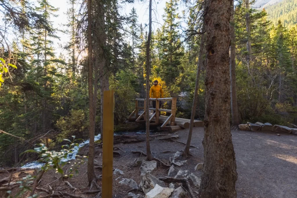
After walking clockwise around the lower lake for a minute or two, the trail crosses a small bridge. The creek running from the lake under the bridge becomes Grassi Falls. The path heading to the left leads away from the lake and down past the waterfall and back to the trailhead via the lower trail.
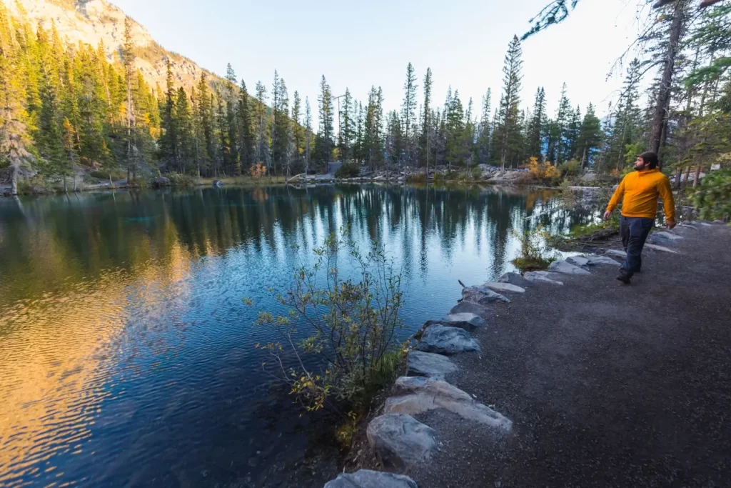
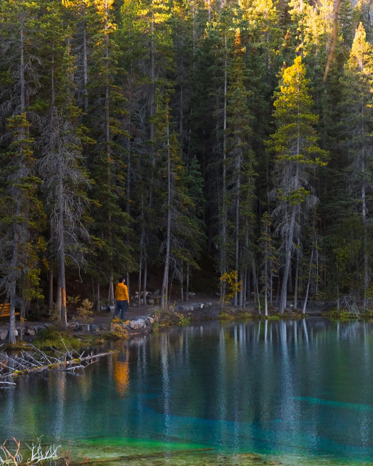
Continuing around the first Grassi Lake. The trail completely circles the lower Grassi Lake, so it doesn’t matter which direction you take around the lake. The trail doesn’t lead all the way around the upper lake though.
The trail heads up for a minute from the first lake to the second.
A gentle stream connects the two lakes, feeding the lower lake from the upper one. This is just below the second Grassi lake. Note that there is no creek feeding the upper lake – it’s fed from below by groundwater.
The trail runs partway around either side of the upper lake, but does not connect. The other side of the lake is closed due to the risk of rockfall.
After spending time soaking in the beautiful Grassi Lakes, following the other trail back down from the first bridge.
Turn left to follow the trail down. The path to the the right heads up to a closeup view of the large water metal pipe.
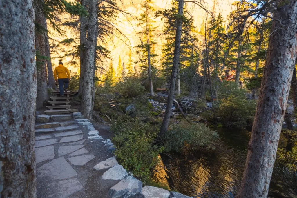
The trail begins along some elevated slabs near the stream. Note the bridge visible in the background on the right.
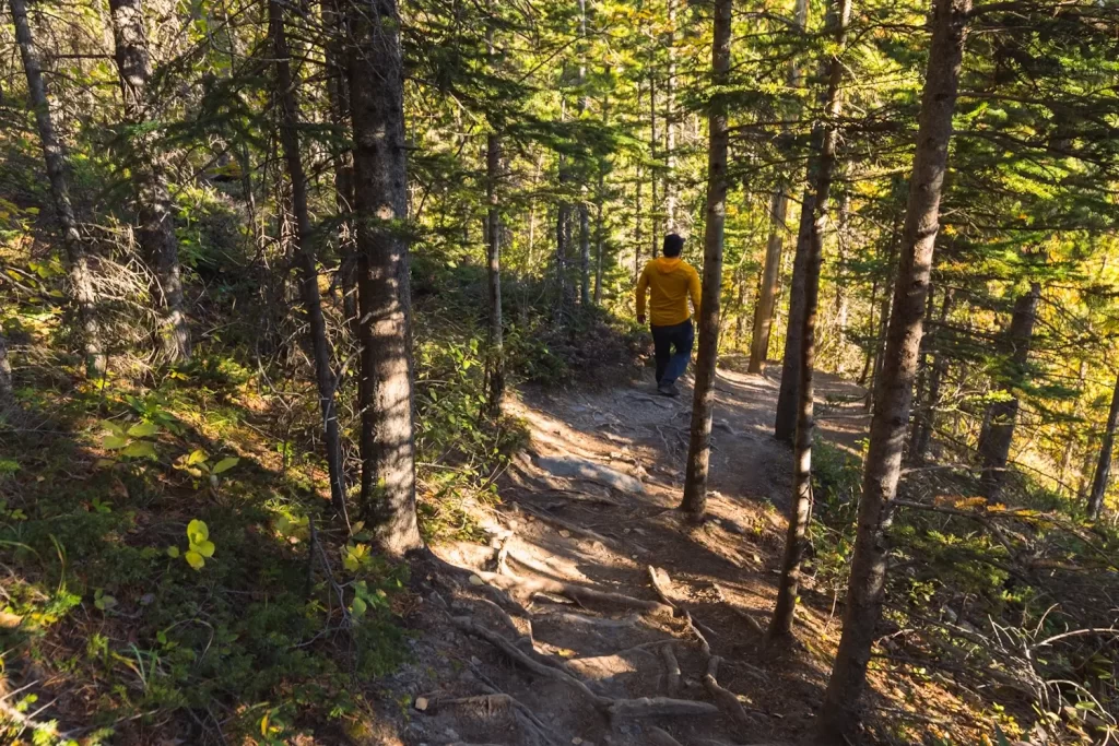
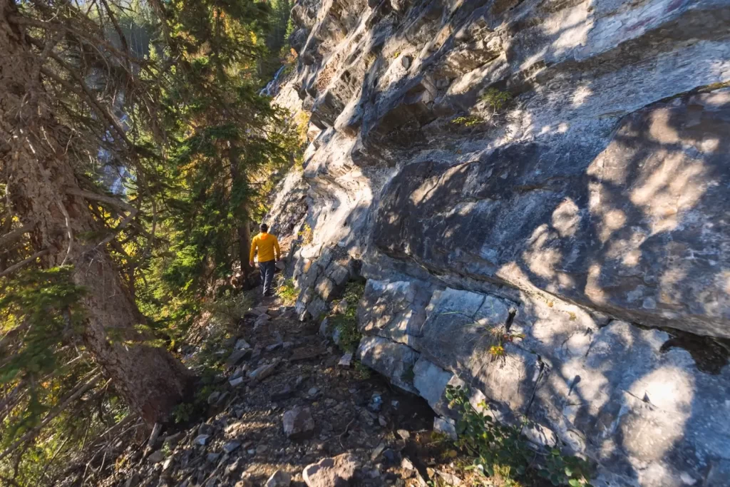
The trail crosses back over the stream via a second bridge. From here the trail is more obvious. Much of this trail is the original trail built by Lawrence Grassi, but it has been upgraded since then. While it’s not super challenging, it is definitely rockier, rootier, and wetter than the easy trail.
Views are great though. This is also close to where the best views down over Grassi Falls are.
The rooty and slightly steep lower Grassi Lakes trail.
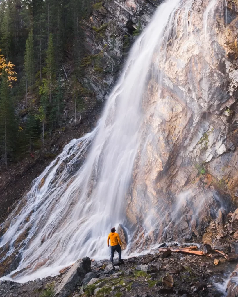
Just below this series of stairs, look out for a social trail leading towards Grassi Falls.
The narrow social trail heading towards the waterfall.
The path here is narrow, rocky, and wet. I don’t recommend it for all hikers, and I don’t recommend it at all once temperatures have dipped below freezing and the water covering everything turns to ice.
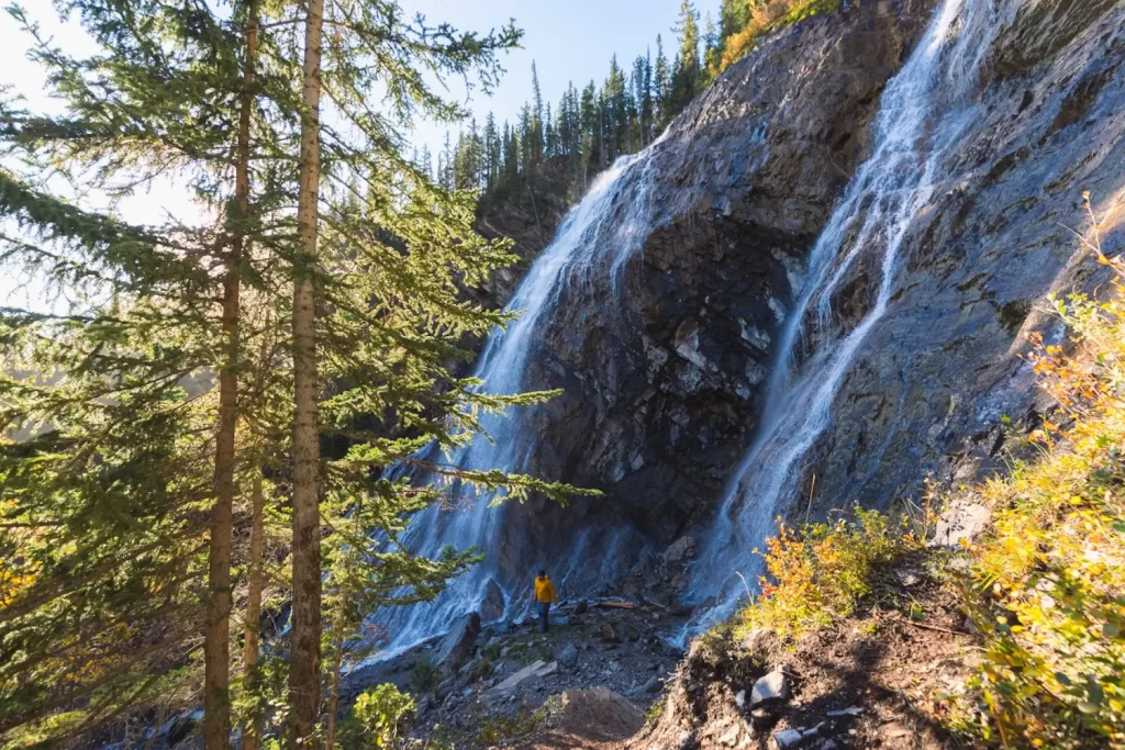
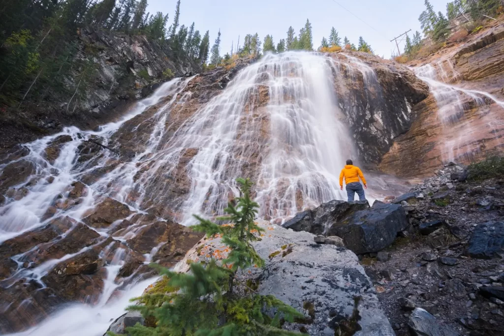
This is Grassi Falls at a relatively low flow late in the year. early in the summer expect much more water.
Even if you don’t take the detour to approach the falls, there are great views of it from further down the trail.
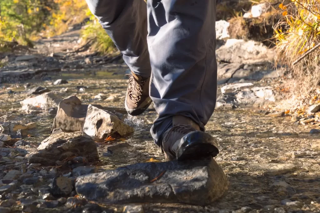
As you can see, much of the trail is very wet with streams running down and across it.
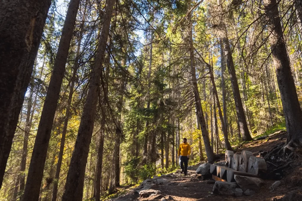
Back in the trees and with most of the views now obscured by the trees, the trail continues down towards the Grassi Lakes parking lot.
Recommended Hiking Gear


Water is a must whenever I’m hiking, especially if the sun is going to be out. My favourite water filter I’ve used is the Katadyn BeFree 0.6L, which unlike other water filters I’ve used packs up really small and lightweight. For hikes where I know there won’t be any readily available water sources along the way, I make sure to bring my own. The Hydrapak Stow 1L bottle is my go-to, for the same reason that it’s made of a soft plastic that folds up and doesn’t take up any more extra space than necessary in my pack. Finally, Aquatabs are another great option for purifying water, with one tablet being suitable for one litre of water. I previously used the Grayl water filter while travelling internationally, and though I found its hard body more convenient for day to day use and easier to drink from, it has a little too much bulk for my fast-and-light style of hiking.


The secret to all my photos of gorgeous sunset and sunrise mountaintop views? A lot of hiking in the dark. And let me speak from personal experience when I say that the last thing that you want to happen when hiking is to be caught in the dark without a headlamp. I used the Black Diamond Spot 400 for years and it worked great – until I lost it on top of a mountain somewhere. The only downside to it was having to worry about the batteries dying, though there’s also a slightly more expensive version that has a rechargeable battery. Nowadays I’m using the Petzl Actik Core, which is a bit pricier than the more budget-friendly Black Diamond, but is also brighter, more comfortable (in my opinion), and has a hybrid power system that is rechargeable but can also take AAA batteries if needed.
You won’t see me using trekking poles on shorter hikes often – but on long hikes and backpacking trips, as well as certain scrambles, they are an absolute lifesaver. I’ve invested in a high quality ultra-lightweight pair of MSR DynaLock Ascent carbon poles which, while pricey, I don’t regret one bit. If you’re not entirely sure how much use you’re going to get out of a pair of trekking poles, the best budget-friendly option would be the Trekology Trek Z 2.0. Amazon does sell a lot of cheaper Made in China-style trekking poles for cheaper, but these usually are much much heavier and not worth buying.
All the best and most long-lasting cables and power banks I’ve ever owned have been Anker. I once had a phone cable from them that lasted me over three years of daily use! That’s why I keep an Anker PowerCore Essential 20K power bank on me. Like many people I use my phone for a lot of stuff when hiking (checking in with family, using online maps, taking photos, flying my drone) so I like to be prepared for that low battery warning by having a backup power source on me just in case.


The only socks I ever buy for myself are from Darn Tough, and I almost always make sure to wear them when hiking. After years of having no problems only wearing these comfortable and rugged socks for hikes, I accidentally wore a pair of no-name socks on a hike last year and ended up with blisters on both feet. Safe to say I’m back to sticking with the Darn Tough. And the best part? They have a lifetime guarantee, meaning that if they ever wear out you can send them back for a brand new pair. For hiking footwear I go between a pair of lightweight approach shoes for quick and dirty mountain ascents or anything involving scrambling and more heavy-duty boots for longer treks. I’ve worn a couple different versions of the lightweight but super durable Arc’teryx Konseal FL 2 approach shoes for a few years now and am very impressed with the durability. I also really like the thick toecap that keeps me protected every time I stumble into a root or large rock. For longer, tougher, or muddier treks I rely on my LOWA Camino EVO GTX, which I find insanely comfortable and made of very high quality.


I wear my Ar’teryx Gamma Lightweight Pants on every single hike I go on, and on many days when I’m not hiking. After several years of abuse they are still holding together extraordinarily well, with only a few small holes from where I’ve fallen down and some slight stains from being repeatedly coated with mud. They’re lightweight, breathable, and super comfortable. For lightweight and breathable hiking tops I’m a big fan of both the Patagonia Capilene Shirt and the MEC Core Shirt. My Arc’teryx Squamish Hoody shows up in a lot of my photos. It’s super lightweight and packable, and does a great job of cutting the wind while also being pretty breathable. I also have an Arc’teryx Atom Hoody and Arc’teryx Beta LT that I pull out for cooler or wetter conditions.
I hope you enjoyed this guide to hiking to Grassi Lakes near Canmore! Feel free to leave any questions in the comment section below or to contact me directly via social media.